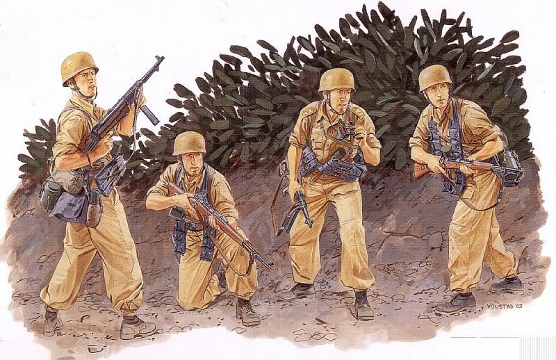
Fallschirmjager
These were the german paratroopers of WW II and they made the first
airborne infantry assaults in history. When germany invaded western
Europe in 1940, these paratroopers parachuted, landed with gliders,
and captured several strategic positions.
A year later, in May 1941, in their greatest operation, "The
Jaegers" invaded and conquered the big island Crete in the
Mediterranean solely by airborne troops. But their losses were such
that Hitler decided never to do another large airborne operation,
so the german paratroopers served the rest of the war as elite
infantry.
The Allies soon learned to have great respect for the fighting
abilities of these Fallschirmjager as they were highly motivated,
tactically sound, and had the most advanced infantry weaponry in
the world including flame throwers, shaped charges, MG42s, and the
world's first assault rifle. Their distinctive camouflaged smocks
were their hallmark and the Allies indication they would have a
hard fight on their hands.
And now a small Fallschirmjager platoon has decided to take up
residence here along the Dry Creek trail. Their corporal in charge
has been given the task of taking and holding the nearby meadow.
Just one brave american with a Tommy gun is in there to hold them
off. Be advised they are NOT TRADE ITEMS, THEY ARE CACHE GUARDIANS.
You might have some fun hunting out these tiny little warriors.
The cache site is just over a mile up the Dry Creek trail and
would be suitable for children. Cache theme is perhaps a little
different than my other "alpine" hides. But of course CoolCache
always likes delivering the unexpected!
>>>> 9/15/07: Cache in good shape with the troops
still holding out. The solo American is proudly hanging on.
TREKKING AIDS IF YOU DO MY WHOLE DRY CREEK SERIES:
- DRYCREEK TRAILHEAD AND PARKING: N 40° 28.962 W 111°
45.031
- STAY TO THE RIGHT AT THIS POINT ON TRAIL FOR EASIER ACCESS
TO RIVER CROSSING POINT: N 40° 30.159 W 111° 43.380. If you go
left, you're in for a hellacious bushwhack.
- SAFE CROSSING POINT ACROSS THE RIVER TO THIS CACHE: N
40° 30.376 W 111° 43.141. It's a safe 3 foot jump. This will be
less of a player if the spring run-off is not in progress. If it
is, this creek can be a dangerous river.
- CACHE ORDER SUGGESTION: If you do my upper Dry Creek
Trail caches a certain order may help you. After logging Abbey's
Rescue, do Cougar, Stayin' Alive Too, Wild America, then Moxie. You
will double back a bit on this order but the best line to go up is
towards Cougar cache.
- SUGGESTED EQUIPMENT: Long pants, gaitors, pair of good
hiking poles, 1.5 gallons of water, Gatorade or other electrolyte
mix (some in party may need this bad as they didn't hydrate and
this can prevent dizziness or fainting), first aid kit, cell phone
(you'll have coverage), extra batteries (everyone always runs out
up here), good sturdy and broken-in hiking boots (no tennis shoes;
one cacher had them and her feet bottoms got badly bruised and
beaten by the trail rocks).
- DOGS: Your dog will have to be in great shape and
"mountain-qualified" i.e. be able to negotiate and tackle heavy
brush, rock jumping, boulder scrambling, and steep, smooth rock
face climbs with confidence. If they aren't up to it and
experienced in this, I suggest leaving them at home unless you want
to carry them out. Even an in-shape dog will be exhausted after
your hiking day is over. Also your dog should be trained and
well-mannered around horses (i.e. no barking, chasing) as you can
encounter many on the trail.
- TIMING: With a leisurely and enjoyable pace, plan on
being on the trail 11 hours to log all the caches up
there.
CoolCache's Dry Creek Trail Caches: Hitting all of these will
take most of the day... start early! Several other good caches are
in the area too making your visit up here productive. Finally all
my upper caches are rated 5/5 to reflect the effort involved even
though they are all easy finds once there (as it should be!)