
The Comber Greenway
The Comber Greenway is a 7 mile traffic free section of the
National Cycle Network (Route 99) developed by Sustrans along the
old Belfast to Comber railway line. The path was completed in
November 2008 and provides a tranquil green corridor all the way
from the heart of East Belfast to Comber with views along the route
of Stormont and Scrabo Tower. The walking and cycling route
provides local people with a traffic free environment for leisure
walking and cycling and offers commuting cyclists a direct and
traffic-free route from Comber to Belfast city centre.
88,000 people live within a mile of the Comber Greenway.
Route Overview
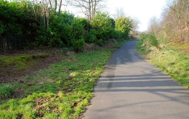
The traffic free route begins at Dee Street in East Belfast and
passes by the CS Lewis statue at the Holywood Arches, along the
Bloomfield Walkway to Sandown Road where it continues past the PSNI
headquarters to a newly installed toucan crossing at the Knock
Road.
From here it travels up to the Kings Road and onwards to Abbey
Road, through Tullycarnet and Ardcarn to East Link Road in
Dundonald. The greenway continues through a wetland area emerging
at the Comber Road, Dundonald where a toucan crossing has been
installed.
The route continues from Comber Road, Dundonald past the Billy
Neill Centre for Soccer Excellence where the former railway line
runs near to the Enler River. Walkers and cyclists can cross the
River Enler and farm lanes using a series of reinstated bridges
before reaching the final destination at the Belfast Road,
Comber.
Where can I walk and cycle on the Comber Greenway?
The full seven miles of the Greenway are now open to the
public.
Neill's Hill Belfast and County Down Railway (BCDR)
Station
From 1850 to 1950, Neill’s Hill was the next station after
Bloomfield on the County Down line to Comber, Donaghadee and
Newcastle. All these years after closure the up platform still
survives, but the down platform has gone.
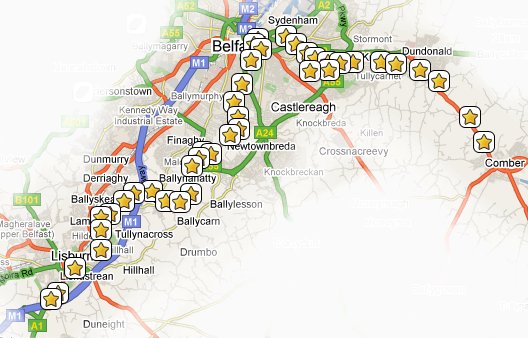
The MournesRambler I Series
There are 17 caches in the MournesRambler I series which is
designed to lure you away from the bright city lights along the
Comber Greenway:
The recommended mode of transport for this series is a bicycle,
but it should also be quite feasible to complete it on foot. Have
you found them all? If you have done them all one after the other
please let us know (in your log entry) how long it took you so that
others will know roughly how long it might take them.
The Calling at Neill's Hill cache
The cache itself is a 35mm film canister and contains a log book
and small pencil. It is hidden on the old Neill's Hill platform
close to where the Comber Greenway crosses the Sandown Road.
A little ingenuity will be required to remove the cache from its
hiding place. Please do not bend the bar.