I have been wanting to place a cache in another location for awhile
but have yet to find myself out in the area. Today was a candidate
hike for Southern Arizona Rescue and I loaded up my already heavy
pack with even more objects.. A fully stocked ammo can with
the plans of placing it in the area I had been wanting to.
Well we know how the best laid plans can fail once in awhile. hehe
Upon meeting this morning the location of our hike was being
changed because of parking and weather concerns. I think some of
us were just bored with always going to the same place :-)
We headed out and I spied a wonderful spot that could use some
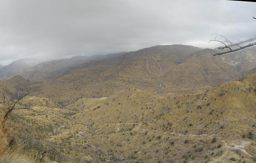
company. This morning was cold and overcast with a light snow
flurry coming down so the pictures wont be as amazing as it
normally is when we hike through here. From this point the saddle
directly below you is named Shreve Saddle. That fence is the
boundary of the Wilderness area and below you to the west (away
from the parking lot) is Sycamore Resevoir and to your east the
high point is the location of Visa Spy Gadget cache.
We would have enjoyed placing the cache lower in the next canyon
towards the resevoir, but the district rangers have informed us
"The bottom line is: There is no specific
prohibition which does not allow you to "temporarily" place items,
as you are requesting, on National Forest System lands. The key is
"temporary". If items are left for long periods of time, they are
construed to be abandoned, and there are prohibitions which carry a
fine. Furthermore, our manual direction advises us to discourage
the placement of geo caches and similar activities. The reason for
this is that individuals or organizations engaged in these
activities tend to create new trails to locations away from
existing trails (just by the continual use). These trails then
become high use trails by others.
Geocaching – An Increasing Recreation Use
As such, we would prefer not to be fined when the cache has been
deemed by the rangers as too long in place. We have been told by
other rangers that Catalina mountains are open to geocaching but to
remain out of the wilderness area, so this is the closest we can
take you to the old resevoir system below.
If you follow the road on down it becomes rutted, but it is
walkable. Recently we were in the area with a 9 year old, 4 year
old and 2 year old so it is not that bad. While it may seem long,
the walk down is really worth it.
Cell service is a nada in most of this area and you need to make
sure you bring plenty of water. I drank over 2 liters today going
to the cache then down the west side and back to parking. .
We really hope you enjoy the area and the views.
FTF pin for the FTF