Tickles and a Flat Earth? EarthCache
Tickles and a Flat Earth?
-
Difficulty:
-

-
Terrain:
-
Size:  (not chosen)
Please note Use of geocaching.com services is subject to the terms and conditions
in our disclaimer.
Change Islands is located
on the Northeast coast of Newfoundland. To get to Change
Islands you must take a passenger/vehicle
ferry that operates from Farewell (Route 335 via
Stoneville).
Change Islands has lots for visitors to experience: rich culture,
picturesque hiking trails, and wonderful hospitality.
Town of Change Islands
The town of Change Islands was first settled by
the French in 1783 as a fishing outport.
The early settlers would fish off the northern island during the
summer months and would change islands in the fall to the south
island for forestry and hunting, hence how the town got its name.
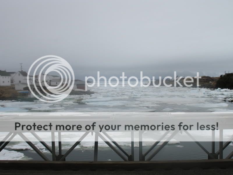
Main Tickle
The focal point of the town, both past and
present is the tickle. A tickle is a narrow saltwater strait, as in
the entrance to a harbor or between islands or other land masses,
often difficult or treacherous to navigate because of narrowness
and tides. The Main Tickle that passes through Change Islands was
most likely created either by one of the many fault lines around
the area or was cut by a passing glacier. The Tickle is relatively
deep with only a handful of dangerous shoals for boaters to be
aware of. Rocks lining the Tickle are shallow marine to subaerial
sedimentary and volcanic rocks. Sedimentary rocks are rock formed
by accumulation and cementing of loose sediment (e.g., sandstone),
the deposition of chemical compounds held in solution in water
(e.g., limestone), or by the accumulation of animal or plant debris
(e.g., coal); whereas volcanic rocks are igneous rock that
solidified on surface following a volcanic eruption; extrusive rock
or lava; generally cools quickly, therefore is fine grained
(Source. Dept Natural Resources NL).
The Main Tickle was the most densely populated by the early
settlers and also by the people of today.
The Main Tickle is dotted with colorful fishing premises which
date back more than 100 years.
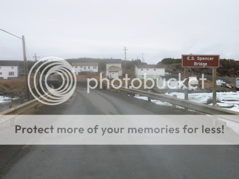
Prior to 1965 the North and South islands were separated by the
tickle and residents had to row across the tickle in the summer and
fall, and walk across the tickle ice in the harsh winter
months.
There are many stories of young love occurring between and man on
the South Island and a girl on the North Island, and him
“borrowing” a rowboat in the darkness of the night to visit his
future bride.
In 1965 the two islands were connected by a causeway, the E.S.
Spencer Bridge, and is still used today almost its same
condition.
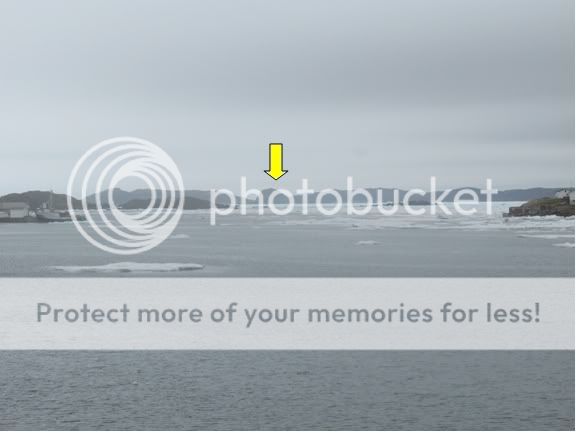
The Fogo Connection
East of the coordinates posted is Fogo Island,
the largest island in the province of Newfoundland &
Labrador.
Fogo Island too has a very unique history.
One of the most unique geological features on Fogo Island is
Brimstone Head, outlined by the arrow in the following picture, and
is especially the interest of a provocative geological
organization. Brimstone head is comprised of mainly graintes
470-350Ma, with an elevation at its peak of ~400ft above sea level.
Granites are light-coloured, coarse-grained felsic igneous
intrusive rock composed of quartz, feldspar and ferromagnesium
minerals such as mica and hornblende; it is the intrusive
equivalent of rhyolite (Source. Dept. Natural Resources NL).
The Flat Earth Society is an organization that originated in
England but now is based out of California, whose theory is the
Earth is flat not round. The past president Charles K. Johnson
determined Brimstone Head as one of the four corners of the earth.
A detailed outline of their arguements and proofs can be seen
here.
To successfully log this
Earthcache, you muST:
--take a photo of yourself facing both sides of the tickle (E &
W)
--estimate the distance to Brimstone Head from the posted
coordinates
--estimate the width of Main Tickle at its narrowest point, and
widest point.
***Please post pictures and email answers to cache owners. ANY
answers posted in cache logs will be deleted!***
Local geocaches on Change Islands &
Farewell:
GCGKBE—Squid Jiggers Trail
GCGJJN—Squidjigger
GCY38E—The Shoreline Trail Cache
GCGZQ8—Farewell
Cache – ITB2
Additional Hints
(Decrypt)
QB ABG CNEX BA PNHFRJNL!!!