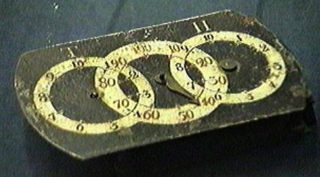
From thinkquest.org, "Believe it or not, the odometer dates all the
way back to Franklin's times, for he was keen enough to foresee its
usefulness in daily life. As postmaster, Benjamin was assigned the
task of mapping mail routes for the local towns. He went out riding
on this carriage to measure the routes and soon realized how
important it was to keep track of the distances. Consequently, he
invented a simple odometer attached to his carriage. The instrument
was designed to measure distances by counting the rotations of the
axles of the wagon. Interestingly, the device was calibrated to
trigger a bell every twenty "rods". Historians speculate that
Franklin used his odometer to establish mile markers along his
postal route.

From francomaine.org: "The King's Highway developed from the
building of roads between early settlements along the coast of New
England. It is the oldest highway in Maine and evolved into part of
Route 1, which stretches from Maine to Georgia. Spur roads diverted
north off the King's Highway and connected the coast of Maine to
inland towns, such as Route 24 from Topsham, up the west side of
the Kennebec River, to the Augusta-Hallowell-Gardiner area."
Go to the above location to check out the historical plaque and
stone. Use the numbers to get you to the second stage.
Plaque: "Set in ABCD." and Larger engraved stone: Mile Marker
number EFG.
Go to 43 4C.ECG / 070 1E.88B
This will take you to a location about 1 mile away with a
similar plaque and stone..."H of I known in Cumberland County."
Mile marker number JKL.
To find cache, go to 43 4I.HJ8 / 070 HJ.980
Have fun and Happy Cachin'!