The Flow of Rivers EarthCache
Trail Jogger: This geocache is being archived. Congratulations to all who have sought and found it.
Trail Jogger
-
Difficulty:
-

-
Terrain:
-
Size:  (not chosen)
Please note Use of geocaching.com services is subject to the terms and conditions
in our disclaimer.
For this Earthcache, you will learn to use publicly available real
time information to understand how the flow of fresh river water is
controlled to prevent flooding. As you will be visiting dams and
streams, you might be wise to bring your camera. Dams are great for
children to see and the view from the top is beautiful in all
directions.
This earthcache is tagged to Columbus, Ohio, which is the site of
the first streamflow measurement taken in the Scioto River that
flows through town and supplies our fresh drinking water. It is not
necessary to visit this location to claim the cache but is worth a
driveby to see the Ohio Historical Sign and the site on King Street
bridge.
The Best Dam Earthcache Photo
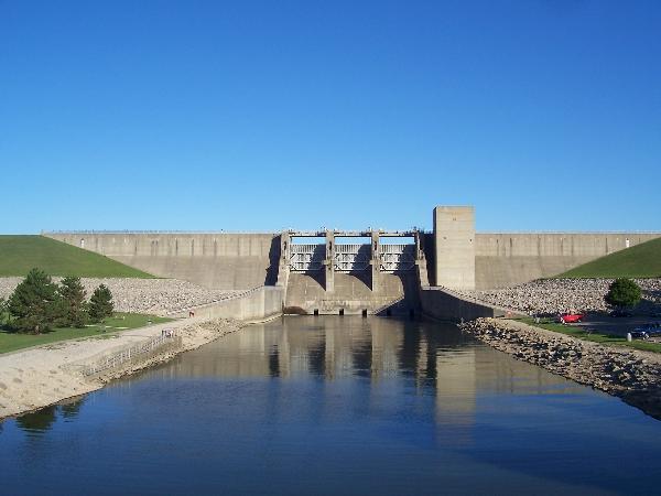
Deer Creek Dam
Direction of Flow
In the northern United States, water in the Great Lakes basin flows
downward toward the Great Lakes and then cascades downhill 601 feet
from one lake to the next until it flows out to the Atlantic ocean.
Rivers in northern Ohio tend to flow in a northerly direction into
Lake Erie while those in central and southern Ohio tend to flow
south toward the Ohio River, which flows west to the Mississippi
River, which then flows south to the Gulf of Mexico.
In central Ohio, the O’Shaughnessy Reservoir feeds Griggs Reservoir
which feeds the Scioto River. Delaware Lake feeds the Olentangy
River. These two rivers unite near Confluence Park in downtown
Columbus. The Alum Creek Reservoir feeds Alum Creek and the Hoover
Dam feeds Big Walnut Creek. These two join Blacklick Creek and
unite as Big Walnut Creek in Three Creeks Park. Big Walnut flows
into the Scioto River south of Columbus.

Central Ohio Dams
Alum Creek Dam (upper left), O'Shaughnessy Reservoir Dam
(upper right)
Delaware Lake Dam (lower left), Griggs Reservoir Dam (lower
right)
The Destructive Nature of Water - Flooding
Floods are a dangerous hazard throughout the world. On average in
the United States, about 165 people are killed and about $2 billion
of damage occurs each year due to flooding. The reason that so many
people drown during flooding is because few of them realize the
incredible power of water. One cubic foot of water weighs over 62
pounds! A mere six inches of fast-moving flood water can knock over
an adult and it takes only two feet of rushing water to carry away
most vehicles, including pickups and SUVs. There are two basic
kinds of floods, flash floods and the more widespread river
flooding, which is our concern in Columbus.
Flash floods generally cause greater loss of life and river floods
generally cause greater loss of property. A flash flood occurs when
runoff from excessive rainfall causes a rapid rise in the stage of
a stream or normally dry channel.
River flooding is generally more common for larger rivers in areas
with a wetter climate, when excessive runoff from longer-lasting
rainstorms and sometimes from melting snow causes a slower
water-level rise, but over a larger area. Most floods can be linked
to a storm of some kind. Even when it is a nice day in Columbus, a
storm may have passed to the north of us. This would cause
increased river flow, which would cause the dams to swell. So dam
engineers must always monitor streamgage readings in their areas to
anticipate the need to raise or lower the levels of their dams.
The National Weather Service collects and interprets rainfall data
throughout the United States and issues flood watches and warnings
as appropriate. The first and most important factor in flood
prediction is the monitoring of the amount of rainfall occurring on
a realtime basis. The second, monitoring the rate of change in
river stage on a realtime basis, can help indicate the severity and
immediacy of the threat and can help to predict how extensive and
damaging an impending flood might become.
The two most fundamental items of hydrologic information about a
river are “stage”, which is water depth and “flow” or
discharge, which is the total volume of water that flows past a
point on the river for some period of time. These two key factors
are measured at a location on the river called a stream-gaging
station.

Central Ohio Streamgages
The U.S.Geological Survey streamgaging program provides hydrologic
information needed to help manage the nation's water resources. The
USGS currently operates a nation-wide network of about 7,300
streamgaging stations, where streamflow is monitored continuously.
The program provides a continuous source of reliable and consistent
water data.

Streamgage Cutaway Diagram
For this earthcache you will be visiting a combination of any three
of the following flood control elements. While researching this
earthcache I have personally visited all 6 dams and all 12
streamgages and am providing you with very accurate locations. You
may use any other dams or streamgages that you find on the USGS
site, but I wanted to give you a few accurate fixes to work with.
Central Ohio
Dams
| N40-09.194 W083-07.568 |
* O’Shaughnessy Reservoir Dam |
| N40-00.972 W083-05.566 |
* Griggs Reservoir Dam |
| N40-21.530 W083-04.139 |
* Delaware Lake Dam |
| N40-11.144 W082-57.994 |
* Alum Creek Lake Dam |
| N40-06.490 W082-52.921 |
* Hoover Dam |
| N39-37.345 W083-12.895 |
* Deer Creek Lake Dam |
Central Ohio Creek and River
Streamgages
Scioto River
| N40-25.167 W083-11.833 |
* Scioto River near Prospect |
| N40-08.654 W083-07.303 |
* Scioto River below O’Shaughnessy Dam |
| N40-00.991 W083-05.566 |
* Scioto River on Griggs Reservoir Dam |
| N39-46.342 W083-00.458 |
* Scioto River near Commercial
Point |
Olentangy River
| N40-21.321 W083-04.044 |
* Olentangy River south of Delaware Lake
Dam |
| N40-06.619 W083-01.932 |
* Olentangy River in
Worthington |
Alum Creek
| N40-11.009 W082-57.794 |
* Alum Creek Spillway south of Alum Creek
Dam |
Big Walnut Creek
| N40-06.166 W082-53.030 |
* Big Walnut Creek south of Hoover
Reservoir |
| N39-51.400 W082-57.433 |
* Big Walnut Creek on Reese
Road |
Big Darby Creek
| N39-57.086 W083-16.166 |
* Big Darby Creek in West Jefferson |
| N39-42.047 W083-06.625 |
* Big Darby Creek in Darbyville |
Deer Creek
| N39-37.233 W083-12.783 |
* Deer Creek below Dam |
| N39-35.130 W083-07.278 |
* Deer Creek in Williamsport |
To claim this earthcache, please complete
Items #1 and #2, below.
(1) Take a picture of yourself or your GPS near any
one dam and one streamgage.
(2) Post the location of the streamgage that you spotted
then, from the US Geological Survey web page located at
http://waterdata.usgs.gov/nwis/rt, select the streamgage you found.
Post the “gage height” (water depth) that you found at this
streamgage for the day that you found it and comment upon any
substantial difference that you observed.
Uploaded pictures of other dams and streamgages are encouraged!
THIS EARTHCACHE WAS PLACED BY A
PLATINUM EARTHCACHE MASTER
Additional Hints
(Decrypt)
Or pnershy nebhaq zbivat jngre.
Treasures
You'll collect a digital Treasure from one of these collections when you find and log this geocache:

Loading Treasures