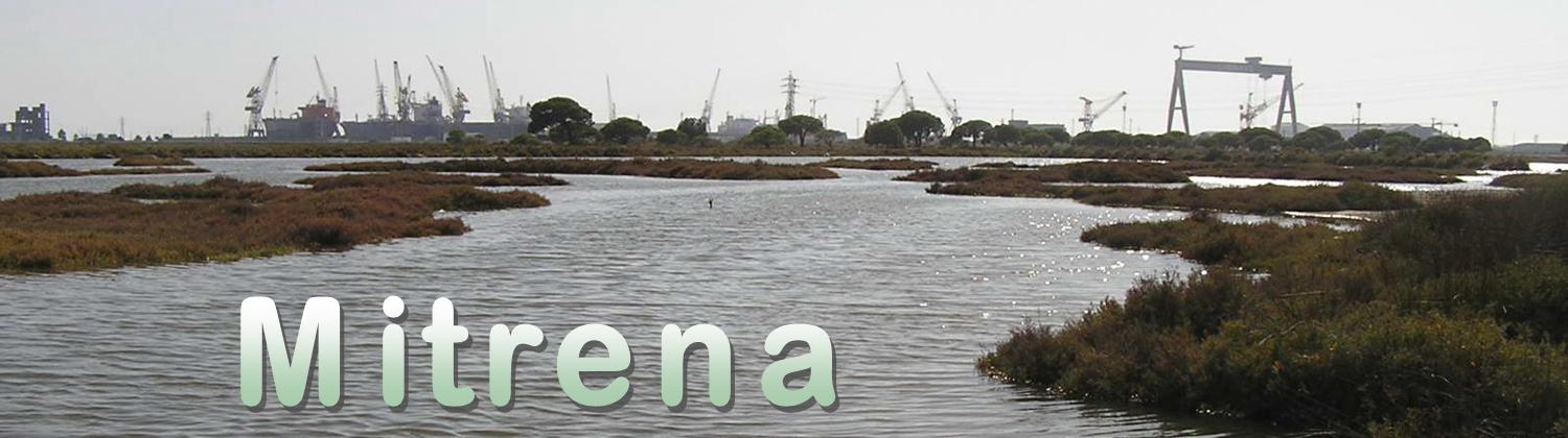
![[PT]](https://imgproxy.geocaching.com/fd803be3bfb7396e826555e469c7752394fb37ae?url=http%3A%2F%2Ffarm1.static.flickr.com%2F212%2F481411265_8928121d68_o.gif) Bem vindo a esta cache que dá a conhecer a
península da Mitrena, em Setubal, o limite norte do Estuário do
Sado e o importante pólo industrial de Setúbal.
Bem vindo a esta cache que dá a conhecer a
península da Mitrena, em Setubal, o limite norte do Estuário do
Sado e o importante pólo industrial de Setúbal.
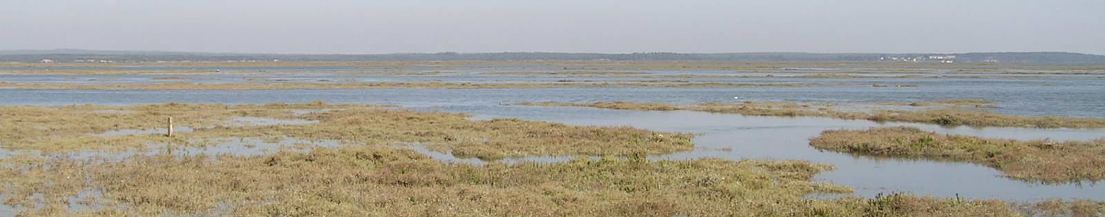
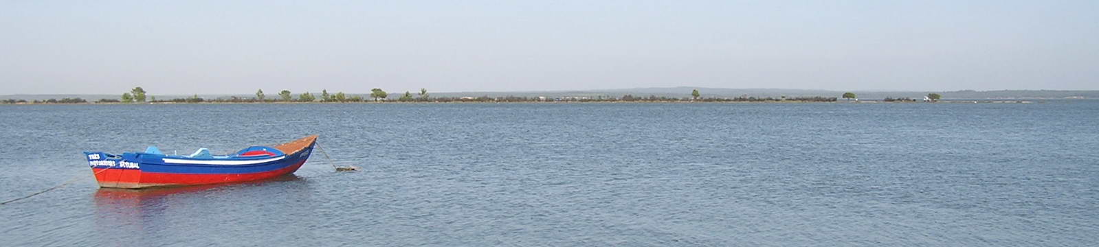
Aqui vai ficar a conhecer toda a faixa litoral
desde Setúbal até à Mitrena, terminando nos estaleiros da Setenave.
Daqui para a frente tem todo o Estuário do Sado, à sua esquerda os
sapais e salinas da Mitrena, que se prolongam até Praias do
Sado.
![[EN]](https://imgproxy.geocaching.com/26dce0e20e21dd7e2c84c6c439fc1ab0a1b1385f?url=http%3A%2F%2Ffarm1.static.flickr.com%2F179%2F481411263_e6595005a4_o.gif) Welcome to this cache that it gives to know peninsula of the
Mitrena, in Setúbal, the limit north of the Estuary of the Sado and
important polo industrial of Setúbal.
Welcome to this cache that it gives to know peninsula of the
Mitrena, in Setúbal, the limit north of the Estuary of the Sado and
important polo industrial of Setúbal.
Here the coastal band goes to be to know all
since Setúbal until the a Mitrena, finishing in the shipyards of
the Setenave. Onward has all the Estuary of the Sado, to its left
the sapais and salt mines of the Mitrena, that if draw out until
Beaches of the Sado.
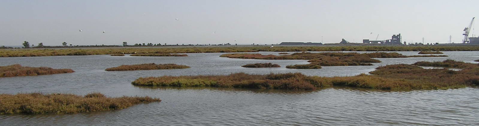
O local
A área da Reserva Natural do Estuário do Sado –
RNES (Decreto-Lei n.º 430/80, de 1 de Outubro) estende-se por
territórios de quatro concelhos: Setúbal, Palmela, Alcácer do Sal e
Grândola, totalizando uma superfície de 23.160 ha, em que cerca de
13.500 ha são estuário.
Embora a região registe grandes concentrações populacionais e uma
faixa industrial entre Setúbal e Mitrena/Praias do Sado, insiste em
preservar uma grande complexidade e diversidade de habitats de
grande valor e produtividade ecológica.
O estuário do Sado foi criado em 1984 e possui
uma área de aproximadamente 160 km2 com um comprimento de 20 km e
uma largura média de 8 km.
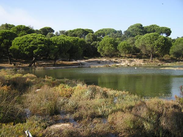
Esta reserva abrange a maior parte do Estuário
do Sado e área envolvente. Dela fazem parte as importantes zonas
dos sapais, as dunas de Tróia, cuja vegetação tem um papel
fundamental na fixação das areias, e as lagoas da Herdade do
Pinheiro, ecossistemas favoráveis à existência de uma fauna e flora
muito rica e diversificada. De características húmidas, é uma área
privilegiada para a nidificação e para a passagem do Inverno de
muitas espécies. Em relação à fauna, destacam-se a lontra-europeia,
o roaz-corvineiro, o gineto, a raposa, a cegonha-branca e a
perna-longa. Merece especial referência o roaz-corvineiro, uma das
espécies de golfinhos que vive junto ao litoral, mas também no mar,
e que possui no estuário do Sado uma comunidade com cerca de 30
animais. Quanto à flora, destacam-se a camarinheira, o
golfão-branco, o valverde-dos-sapais e algumas espécies endémicas
portuguesas na Reserva Botânica das Dunas de Tróia.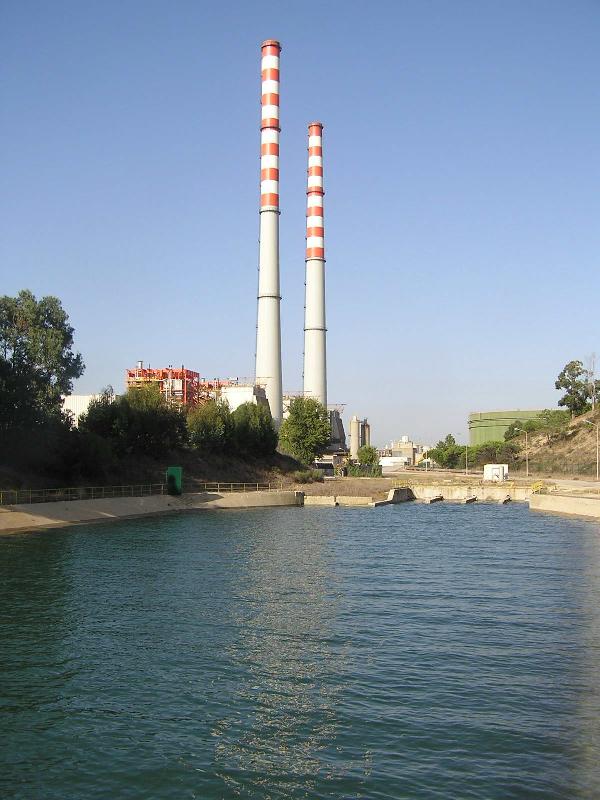
Se quiser passear e fazer Geocaching nas imediações do Estuário
aconselha-se uma visita à
Carrasqueira, aldeia ribeirinha junto à praia da Comporta, que
conserva uma obra-prima da arquitectura popular: um cais
palafítico, que se estende e ramifica durante centenas de metros
pelos esteiros lamacentos rio Sado.
Também é possível visitar o Moinho de Maré da Herdade da Mourisca,
que tem um Centro de Educação de Sal e o Galeão de Sal de 1944,
recentemente restaurado, e a cache
Mouriscas.
A região constitui uma das áreas naturais de
maior valor ecológico e paisagístico de Portugal.
Numa posição central do território nacional, a região foi ocupada
desde cedo, desenvolvendo-se na época romana a actividade
industrial de salga e conservação de peixe, como pode ser visto nas
caches
Fornos do Pinheiro (temporariamente indisponivel, assim
esperamos..) e na cache
Fornos II - Ruínas de Abul.
O Estuário do Sado é o segundo maior estuário de
Portugal e constitui a terceira zona húmida mais importante do
território português, em termos das aves aquáticas que o visitam.
Com grande importância para a Conservação da Natureza, a região
desempenha simultaneamente um papel importante no lazer e recreio
das populações e visitantes.
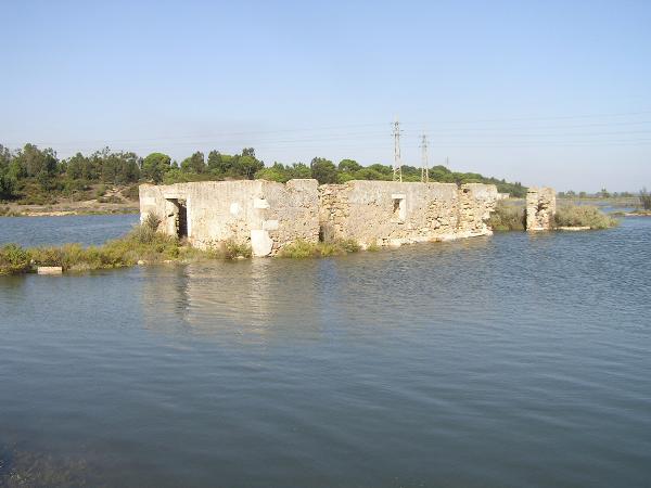
Não deixe de visitar o Moinho de Maré da
Mitrena que se encontra em ruínas e que está em N 38º 29.275
W 008º 47.582.
The local
The area of the Natural Reserve of the Estuary
of the Sado - RNES (Decree n.º 430/80, of 1 of October) is extended
for territories of four concelhos: Setúbal, Palmela, Alcácer of Sal
and Grândola, totalizing a 23.160 surface of ha, where about 13.500
ha is estuary. Although the region registe great population
concentrations and an industrial band between Setúbal and
Mitrena/Beaches of the Sado, insists on preserving a great
complexity and diversity of habitats of great value and ecological
productivity.
The estuary of the Sado was created in 1984 and
approximately possesss a 160 area of km2 with a 20 length of km and
8 an average width of km.
This reserve encloses most of the Estuary of the
Sado and involving area. Of it the important zones of the sapais
are part, the dunes of Troia, whose vegetation has a basic paper in
the setting of sands, and the lagoons of the Farm of the Pine,
ecosystems favorable to the existence of a fauna and flora very
rich and diversified. Of wet characteristics, it is a privileged
area for the nest building and the ticket of the Winter of many
species. In relation to the fauna, they are distinguished it
otter-European, the roaz-corvineiro, gineto, the fox, the
stork-white and the leg-long one. The roaz-corvineiro deserves
special reference, one of the species of dolphins that live next to
the coast, but also in the sea, and that it possesss in the estuary
of the Sado a community with about 30 animals. How much to the
flora, they are distinguished camarinheira it, the golfão-white,
valverde-of - sapais and the some Portuguese endémicas species in
the Botanical Reserve of Dunes of Troia.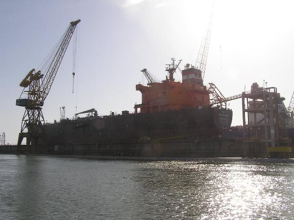
If to want to walk and to make Geocaching in the
immediacy of the Estuary advises a visit to the
Carrasqueira, marginal village next to the beach of Comporta,
that conserves a masterpiece of the popular architecture: a
palafítico wharf, that if extends and ramifies during hundreds of
meters for the muddy esteiros river Sado. Also it is possible to
visit the Mill of Tide of the Farm of the Moorish, that has a
Center of Education of Salt and Galeão de Sal of 1944, recently
restored, and cache
Mouriscas.
The region constitutes one of the natural areas of bigger
ecological and paisagistic value of Portugal. In a central position
of the domestic territory, the region was busy since early,
developing at the time Roman the industrial activity of salts and
fish conservation, as it can be seen in caches
Fornos do Pinheiro (temporarily indisponivel, thus we wait.) e
in cache
Fornos II - Ruins of Abul.
The Estuary of the Sado is as the bigger estuary of Portugal and
constitutes the third more important wet zone of the Portuguese
territory, in terms of the aquatic birds that visit it. With great
importance for the Conservation of the Nature, the region
simultaneously plays an important role in the leisure and
recreation of the populations and visitors.
Don´t leave to visit the Mill of Tide of the Mitrena that if
finds in ruins and that it is in N 38º 29.275 W 008º 47.582.
Informação Turística
Pode (e deve) fazer o Percurso Mitrena –
Tem início na Península da Mitrena e uma extensão de 9 km.
Duração: 1h30 minutos; Grau de dificuldade: médio; Interesse: vista
sobre o Rio Sado e os sapais, área florestal e observação de aves.
É altamente recomendável para BTT ou ainda TT.
Poderá ainda efectuar visitas ao Estuário do Sado
destinadas à observação dos golfinhos (roaz) do Sado (mínimo 20
pessoas). Entre as empresas que efectuam estas viagens, poderá
contactar o Projecto Delfim – Centro Português de Estudo dos
Mamíferos Marinhos (Tel. 21 465 86 42; Fax: 21 465 86 49;
projectodelfim@apoiologico.pt; www.projectodelfim.pt)
Touristic information
You can (and it must) make the Mitrena Passage -
It has beginning in the Peninsula of the Mitrena and a 9km of
extension. Duration: 1h30 minutes; Degree of difficulty: medium;
Interest: sight on Rio Sado and the sapais, forest area and comment
of birds. It is highly recommendable for BTT or TT.
It will be able to still effect visits to the
Estuary of the Sado destined to the comment of the dolphins (roaz)
of the Sado (minimum 20 people). Between the companies who made
these trips, will be able to contact the Project Dolphin -
Portuguese Center of Study of the Marine Mammals (Tel. 21 465 86
42; Fax: 21 465 86 49; projectodelfim@apoiologico.pt;
www.projectodelfim.pt)
A Cache
Para chegar ao local da cache encontrá-la deverá
dirigir-se a Setúbal. Aí deve procurar a EN10 que vai de Setúbal em
direcção ao Alentejo. À saída de Setúbal encontra uma saída à
direita que diz Mitrena. Siga por aí. Irá passar por várias
industrias marcantes de Setúbal, nomeadamente a Central
Termoeléctrica. Aí deve virar à esquerda até ao fim do alcatrão.
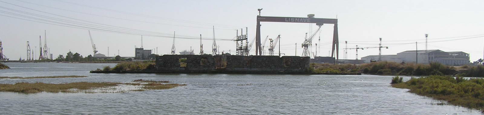
Pelo caminho vai encontrar a Sapec, o novo terminal de passageiros
e veículos, a fábrica de pasta de papel da Portucel, a "ilha"
da Galp e por fim já na Mitrena os estaleiros da Lisnave e
Setenave. A cache encontra-se numa lingua de areia que entra pelo
estuário adentro, local escolhido pelos pescadores desportivos e
com uma óptima vista. Os últimos 300m não são os ideais para quem
gosta de estimar o carro, se não for o caso pode ir no mesmo até
10m da cache.
Recomendo a maré alta para visitarem o local, se
quiser desfrutar de uma praia e banhos de sol é preferível a maré
baixa.
É fácil, não custa nada. Espero que
gostem!:)
Esta cache é um tupperware de tamanho regular
envolto num saco de plástico verde de tamanho +/- 12x12x10cm.
O conteudo inicial da cache além do Logbook,
stashnote, lápis, afia e documentação é:
- Carrinho
- Tamagoshi
- Borracha
- Boneco
A cache encontra-se tapada no chão no meio de
uns arbustos. Seja discreto/a na sua procura pois o local é muito
frequentado.
Deixe-a exactamente como a encontrou, bem
escondida e tapada.
The Cache
To get to the location of the cache you should head to Setúbal.
There you should look for the EN10 that leaves Setúbal in the
direction of Alentejo. When leaving Setúbal you’ll find an exit to
the right with the indication Mitrena. Go through there. You’ll
pass several important industries in Setúbal, namely the
Thermoelectric Power Plant. There you should turn left and go until
the end of the road. On your way you’ll see the Sapec, the new
passenger and vehicle terminal, Portucel's paper factory, the Galp
“island” and finally, when you’ve reached Mitrena, the Lisnave and
Setenave shipyards. The cache can be found in a branch of sand that
enters the estuary, a place that is chosen by sports fishermen and
with a great view. The last 300mts aren’t advisable for those who
like to take good care of the car, but if that’s not the case you
can use it to get to about 10mts from the cache.
I recommend that you visit the place during the high tide,
although if you want to enjoy the beach and sunbaths the low tide
is preferable.
It’s easy, it doesn’t cost a thing. I hope you like it!:)
This cache is a Tupperware of regular size wrapped in a green
plastic bag of about 12x12x10cm of size.
The initial contents of the cache, besides the Logbook,
stashnote, pencil, pencil sharpener and documentation, are:
- Small Toy Car
- Tamagoshi
- Rubber
- Doll
The cache is covered in the ground, amidst some bushes. Be discreet
in your search, as the place is very busy.
Leave it exactly as you found it, well hidden and covered.
Ah, e não se esqueça nunca/Oh,and never forget:
Cache In Trash Out!
 ¤ menu
>
início :: Mitrena ¤ menu
>
início :: Mitrena |
translate:

|
|
|