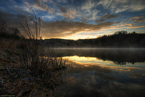
Kame to see Forks and a Kettle EarthCache
Kame to see Forks and a Kettle
-
Difficulty:
-

-
Terrain:
-

Size:  (not chosen)
Please note Use of geocaching.com services is subject to the terms and conditions
in our disclaimer.
An easy hike through rolling hills on a hardpacked trail.

Welcome to Forks of the Credit Provincial Park. The posted
co-ordinates will lead you to the parking area. Please note there
is an admission fee for this park.
Looking into the park, the view is dominated by Kame Hills and a
Kettle Lake. You should take some time and explore this park and
it's many geological features. Church's Falls is located within
this park and features the ruins of an old mill. This is where the
Credit River plunges over the Niagara Escarpment. If you have time,
the falls are located near N43 49.316, W 080 01.263, which is a 30
minute hike from the Earthcache.
To complete this earthcache, pay attention to the Kettle Lake in
front of you. Kettles occur when blocks of ice are calved fron the
front of a receding glacier, and end up buried. After time, the ice
block melts and a hole is left in it's place. Most kettles are
smaller than 2 kilometers, and less than 45 metres in depth. If it
fills with water, it becomes a Kettle Lake. Kettle lakes normally
rely on precipitation or the local groundwater table.
To log this earthcache, follow the trails that surround the lake.
You can walk around the lake using the Meadow Trail, Kettle Trail
and the Trans Canada Trail. An interpretive plaque is located at
N43 49.177, W080 00.294.
Please answer the following questions:
- Measure the altitude difference between the lake's water level
and hills that surround the lake.
- How many streams or rivers feed or are fed by this kettle?
Do not leave the marked trails. Take nothing but photographs, leave
nothing but footprints. The trails are bike friendly, and the park
is open year-round. There are washrooms at the parking area, and
the park connects to the Trans Canada Trail, and the Bruce Trail.
The Elora-Cateract Trail leads from the Falls to the Elora Gorge
(which also has an Earthcache). This is a popular place for
snowshoeing and cross country skiing.
Forks of the Credit Park website: http://www.ontarioparks.com/English/fork.html
Trail Map (also posted at the park entrance):
http://www.thehillsofheadwaters.com/earlrowe/documents/earlrowe/forksmap.jpg
Please send your answers to me, do not post your answers
here.
Additional Hints
(No hints available.)