Caprock Canyons State Park and Trailway is a 15,313-acre gem about 75 miles southeast of Amarillo (or 75 miles northeast of Lubbock), on the natural border between the Llano Estacado (staked plain) of the Texas Panhandle and the Low Rolling Plains that extend east toward central Texas.
One measure of park quality is the variety of activities available. Caprock Canyons has hiking; horseback riding; mountain biking; boating on a no-wake lake (120-surface-acres, 30' deep when full); fishing; lake swimming; a scenic drive; guided tours, and wildlife viewing including home to the Texas State Bison Herd. Other measures of park quality are accessibility, facilities, and opportunity for solitude. A variety of well-maintained roads and trails provides easy accessibility to most of the park. A variety of camping options range from well-maintained water/electric hookups to primitive sites. Only 75,000 visitors a year ensures solitude, especially during off-season months in the summer and winter. A $3 per person, per day, entry fee is required.
Caprock Canyons is a tale of erosion. Although there are many geologic sites where erosion is the shaping force, the proximity to “edges,” whether an ancient shoreline, southern extent of a glacial period, or the current Rockies uplift, produces a wonderful diversity of terrain at Caprock Canyons.
This Earthcache is designed to provide an overview of the park and its geologic features. It can be completed in 90 minutes at a leisurely pace. Here are five suggested stops and three requirements to complete the Earthcache
1. The rangers and volunteers are very helpful at the new Visitor’s Center. Email me the answers to the following question: These redbeds were laid down during the __________ Age, approximately __________ years ago.
Waypoint: N 34° 24.618 W 101° 03.211
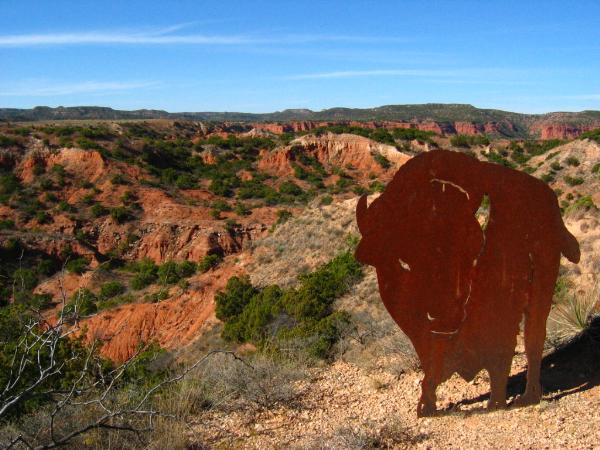
2.***OPTIONAL TASK, NOT REQUIRED*** Take a picture of your group with this bison and include it with your log.
Waypoint: N 34° 25.211 W 101° 03.624
3. Visit the South Prong parking area and email me the answer to the following question: __________ are formed when a hard cap of sandstone protects underlying bedrock from eroding as fast as nearby rock.
Waypoint: N 34° 26.465 W 101° 05.578
4. Park at the Eagle Point parking area: Waypoint: N 34° 26.355 W 101° 04.197
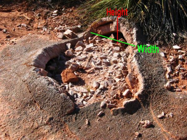
Then walk along the road to the Eagle Point Trailhead. You will see gypsum arches along the trail. These are temporary structures that appear and disappear due to erosion. Email me your measurement of the height and length of one of these arches. The one in the picture below is 0.10 miles from the Eagle Point parking area.
Waypoint: N 34° 26.286 W 101° 04.131
5. ***OPTIONAL TASK, NOT REQUIRED*** Another 0.15 miles down the trail is a natural bridge that is well worth the short walk!
As usual, do not post answers to the questions. Any posts containing them will be deleted.