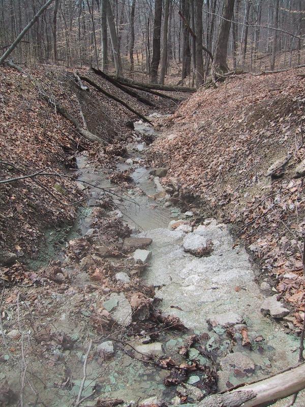
The
listed coordinates will take you to the intersection of the
red trail and fossil creek.
The fossil bed is located about 100 feet upstream
from here.
Use care when approaching the fossil bed and avoid
damaging the surroundings.
Burnt Knob in Iroquois
Park is one of the northern most outliers of the Borden
Formation in Jefferson County which is the prominent geologic
formation throughout the Jefferson Memorial
Forest. This
formation is comprised predominantly of siltstone and shale
from the Mississippian age 360 to 325 million years ago.
During this time the local area was covered by a shallow warm
sea.
Shale and siltstones found in the Borden
formation are the result of mud, silts, and sands brought in
by rivers and streams from uplands many miles away and
deposited in this shallow sea. Calcite
from marine organisms along with silica, chert, clay, silt,
sand and sea animal skeletons also combined to form layers of
sediment in these tropical seas. The
layers of sediment compressed under pressure from subsequent
layers coupled with the receding of the sea would eventually
allow for the formation of shale, siltstone, and
limestone.

The Borden Formation
in this area is comprised of the Muldraugh, Holtsclaw
Siltstone, Nancy, Kenwood Siltstone, and New Providence Shale
members.
The New Providence Shale member is found in Iroquois Park
from about 530 to 670 feet in elevation. Above this the Kenwood
Siltstone member is found from about 670 to 740
feet. The gently
rolling field on top the knob is capped with up to 20 feet of
Loess and sand mix.
 |
|
 |
|
Fossil Creek |
|
Fossil Bed |
The Iroquois Park
fossil bed is located in the New Providence Shale
member. This
member is characterized by clay shale and minor
limestone. The
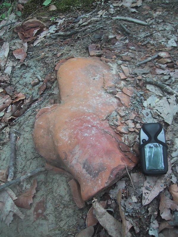
Clay shale is olive-gray and weathers yellowish gray to light
greenish gray. The shale can be iron
stained and contain light to dark brown and yellowish-brown
ironstone concretions also known as kidney boulders or
ironstones. You can
find an example of this along the nearby trail that goes to
the top of the hill.
Crinoids (multi-arm sea
animal), brachiopods (sea shells), cnidaria (corals),
pelecypods (clams), gastropods (snails), bryozoans (colonies
of Microscopic sea animals), trilobites (bug like arthropod),
and cephalopods (squid like animals) can be found in a thin
limestone layer of the New Providence member at about 80 to
100 feet below the Kenwood Siltstone member
contact.
|
 |
|
|
Ironstone Along Trail |
|
To get credit for this Earthcache post a
picture of yourself at the fossil bed and send an email to
Mooseky@gmail.comwith the answers to the following questions.
1. What is the
approximate size of the exposed fossil bed?
2. What is the
predominant fossil found here?
3. What color is the
shale just above the fossil bed?
Please remember our
parks are sanctuaries. No removal of natural resources – such as
rocks, plants and flowers is allowed.
References:
Geologic Map of Parts Of The Louisville West And Lanesville
Quadranges, Jefferson County Kentucky by Roy C. Kepferle –
1974.
The Geologic Story of Kentucky by Preston McGrain – 1983
Geology of Kentucky by Arthur C. McFarlan –
1950