|
 |
|
|
Iroquois Park Dry Waterfall |
|
The
listed coordinates will take you along side the upper cascade
of a 3 cascade waterfall.
There is an easy access path from the road
above.
The path starts behind a concrete foundation of where
a picnic shelter house previously stood.
 |
|
 |
|
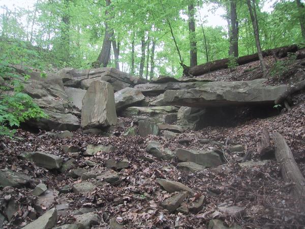
Upper Cascade |
|
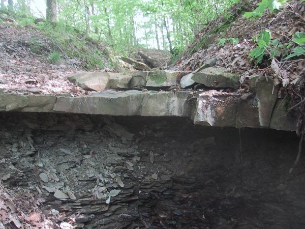
Middle
Cascade |
This is a good example
of an ephemeral stream waterfall. What I call the
upper cascade is actually a small plunge water fall with it's
tiny plunge pool below. During wetter periods of the
year this waterfall will continue to dribble water long after
rain storms, but the small stream will disappear before it
gets to the cascades down below. Unless
you are here during periods of heavy rain, you unfortunately
won’t see the actual cascade waterfall. The creek at
this elevation has a small drainage basin and flows
only during and shortly after precipitation. What is
of note to the area is a good example of the Kenwood
Siltstone rock exposure and a small but interesting type of
rock shelter that's not very common to this
area.
|
|
|
|
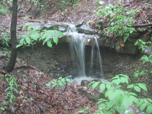
Upper Cascade After Rain Shower |
|
|

|
|
|
|
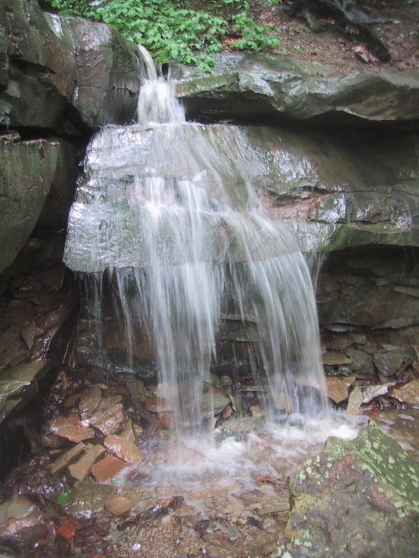
Middle & Lower Cascades After Rain |
|
Middle Cascade After
Rain |
The Kenwood Siltstone
member is part of the Borden Formation which is located above
the New Providence shale member at about the 670 to 740 foot
elevation in the park. The siltstone is
characterized by clayey, sandy appearance with light to
medium gray color that weathers yellowish gray. The siltstone beds in this
member can be up to14 feet thick separated by beds of clay
shale similar to that found in the underlying New Providence
member. In
general the siltstone and embedded shale in the Kenwood
siltstone formation is courser grained than the underlying
New Providence member. This formation extends south
into Bullitt County and is exposed in multiple areas through
out the Jefferson Memorial Forest.

As you may already
know at one time the Louisville area was a shallow
ocean. It is
speculated that during the early Mississippian geologic
period the distinct layering of shale and siltstone of the
Kenwood member was caused by seismic shocks from earthquakes
in an area to the east. The Kenwood siltstones were
deposited from sediments carried by bottom flowing currents
that descended swiftly down the under water slopes as a
result of these earthquakes.
The occurrence of fossils in the Kenwood
siltstone member is uncommon but bryozoans have been
found. What is of
interest to this formation is the occurrence of Scalarituba
Missouriensis. These
tube like casts are believed to have been made by some species of
marine worm which lived in great abundance in shallow water,
probably in the tidal flats. The
worms burrowed through the sediments while eating and passed the
sediment through its digestive track. Its excretion helped form a
chevron or scale like pattern within the burrow. If
you look carefully at the top of the second cascade and surrounding
area you can see some of these worm like casts.
The Kenwood Siltstone
has been used in the Iroquois Park area for building
foundations and home facings. It has been used in the park
for guard rails and steps. Stone quarried from the top
of neighboring Kenwood hill has been used in buildings like
the Broadway Baptist Church and the Old Kaufman building
located at 4th street live.
To get credit for this Earthcache post a
picture of yourself at the dry waterfall (or wet if you like rain)
and send an email to Mooseky@gmail.com with the answers to the following
questions.
1. What type rock do you see just below the Siltstone lip of
the upper cascade?
2, What is the approximate length, width and
height of the small rock shelter?
3.
What is the total approximate
height of the waterfall including its three
cascades?
References:
Geologic Map of Parts Of The Louisville West And Lanesville
Quadranges, Jefferson County Kentucky by Roy C. Kepferle –
1974.
The Encyclopedia of Louisville by John E. Kleber – 2000.
Scalarituba Missouriensis And Its Stratigraphic Distribution by
James E. Conkin and Barbara M. Conkin - 1968.
A View From The Top by Stefanie Rae Buzan and Rosemary Hauck
McCandless – 2007.