An Ancient Plain in Sal
Cape Verde Islands
International and political setting
From the guidelines: "People do not need to wait for permission to log your EarthCache. Requiring someone to wait is not supported by the EarthCache guidelines. People should send their logging task answers to you, then log your EarthCache. When you review their logging task answers, if there is a problem, you should contact them to resolve it. If there is no problem, then their log simply stands."
The Republic of Cape Verde (Portuguese: Cabo Verde) is a republic located on an archipelago in the Macaronesia ecoregion of the North Atlantic Ocean, off the western coast of Africa. The previously uninhabited islands were discovered and colonized by the Portuguese in the fifteenth century (though there may have been earlier discoveries), and attained independence in 1975.
Cape Verde was uninhabited when the Portuguese arrived in 1460 and made the islands part of the Portuguese empire. Due to its location off the coast of Africa, Cape Verde became an important watering station, then sugar cane plantation site, and later a major hub of the trans-atlantic slave trade that would later form the contemporary African Diaspora.
In 1975, Cape Verde achieved independence from Portugal after the African Party for the Independence of Guinea-Bissau and Cape Verde (PAIGC) long armed struggle in the jungles of neighboring Guinea-Bissau. Although there was no armed struggle in Cape Verde, some Cape Verdeans who fought in Guinea-Bissau asked for independence of Cape Verde. The PAIGC was the main entity responsible for the independence of Cape Verde. After independence, the PAIGC attempted to unite Cape Verde and Guinea-Bissau into one nation, the PAIGC controlling both governments, but a coup in the latter nation in 1980 ended these plans. As a result, the G, standing for Guinea-Bissau, in PAIGC was dropped, and the PAICV (African Party for the Independence of Cape Verde) was formed. In Cape Verde the PAICV (affiliated with the PAIGC) governed until democratic elections, held in 1991, resulted in a change of government. The Movimento para a Democracia (MPD) won that election. The MPD was re-elected in 1996. The PAICV returned to power in 2001, and was re-elected in 2006. (edited from: (
visit link))
Geographic setting
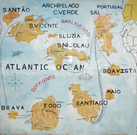
Cape Verde is divided in to a northern island group and a southern island group. The northern group is made up of Boa Vista, Sal, Santa Luzia, Santo Antão, São Vicente and São Nicolau Islands while the southern group is made up of Maio, Brava, Fogo and Santiago islands.
Of these, only Santa Luzia and the five islets are uninhabited and it has been converted into a natural reserve. All islands are volcanic and an active volcano exists on one of the islands, Fogo.
Ilha do Sal (Sal Island)
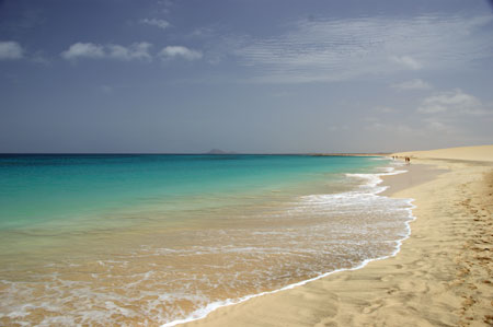
Sal Island, of volcanic origin, some 30 km long and 12 km wide, is the main focus of tourist attraction in the Cape Verde archipelago and holds over 50% of the bed occupancy of all the islands. Population figures hover in the 15000 people.
The name (sal) is derived from the fact that a salt mine was discovered in on the island in 1833. Today the island boasts both natural and artificial salt pans.
The island is flat which makes it ideal to locate the Amílcar Cabral international airport.
Although the island is considered flat it nevertheless has small elevations of which the highest reaches 406 m (Monte Vermelho/Grande in the north) and Monte Leste in the NW of the island.
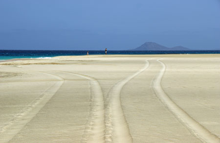
Although the island is flat it is a textbook example of what can happen in the “Erosion Cycle of Continents”.
The concept of the “Erosion Cycle of Continents” is the continued process over geological time that causes any landscape to progressively approach base level and eventually all erosion will cease resulting in a low, nearly featureless, simple, flat surface or plain.
This concept, which is still not consensual, assumes that at the beginning you have very rapid uplift of landmasses followed by a very long period of tectonic quiescence with perhaps very short periods of minor uplift. These ideas lead to the concept of pedeplains and peneplains both of which are viewed as very ancient plains and both of which are similar.
Pediplains are extensive erosion surfaces, interrupted by the occasional kopje or inselberg, and found in semi-arid and savanna landscapes, especially those of Africa. Pediplain formation, or pediplanation, is thought to result from the coalescence of neighbouring pediments. It is regarded as the last stage in an arid cycle of erosion or pediplanation cycle. In the early stages of the cycle, streams are rejuvenated and start eroding headwards from the coast. Scarps then retreat away from the drainage lines.
The concept of a peneplain (the word meaning “almost a plain”) emerged from W.M. Davis’ cyclic view of landscape evolution. As rivers and hillslopes reduced relief through the phases of youth, maturity, and old age, explained Davis, the eventual result was a plain of extremely low relief. This plain could only change very slowly, since potential energy for fluvial action was greatly reduced. Such a peneplain, as with any planation surface, could become relict when renewed uplift induced stream incision below its former position on the plain.
Because it is tied genetically to the Davisian theory of landscape development, the concept of peneplains is rarely used in modern geomorphology. There is, however, frequent reference to peneplanation in older literature. For modern applications, it is best to use a purely descriptive term such as planation surface or erosion surface for features that were formerly classified as peneplains.
Peneplanation is the wearing away of the entire landscape, so that the planation surface evolves over all sections at all times, whereas in pediplanation the scarps are subject to progressive retreat.
In both cases the result, prior to the completion of the process of erosion, are the remaining hills called inselbergs (kopjes in Africa) or monadnocks of which perhaps the most famous is Uluru in central Australia.
The cache
This earthcache will take you to the peneplain in the north of Sal Island to explore and feel the arid landscape. At the given coordinates, look to the ENE and calculate the elevation of the “hill” you see in front of you and take a picture of yourself in front of this hill. In case of doubt, consultation with the local inhabitants may help.
E-mail me the answer and the image to ffortes@ptero.com .
References:
Holmes, A. 1978. Principles of Physical Geology (3rd Ed). Nelson (Great Britain), 730p.
Judson, S., Deffeyes, K.S. and Hargraves, R.B., 1976. Physical Geology, Prentice Hall (London), 560p.