Sal = Halite = NaCl
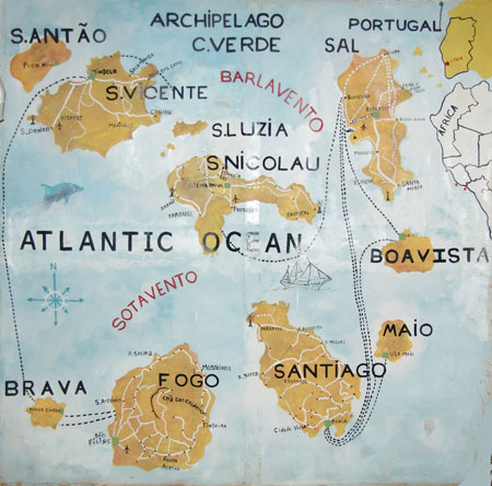
Cape Verde

From the guidelines: "People do not need to wait for permission to log your EarthCache. Requiring someone to wait is not supported by the EarthCache guidelines. People should send their logging task answers to you, then log your EarthCache. When you review their logging task answers, if there is a problem, you should contact them to resolve it. If there is no problem, then their log simply stands."
The Republic of Cape Verde (Portuguese: Cabo Verde) is a republic located on an archipelago in the Macaronesia ecoregion of the North Atlantic Ocean, off the western coast of Africa. The previously uninhabited islands were discovered and colonized by the Portuguese in the fifteenth century (though there may have been earlier discoveries), and attained independence in 1975.
Cape Verde was uninhabited when the Portuguese arrived in 1460 and made the islands part of the Portuguese empire. Due to its location off the coast of Africa, Cape Verde became an important watering station, then sugar cane plantation site, and later a major hub of the trans-atlantic slave trade that would later form the contemporary African Diaspora.
Cape Verde is divided in to a northern island group and a southern island group. The northern group is made up of Boa Vista, Sal, Santa Luzia, Santo Antão, São Vicente and São Nicolau Islands while the southern group is made up of Maio, Brava, Fogo and Santiago islands.
Ilha do Sal (Sal Island)
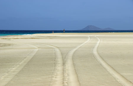
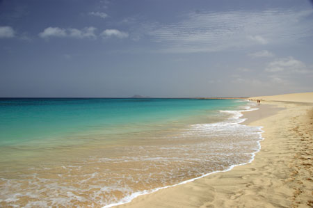
Sal Island, of volcanic origin, some 30 km long and 12 km wide, is the main focus of tourist attraction in the Cape Verde archipelago and is the closest island to the West African Coast.
Diogo Gomes and Antonio da Noli, navigators in the service of the Portuguese Crown sighted Ilha do Sal in 1460. However, Sal as well as other islands in the Cape Verde archipelago may have been known to the Moors long before Portuguese "discovery". The Portuguese explorer Jaime Cortesão reported the story that Arabs were known to visit an island which they referred to as "Aulil" or "Ulil" and take salt from natually occurring "salinas" . From the descriptions one might assume that they were visiting Ilha do Sal. Most historians contest the theory and point out that the island referred to as "Ulil" by ancient Arab sailors allegedly sunk beneath the seas and disappeared! Curiously, modern day geologists have demonstrated that the southern third of Ilha do Sal was indeed covered by water in some prehistoric era. There is clear fossil evidence of coral reef formation in the middle of Sal island.
The original name given to Ilha do Sal by the Portuguese sailors was "Llana". However, some years later after the discovery of the natural salt lake in Pedra Lume, the name of the island was changed to Sal which means "salt" in Portuguese.
Slaves from nearby Boavista Island established the first settlement on Sal. But this was not to be a significant village until the late 17th century when the demand for salt and livestock intensified because of slaving activity on the West African coast. Basic commodities and manufactured goods would be traded in Ilha do Sal for salt which could be carried for ballast in the holds of the ships.
At the end of the 18th century, the Dutch geographer, Dapper, wrote that he located a settlement of some 72 sailors in what is today the Village of Santa Maria supporting itself by extracting salt which was then used for salting goat meat and turtle meat. Dapper reports that there were large numbers of turtles nesting on nearby beaches.
During this same period, an English adventurer named Dampier arrived in Santa Maria. He describes the village he found on the south coast of the island as having a half dozen inhabitants living "miserably" but who managed to scratch out a livelihood by exchanging goat skins or a few sacks of salt to trade for used clothing with the occasional ship which dropped anchor in the bay.
Historically, the colonial authorities paid little attention to Ilha do Sal and many of the other outer islands until well into the 20th century. A family's survival depended on good fortune, resourcefulness and a readiness to seize whatever opportunities passed by in order to live from day to day (visit link)
Pedra de Lume Salt pans
Midway up the eastern coastline of “Ilha do Sal” lies the Village of Pedra de Lume. High above the coastal town is a salt lake situated inside the mouth of a long extinct volcano. According to geologists, the waters in the lake rise from deep in the earth rather than from lateral infiltration from the ocean. For many centuries salt has been extracted here. Earlier in this century there were 40 hectares of salt pans on this site.
In the 18th century a Cape Verdean names Manuel Antonio Martins began to develop the salt business which had already existed for many years on Boa Vista. The most challenging technical issue confronting the establishment of the salt business at Pedra de Lume was to design a way of transporting the salt from the Salinas (salt pans) high above the village to the embarkation point at the port. Initially pack animals were used to do the work. Later a tunnel was cut through the wall of the extinct volcano thereby easing access to the salina.
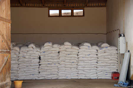
In 1919 a businessman from Santa Maria and a French company based in Bordeaux purchased the salt company from the descendants of Mr. Martins. They installed a tramway system which revolutionized their ability to transport the salt to the port. The tramway was 1100 meters in length and was able to transport 25 tons of salt per hour. The new company found a market for its exports to several West and Central African countries.
By 1985 the salinas of Pedra Lume ceased all exportation. Today the company's minute production does not even satisfy local demand.
In 1990 there were about 700 full time residents in Pedra de Lume. Unfortunately, the economy of the town only offered 22 year-round jobs to local residents. The rest of the town's workers have had to migrate to other parts of Sal or have been compelled to move to other islands or abroad.
Salt formation in arid environments
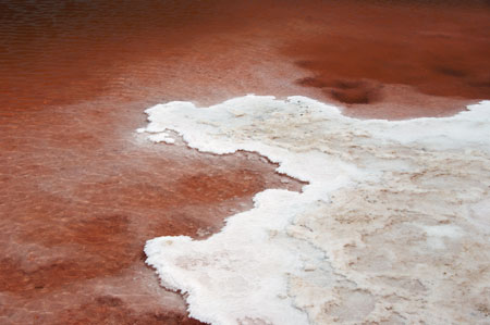
Evaporite chemical sedimentary rocks form as water evaporates from a lake or ocean. During the process of evaporation, water molecules change from the liquid phase to the gas phase, but atoms such as calcium, sodium, and chlorine are left behind. As a result, the remaining water becomes enriched in these atoms which begin to precipitate from the water. Evaporite minerals and rocks tend to form in arid climates where the rate of evaporation greatly exceeds rainfall. Therefore, evaporites are common where lakes form and then evaporate in a desert (such lakes are referred to as playa lakes), or in shallow and warm arms of the ocean adjacent to desert areas.
Salt (halite) is not the only mineral that can be formed in evaporite deposits. Minerals such sylvite (KCl), fluorite, gypsum, barite, anhydrite, nitratite, niter, borax and other carbonates can also be formed.
The cache
The above coordinates are for the entrance of the tunnel that was cut in the ancient volcano to allow access to the salina. You are asked to measure the height of the tunnel and take a picture of yourself at the entrance of the tunnel.
E-mail me the answer and the image to ffortes@ptero.com
A special thanks to DanielOliveira who has contributed to this EarthCache. You can visit his notable EarthCache work in:
http://www.geocaching.com/seek/nearest.aspx?tx=c66f5cf3-9523-4549-b8dd-759cd2f18db8&u=danieloliveira