A Portion of an 1855 map of Hartford County
Showing the Area of the Coop Sawmill Homestead
Geocache
This section of an 1855 map of Hartford County shows the area
around Coop Sawmill. The sawmill, which spans Roaring Brook, is
represented on the map by the abbreviation S.M. There appears to
have been a small hamlet supporting the sawmill, with houses owned
by Joseph Gallopp and S. Franois.
Park at N 41° 43.822, W 072° 30.230. This cache is part of the
Buckingham Reservoir series of 13 caches. Most of the cache
locations are on or near well-worn trails, however, some of them
may be extra challenging during certain seasons of the year.
There is an abundance of wildlife in the area. It’s quite
possible to encounter beaver, bobcats, coyotes, deer, fishers, red,
grey and yellow foxes, four varieties of owls, snapping turtles,
timber rattlesnakes, various water snakes, weasels and the very
rare occasional wandering bear. Exercise caution and remember that
this is their home.
This is at an old homestead site, where the Coop Sawmill
existed. You can still see the foundation of the old sawmill and
the mill race in the ruins of the dam. There are various pieces of
sharp ironwork scattered around from the mill operating days, so be
careful where you walk.
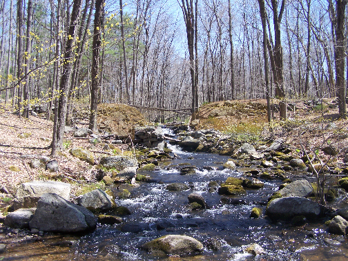
In colonial times, there was a sawmill here. It was called Coop
Sawmill, and was powered by a waterwheel, which probably sat in
this slot in the dam. The stream is Roaring Brook, a major
tributary of the Connecticut River.
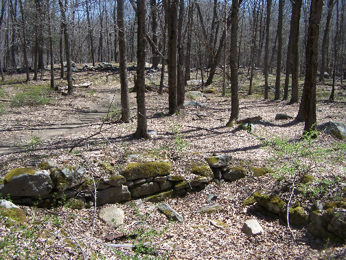
One of about six similar foundations nearby, this small
foundation is about twelve feet by twelve feet and only three feet
deep. Some of the others are up to eight feet deep. They are
clustered around the site of Coop Sawmill, forming a sort of
village.
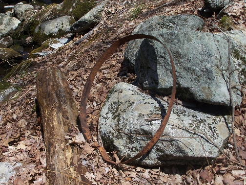
Some of the previously mentioned sharp ironwork. This rusty iron
hoop is all that remains of what was once a barrel. The wooden
staves have long since disintigrated.
Enjoy!