Arngast – eine verschwundene Insel
Ort
Dieser Multi-Earthcache führt zum Leuchtturm Arngast. Er ist auf den Resten einer Insel erbaut.
Erdgeschichtliche Betrachtung
(Earthcache Classification: Coastal Feature)
Wasser hat schon immer wesentlichen und vielfältigen Einfluß auf die Erde und ihre Lebewesen. Es sorgt für Leben (und Tod), transportiert Nährstoffe, gibt Nahrung, formt die Erdoberfläche, u.s.w. Die Küsten sind vom Einfluß des Wassers besonders betroffen.
Sowohl sich langfristig verändernde Wasserstände der Meere als auch plötzliche Fluten sorgten immer wieder für Veränderungen der Küstenlinie. Erst in letzter Zeit (erdgeschichtlich nicht mal ein „Wimpernschlag“) versucht der Mensch u.a. durch Deiche, den Einfluß des Wassers zu beherrschen. Der größte Teil des heutigen Jadebusens war ursprünglich Hochmoor. Er gehört zu den Buchten, die im Mittelalter durch Sturmfluten einbrachen. Entstanden ist er durch die Julianenflut von 1164, die Clemensflut von 1334 sowie die verheerenden Marcellusflut (grote Manndränke) von 1362. 12 kleine Dörfer fielen den Sturmfluten zum Opfer und Butjadingen wurde teilweise zur Insel. Durch die Sturmfluten von 1509 sowie 1511 nahm der Jadebusen noch größere Ausmaße an. Sein Flaschenformumriss läßt die Kraft des Meeres deutlich erkennen. Der nördliche Teil, wo das Meer in junges Groden- oder Polderland eingedrungen war, ist schmal und tief. Besonders viel Landfläche ging landeinwärts in niedrig gelegenen Sietlandgebieten verloren. Das Wasser bahnte sich den Weg bis zum Geestrand wie z. B. Dangast vor. Erst durch haltbare Eindeichungen wurden weitere Veränderungen verhindert.
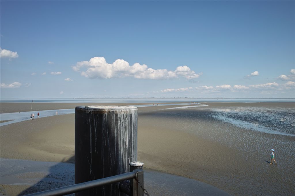
Auf der Wanderung zu den Resten der Insel Arngast kann man noch jahrhundertealte Zeitzeugen im Watt finden, konservierte Baumwurzeln. Die Wanderung startet auf Land, das einmal Meer war und führt ins Meer, das einmal Land war.
Strecke
WP1 bezeichnet den Campingplatz, der bei der Anfahrt rechterhand einen großen kostenlosen Parkplatz bietet. Dann geht es rd. 3 km auf dem Deich zu WP2. Hier führt ein 700 m langer Weg durch die Salzwiesen ans Watt (WP3). Nun ist das Ziel ncht mehr zu übersehen ;-). An WP4 findet man interessanten Untergrund und an WP5 einen Zeitzeugen aus vergangenen Jahrhunderten. Nach rd. 9 km Wanderung ist das Ziel erreicht (WP6)! Nun geht es 9 Kilometer zurück ;-)
Besonderer Hinweis
Der Weg zum Leuchtturm ist frei zugänglich und ohne Genehmigung jederzeit benutzbar. Die Regeln des Nationalparks Wattenmeer sind hier nachzulesen und zu beachten: https://www.nationalpark-wattenmeer.de/nds/. Die Strecke ist anstrengend und lang. Sie führt durch schwer zu bewältigendes Watt. Als wir unterwegs waren, kehrten 8 Teilnehmer nach 10 Metern Wattwaten wieder um – sie kamen nur auf allen vieren voran. Deshalb ist die Teilnahme an einer Wattführung dringendst anzuraten! Dann ist stets Hilfe nahe, auch wenn die Flut zu früh einsetzt, Nebel oder Sturm aufzieht. Unter https://www.nationalpark-partner-wattenmeer-nds.de/partner/wattfuhrungen-dangast sind zugelassene Wattführer empfohlen. Deren Rat bezüglich Kleidung (Schuhe!!!), Ausrüstung und Kondition sollte unbedingt beherzigt werden.
Logbedingung
1. Fotografiere Dich bzw. Dein GPS am WP5 mit dem Baumstumpf und an WP6 mit dem Leuchtturm und lade sie zu Deinem Log hoch (ab 01.01.11 optional, aber natürlich vom Owner und den Beobachtern gern gesehen).
2. Wieviele Ecken hat das Schild an WP3?
3. Wenn Du an WP4 die Oberfläche beiseite schiebst, was findest Du darunter?
4. Als der Jadebusen entstand, soll eine sagenumwobene Burg versunken sein. Wann war das und wie hieß die Burg? (Internetrecherche)
5. Die Leuchtturmtür hat eine Art “Lenkrad“ als Türverschluß. Wieviele Löcher sind in den Speichen?
6. Auf dem Foto "Entwicklung" siehst Du verschiedene Ausdehnungen des Jadebusens. Recherchiere einen Ort, der durch die Entwicklung des Jadebusens verschwand und datiere es.(Internetrecherche)
Maile die Antworten an Keitaro64{at]web.de.
Arngast - a lost island
Location
This Multi-Earthcache takes you to Arngast Lighthouse, which was built on the remains of a former island.
Geological Background
(Earthcache Classification: Coastal Feature)
Water has always had a major and varied influence on the Earth and its living creatures. It brings life (and death), transports nutrients, provides food, and shapes the Earth’s surface. Coastlines in particular are heavily affected by the power of water.
Both gradual changes in sea levels and sudden storm surges have repeatedly altered the coastline. Only in relatively recent times (a mere blink of an eye in geological terms) has humanity tried to control water’s influence with dikes. Most of today’s Jade Bight was originally raised bog. It is one of the bays that formed during the Middle Ages when massive storm floods broke through. It was created by the Julianenflut (1164), the Clemensflut (1334), and the catastrophic Marcellusflut (Grote Mandränke) of 1362. Twelve small villages were lost and Butjadingen became partly an island. Further storm floods in 1509 and 1511 enlarged the Jade Bight even more. Its characteristic bottle shape clearly shows the power of the sea. The northern section, where the sea broke into young polder land, is narrow and deep. Large areas of low-lying marshland were lost inland. The water even reached the edge of the Geest, for example at Dangast. Only stable dikes finally stopped further major changes.
On the hike to the remains of Arngast island you can still find centuries-old witnesses in the mudflats: preserved tree roots. The trail starts on land that was once sea and leads into the sea that was once land.
Route
WP1 is the campsite that offers a large free parking area on the right when approaching. From there it is about 3 km along the dike to WP2. A 700 m path then leads through the salt marshes to the mudflats (WP3). From here the destination is hard to miss 😉. At WP4 you will find interesting ground, and at WP5 a witness from past centuries. After a total of approx. 9 km you reach the goal (WP6). Then it’s another 9 km back!
Important Note
The path to the lighthouse is freely accessible at any time without permission. Please observe the rules of the Wadden Sea National Park: https://www.nationalpark-wattenmeer.de/nds/. This is a long and strenuous hike through difficult mudflats. When we did it, 8 participants turned back after just 10 metres because they could only move on all fours. We strongly recommend joining a guided mudflat tour: https://www.nationalpark-partner-wattenmeer-nds.de/partner/wattfuhrungen-dangast ! Their advice on clothing (especially proper shoes!), equipment and fitness is essential.
Log Requirements
- Please upload a photo of yourself or your GPS at WP5 (with the tree stump) and at WP6 (with the lighthouse). (Optional since 01.01.2011, but very welcome!)
- How many corners does the sign at WP3 have?
- If you push the surface aside at WP4, what do you find underneath?
- When the Jade Bight was formed, a legendary castle is said to have sunk. When did this happen and what was the name of the castle? (Internet research)
- The lighthouse door has a kind of “ship’s wheel” as a handle. How many holes are in the spokes?
- The photo “Entwicklung” shows different sizes of the Jade Bight over time. Name one place that disappeared because of the development of the Jade Bight and when this happened. (Internet research)
Please send your answers to: Keitaro64(at)web.de
Sources:
Wikipedia
Wattführer
Nationalparkverwaltung
Wadden Sea National Park