Ring of Fire – Peru Chile Trench
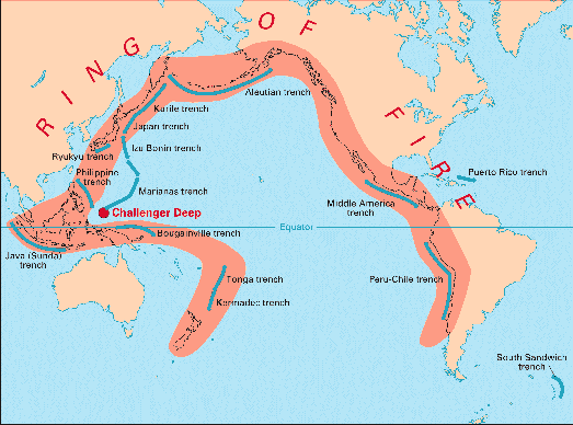
Volcanic arcs and oceanic trenches partly encircling the Pacific Basin form the so-called Ring of Fire, a zone of frequent earthquakes and volcanic eruptions. The Peru – Chile trench is one part of the Ring of Fire.

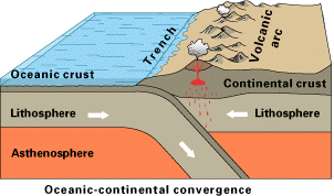
Off the coast of South America along the Peru-Chile trench, the oceanic Nazca Plate is pushing into and being subducted under the continental part of the South American Plate. In turn, the overriding South American Plate is being lifted up, creating the towering Andes mountains, the backbone of the continent. Strong, destructive earthquakes and the rapid uplift of mountain ranges are common in this region. Even though the Nazca Plate as a whole is sinking smoothly and continuously into the trench, the deepest part of the subducting plate breaks into smaller pieces that become locked in place for long periods of time before suddenly moving to generate large earthquakes. Such earthquakes are often accompanied by uplift of the land by as much as a few meters.

On 9 June 1994, a magnitude-8.3 earthquake struck about 320 km northeast of La Paz, Bolivia, at a depth of 636 km. This earthquake, within the subduction zone between the Nazca Plate and the South American Plate, was one of deepest and largest subduction earthquakes recorded in South America. (Source: USGS)

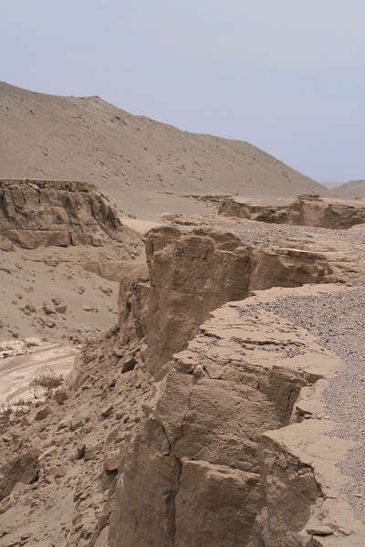
The above coordinates will take you to the closest point between Panamericana Sur Highway and the Peru –Chile Trench. You are standing on the surface dominated by the Nazca Plate. Over the trench the surface is dominated by the South American plate. Danger: Don't stand close to the rim.

To log the cache you have to:
1) Take a picture which shows your GPSr and the trench in the background
2.) Estimate the visible depth of the trench
3.) Estimate the maximum width from rim to rim.
Email me your answers via my profile page. Only Email! No Message-Center! Then log your found. Incomplete answers or cheats will be deleted from log.
