In
this series, I have hidden silver/grey micro-cache capsules near to
each of the 17 parish churches, on (or just slightly off)
the route of the walk's course. Each capsule contains a rolled-up
log-book only (please bring your own pen/pencil).
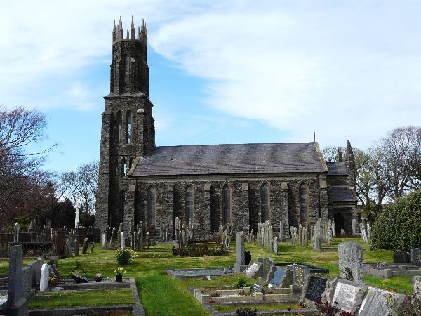
This cache is for
the 10th in the series and can be found near the parish church of
St. Mary de Ballaugh. The parish is mainly agricultural on the
north-western coast of the island. The parish runs for some three
miles (5 km) along the north-west coastline of the island. The
average breadth of the parish is about 3 miles (5 km) and it covers
an area of around 9 square miles (23 km²). The south-east corner is
hilly and the remainder is low, including part of the marshy
depression of the Curraghs. The only village in the parish is
Ballaugh.
The
name 'Ballaugh' derives from the Manx "Balley-ny-Loghey" or "the
place of the lake". The Ballaugh Curraghs is all that remains of
this lake. The lake, which measured up to a mile in length, was
drained by the excavation about 300 years ago of the silted-up Lhen
trench which, during the ice-age, is believed to have been a
melt-water channel flowing north to south from the melting ice
front.
Parking is
available right at the site of the cache. Please replace the cache
exactly as found, and as usual, WATCH OUT FOR MUGGLES!
Happy
caching!