German:
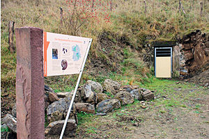
Nach ersten urkundlichen Eintragungen von 1867 wurde am Ralekesberg Eisen gewonnen. Es wurden damals zwei Versuchsstollen gegraben, wovon einer noch heute sichtbar ist. Im Anschnitt des Grubeneingangs steht Ton- und Mergelstein aus dem unteren Jura (vor rund 200 Mio. Jahren) an. An der Böschung und im Abraum vor dem Stollen können Sie mit Glück die austernähnlichen Schalen der Muschel Gryphaea arucata entdecken, die darauf hindeutet, dass das umgebende Gestein aus Meeresablagerungen entstanden ist.
Um den Cache loggen zu dürfen, bitte ich euch, nachfolgende Fragen zu beantworten:
1. Wie groß ist der heute noch sichtbare Teil des Stollens (Gesamtlänge, Höhe und Breite)?
2. Wohin sollte das im Ralekesberg vermutete Erz zur Verhüttung gebracht werden und warum wurde der Abbau im Jahr 1930 eingestellt?
Es wäre schön, wenn ihr außerdem ein Foto von Euch mit eurem GPS vor dem Schild oder Stolleneingang einstellt.
Bitte schreibt die Lösungen nicht in eure Logs, auch nicht verschlüsselt.
English:
To the first documentary registrations of 1867 iron was won at the Ralekesberg. At that time two test tunnels were dug and one of them today is still visible. In the first slice of the pit entrance you can see clay stone and marl stone from the Jurassic Period (about 200 million years ago). In the embankment and in the overburden before the tunnel you can discover with luck the shell of the mussel Gryphaea arucata which points to the fact that the surrounding rock from marine deposits has originated.
To claim the cache please answer the following questions:
1. How big is the still visible part of the tunnel (total length, height and width)?
2. Where should the ore supposed in the Ralekesberg be brought to the smelting and why did they stop it in 1930?
It would be nice if you do also post a photo of yourself with your GPS in front of the pit entrance or the shield.
DO NOT post answers - even encrypted on this site.