This Earthcache is located in Lapham Peak State Park. There is a small fee to get into the park unless you have a WI state park sticker.
Kettle Moraine is an area of the state that has lots of evidence of glaciers! Have you ever wondered why that is? Wisconsin was covered by glaciers for parts of the Quaternary period. The Lake Michigan Lobe covered the eastern part of the state, while the Green Bay Lobe covered most of the rest of the state, all but the driftless area in the southwestern corner of the state. These glaciers reached their maximum extent about 18,000 years ago.
The discontinuous ‘line’ of the kettle moraine (roughly between Manitowoc and Beloit) is where the two glacier lobes met. They met up against the Niagara Escarpment and they each left behind their own sediment, leaving an obvious mark of where they had met up. One will notice that there are many depressions in the kettle moraine… not just a line of hills. This is because there was buried underneath the sediment left behind. It would melt, and then the sediment would fall into the earth where there had been ice… and a depression was created. These were called kettles because they resemble the cast iron kettles used in the 1800’s.
Lapham Peak is named after Increase Lapham. He was was interested in many of the different parts of science and how they worked together. Lapham is most known as being the 'Father of the US Weather Service.'
Now, to log the cache, you must do these things:
1. How tall is the peak and what is its' significance (a reason Lapham used it for his studies?)
2. What cities can you see from the top of the tower? How far away do you think they are?
3. take a picture with your GPSr and your party in it.
All of these need to be submitted at the time of logging. Please email these to the cache owner.

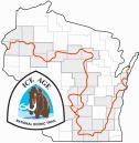
IATCC is the cache designation to highlight a series of EarthCaches along the ICE AGE National Scenic TRAIL grouped into a special category called "COLDCACHE." The Ice Age Trail is one of eleven (11) National Scenic Trails designated by the National Park Service. This unique trail is entirely within the state of Wisconsin and follows along the terminal moraine of the most recent glacier. This project is supported by the Ice Age Trail Alliance. The goal is to bring more visitors to the trail and promote public awareness, appreciation, and understanding of Wisconsin’s glacial landscape. More information on the Ice Age Trail Atlas, the ColdCache Project and Awards Program is available at:http://www.iceagetrail.org/coldcache.htm.
The Geocache Notification Form has been submitted to Ed Muzik, Lapham Peak Property Manager, Wisconsin DNR. Geocaches placed on Wisconsin Department of Natural Resource managed lands require permission by means of a notification form. Please print out a paper copy of the notification form, fill in all required information, then submit it to the land manager. The DNR Notification form and land manager information can be obtained at: http://www.wi-geocaching.com/hiding.
