Ahoy there maties! This cache is NOT at the posted coordinates. If one does not know to which port you are sailing, no wind in favorable. So ye best get your jibs up and solve this puzzle. Please stow the cache securely in its crevasse after signing the log. A famous Mathew Brady portrait of our 16th president autographed by Anna Escobedo Cabral and countersigned by John W Snow awaits the FTF!
Congrats to huntin'hodgkins for First to Solve & Find!!!
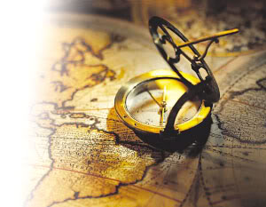
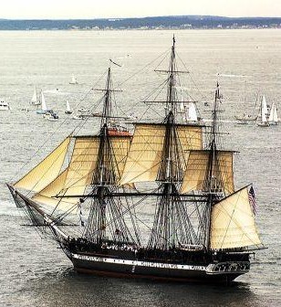
Sailing Ships Navigate the Seven Seas
|
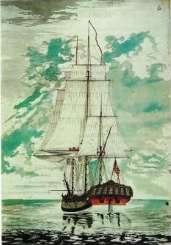
| That GPSr you have there is a pretty handy device. Alas, it didn't used to be so easy to find your way around the planet. Take for instance Cpt Cook in his Barque sailing ship HMS Resolution as they explored and mapped many areas of the Pacific Ocean including much of the coastline of Alaska. With only clock, compass, and the heavens to guide them, they found their way around with amazing accuracy. They even managed to locate the islands of Hawaii in the middle of the Pacific ocean twice, though that second visit might have been a bad idea. |
 |
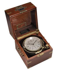 |
One key item that helped with navigation was an accurate clock. The advent of more accurate Marine Chronometers assisted navigators with determining how far east or west of specific meridians they have traveled. Our modern GPS system still relies on the use of extremely accurate time keeping to figure out where you are. |
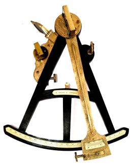
| The GPS satellites in orbit have replaced our need to look at the sun, moon, and stars for direction. Instead of visual bearings, we now use invisible radio transmitted signals. But in the days of the great sailing ships, the navigator used a Sextant to look at various celestial bodies and find the elevation of them compared to the horizon. This allowed them to calculate, using detailed charts and some fancy math, their position north or south of the equator. |
 |
 |
Of course there are many times when the sailor has no way to see the heavens or even locate the true horizon for that matter. When the weather doesn't cooperate, it is necessary to use other methods such as Dead Reckoning to find your way. This is where vast experience, knowledge of the ship and her capabilities, and a good compass will be needed. Your GPSr works in any weather. |
| The magnetic compass, along with maps of the oceans and coastal areas that are called Charts, is the basis for any movement out on the water. Especially when you get away from land. If the vessel track is true, then a steady heading can be found with the compass and the ship may be sailed along that heading for great distances between position calculations. This track line can be plotted on the chart as you go to show the approximate current location based on your speed. |
 |
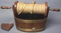 |
A key element of dead reckoning is to estimate the distance you have traveled. By keeping track of the time and the speed of the ship, the distance is easily calculated. A ship's speed is measured in the unit "knots" using a Log Line. |
| A Log Line consists of a length of rope with knots tied every 7 fathoms (42 feet) and a 30 second sand glass timer. A wood "Chip" tied to the end of the line is tossed into the water and the line is allowed to freely play out from the moving ship. The timer is started when the first knot passes by and the number of knots are counted as they go out. At the end of the 30 seconds, the speed in knots is known. The knot is still used for reporting the speed of ships, though refinement in measurement has made the distance between the knots 47 feet 3 inches with a glass time of 28 seconds. Today we measure this using the GPS. |
| So hoist the main, run the rigging and head for the summer sea. The dead of winter is no time to seek out this treasure. And ye may find a moment or two each month where the Flood would wet your toes on this one. If that be the case, a wait for Ebb will provide smooth sailing. |
 |
| So you think you've got it figured out? Do you want to make sure, or just go for it? |
Printing the whole cache listing will not help you solve the puzzle. Think International. Oh, one more thing... this puzzle is impossible to solve from a Pocket Query.
This Cache is provided for your enjoyment by a Sourdough Member of:

GCAK! is working hard to promote Geocaching in Alaska! Please join us today!
Znl gur jvaq nyjnlf or ng lbhe Onpx naq lbh arire eha n Tebhaq.