Throughout countless ages, the surface of the land here has undergone profound change. The main story has been one of erosion, but let us go back many millions of years and begin the geologic account with the rock-making and the building of the mountains which took place in another age.
The Smokies are a part of the oldest range of mountains in the country. The boundaries of the beautiful and tranquil Great Smoky Mountains National Park actually began roughly 500 million to 600 million years ago on the bottom of an ancient ocean floor, somewhere east of Charlotte, N.C. It was all pushed westward by the force of crashing continents. Back then, there was no 6,593-foot Mount Le Conte. The land was flat. The mountains here are made up of sediments from the ancient sea that once covered it. As the planet evolved, there was almost constant movement on the earth's surface. Land masses danced about and ocean sediments dropped off along the continental margins. These sediments would later become the bedrock for Mount Le Conte that rises majestically in the distance.
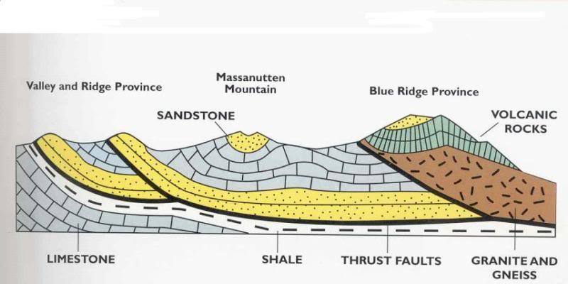
Most of the rocks that compose the mountains here belong to a group called the Ocoee series. They were formed from sediments—muds, sands, and gravels—derived from a very ancient land mass and deposited in great quantities on the floor of a shallow sea. Here they gradually accumulated in extensive layers to a thickness of 20,000 feet or more. Deep burial and compaction, plus the chemical action of water depositing natural cement among the particles, changed the sediments to rock. Ocee rocks are so ancient that they contain no fossils of plants or animals, having been formed before life was abundant on the earth. According to geologists, these rocks antedated the Cambrian period of the Paleozoic era, more than 500 million years ago.
The accumulation of sediments extended over long periods in geologic time. The land surface was then raised and subjected to tremendous lateral pressures which caused the rock formations to buckle into folds and to break in many places, forming over thrust faults. The major disturbance of the earth's crust here was known as the Appalachian revolution, an epoch of mountain-building in the Eastern United States.
Geologists say that at least three mountain ranges have occupied the region where the Great Smokies stand today. About 200 to 300 million years ago, the last phase of Appalachian Mountain building occurred when the North American continent collided with the African and European continents, closing the early Atlantic Ocean. This process, part of a continuous mountain building cycle known as "plate tectonics," ended sedimentation in the Appalachian region and uplifted the entire Appalachian mountain chain from Newfoundland, Canada to Georgia. The last mountain building event known as the Alleghenian Orogeny 270 million years ago left the mountain configuration generally as it is today, except that the forces of weathering such as freezing, thawing, and erosion have rounded their peaks and lowered mountain elevations.
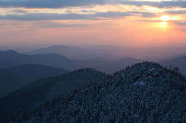
At 6,593 ft Mount Le Conte is the third highest peak in the nearby national park. From its immediate base to its highest peak, Mount Le Conte is the tallest mountain in the Eastern United States- rising 5,301 ft from its base, near Gatlinburg which sits at 1,292 ft. Le Conte lies in the Appalachian Blue Ridge geologic and physiographic province. Here time is captured in stone, water and plants, leaving behind a record of existence almost beyond the imagination. Space and dimensions of time stretch as majestically as the mountain whose crest once served as the floor of ancient sea beds.
Through nature‘s forces the sandstone underlying Mount Le Conte began rising up and ultimately formed peaks at least as high as the present day Rocky Mountains. Perhaps higher. Weather and erosion have worn them down to their present height. Based on the tremendous volume of material eroded from them and deposited along the east coast of the United States, it is estimated that a layer of rock as much as 20 miles in thickness has been removed.
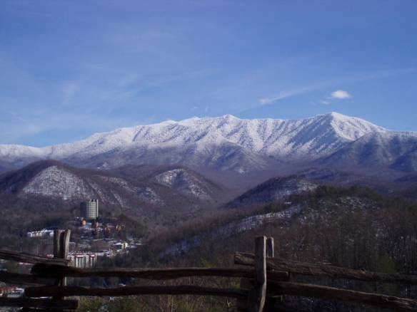
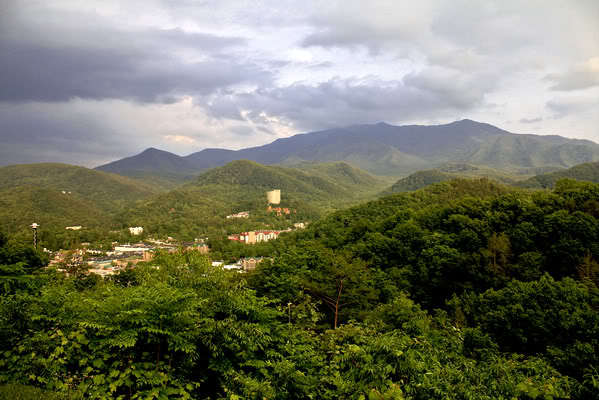
Mount Le Conte is the terminating pinnacle of a five-mile spur off the Great Eastern Divide, the ridge separating Tennessee from North Carolina. Formerly, the mile-high wall of the Eastern Divide literally separated the 'civilized' east from Indian Territory to the west. Le Conte is distinctive in its three prominent peaks, all above 6,000 feet, running almost due east west. It overshadows the small town of Gatlinburg, nestled six miles northwest of and one mile beneath its crown.
To view Mount Le Conte, travel the Gatlinburg By Pass to the coordinates provided. Take some simple measurements and email us the answers. Post a picture of the lofty mountain with your log and think about how very different the place you are in today looked eons ago.
1. Take an elevation reading at the coordinates provided at the overlook.
2. Calculate the difference in elevation of terrain from the coordinates provided and the listed peak of Mount Le Conte.
3. Calculate the difference in elevation of terrain from the provided coordinates and the valley below at the town of Gatlinburg.
Looking out today at the quiet beauty and spectacular vistas offered to all who visit these lovely mountains, one can appreciate what the forces of nature have done over the millennia to create them. And, as we have also seen, to slowly, imperceptibly bring them back down to what they once were- sand and sediment gradually rinsing off the land and building up the bottom of the Atlantic Ocean. On earth there is a circle of life!