Clinch Mountain’s Millennium Spring EarthCache
Clinch Mountain’s Millennium Spring
-
Difficulty:
-

-
Terrain:
-
Size:  (not chosen)
Please note Use of geocaching.com services is subject to the terms and conditions
in our disclaimer.
The Spring location is 3.2 miles north on Hwy 25 E from the
Bean’s Gap Overlook and just down from the foothill of Copper
Ridge.
How are springs
formed
Springs may be formed in any sort of rock. Small ones are
found many places. The largest springs are formed in limestone and
dolomite (a magnesium bearing limestone) in karst topography. Both
dolomite and limestone fracture relatively easily. When weak
carbonic acid (formed by rainwater percolating through organic
matter in the soil) enters these fractures it dissolves bedrock.
When it reaches a horizontal crack., or a layer of non-dissolving
rock such as sandstone or shale, it begins to cut sideways, forming
an underground stream. This stream has found itself at the surface
just below the Copper Ridge of the Clinch Mountain.
Sometimes, as the process continues, the water hollows out
more rock, eventually admitting an airspace, at which point the
spring stream can be considered a cave. This process takes tens to
hundreds of thousands of years to complete. The age of a spring or
cave is difficult to estimate due to the variables of rock
composition and water volume doing the work. A rock collapse could
occur in minutes, which would have otherwise taken centuries to
form. In this case, it would make an age estimate problematic.
There are several known caves in the Clinch Spring area that have
springs that do not ‘bubble’ up or can be viewed from the outside
surface.
According to the USGS, “A spring is a water resource formed
when the side of a hill, a valley bottom or other excavation
intersects a flowing body of ground water at or below the local
water table, below which the subsurface material is saturated with
water. A spring is the result of an aquifer being filled to the
point that the water overflows onto the land surface. They range in
size from intermittent seeps, which flow only after much rain, to
huge pools flowing hundreds of millions of gallons daily.”
We have passed by the Clinch Spring for nearly three
decades and have often stopped to fill spare jugs with its pure
water. If you have never brewed a cup of tea or even coffee using
fresh spring water you don’t know what you are missing. During wet
or dry periods, the flow is almost constant and runs very fast.
Years ago when Highway 23 was a narrow two lane road, folks
depended on the spring for its clear water. Even when the road was
a dusty country road, the spring flowed freely and wagons pulled up
to fill barrels with the gushing water. Folks used to have cross
the small creek and fill bottles by holding them against the rock
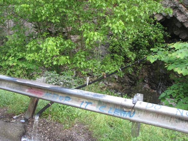
wall in order to obtain the sparkling water. Now, a large black
pipe that has been inserted deep into the mountain crosses the
creek and empties the spring. It is just a matter of stepping from
your vehicle and quickly filling any size container. Overflow runs
downhill into the creek.
Now that we have mentioned how springs are formed and
described the Clinch Spring we want to share a story on how the
Clinch Spring got its more modern name. Prior to the passing of the
year 1999 into the new millennium of 2000, word spread rapidly
through the Mountain and valleys, that at midnight (New Years Eve)
the Spring would stop flowing! A very different and somewhat odd
party, if you can call it that, took place at the Spring prior to
the clock moving into the New Year. Folks gathered from all around
to see the Spring ‘dry up’! After the bell tolled at midnight,
guess what? Yes, the Spring continued to gush its contents for all
to use. A toast was made to the new millennium and to the Spring .
Naturally, the toast was made using the Springs water. From that
point, we have referred to the Spring as the Clinch Mountain
Millennium Spring!

Spring 1
Spring 2
Please Note. You will need a thermometer and a container
of a known volume. In order for you to claim a find of the
Spring, you must complete the following: 1. Answer these
questions: A. What is the temperature of the Spring?,
B. Using your container, what is the flow rate expressed as
gallons per minute?, C. At this point, what is the elevation
of the Spring?, D. In what direction does the Spring flow after
exiting the pipe? Send all answers via email, please do not post
answers! 2. Post a photo of your self and your GPSr with
the Spring in the background. We hope you have enjoyed finding the
Spring and have a drink. This one is on us!
This Earthcache was approved by the
Geological Society of America
| We have earned GSA's highest
level: |
 |
Additional Hints
(Decrypt)
Vg'f Fcevat urer 365 qnlf va n lrne!