Welcome to Project Smiley - A series of caches dedicated to the fun side of Geocaching. I will provide the eyes, nose and mouth,and visitors are encouraged to complete the outside circle using the containers and instructions in the 'Keimzelle' seed cache - This will result in a smiley nearly 3km wide, similar to the following:
Die "Over the hills"-Serie is ein Rundweg über die Hügel rund um Gültlingen. Er besteht aus 5 Multis über 9km mit 300 Höhenmetern, und geht direkt vorbei oder nah an 11 andere Caches. Jede Menge tolle Aussichten und du kannst dabei fit werden :o), geeignet zum Wandern oder Radeln, aber sehr harte Arbeit mit dem Kinderwagen. Für die komplette Runde ohne Abstecher zu anderen Caches benötigt eine Familie ungefähr 4 Stunden zu laufen. Nachfolgend das Höhenprofil der Wanderung, inklusive einige kurze Abstecher zu anderen Caches (siehe unten).
Jeder Multi hat mehrere Stationen, an denen Schilder zu suchen sind. Jedes Schild hat eine bestimmte Form und/oder Farbe, und mit dieser Information wird bestimmt, welche von 3 möglichen Koordinaten für die nächste Station korrekt sind. Wenn nicht anders angegeben, notiere die Anzahl der Seiten des Schildes, z.B. Kreis:1, Dreieck:3, ... Du solltest außerdem jeweils eine bestimmte Farbe für später notieren. Eine Digitalkamera kann hier helfen, um die Ergebnisse zu "speichern".
Alle Caches befinden sich nur wenige Meter abseits der Wege. Es gibt einen Abschnitt in Teil 3, wo man sich entscheiden muss, den direkten Weg über eine Wiese oder einen kleinen geteerten Umweg zu nehmen, bleibt aber sonsten bitte auf den Wegen. Die "Over the hills"-Serie beginnt an einem See, der zu einem größeren Teich wurde, seit er undicht ist! Ich habe jede Menge Enten und Reiher im Schilf gesehen, also haltet die Augen auf. Teil 1 und 2 führen auf den Lerchenberg, der vielleicht von einem fernen Rätselcache bekannt ist, der eine Bild von einem Turm zeigt. Teil 3 geht auf den Kapf, Teil 4 bergab und über die Wildberger Straße zum Westen des Dorfes, und Teil 5 geht fast zurück zum Startpunkt. Es gibt viele Kaninchen, Rehe und Wildschweine in dem Gebiet, also achtet auf Jäger gegen Sonnenauf- und -untergang!
The "Over the hills" series is a circular walk around the hills surrounding Gültlingen. It consists of 5 Multis over 9 km, with 300m height to be gained, and takes you directly past or close to 11 other caches. Lots of great views and you can get fit on the way :o) Suitable for walking and cycling but very hard work with a childrens buggy. The complete round will take a family approximately 4 hours to walk without detours for other caches.
Each Multi has several stages which require you to find signs. Each sign has a certain shape and/or colour and this information is used to determine which of 3 possible coordinates for the next stage is correct. Unless instructed otherwise, make a note of the number of sides the sign has. e.g. Circle:1, Triangle:3, ... You must also make a note of a certain colour for later. A digital camera may help to record your results.
All caches are within a few meters of tracks and roads. There is one section in Part 3 where you must decide whether to walk straight up the meadow or take a detour along the road but otherwise please stick to the paths.The over the hills series starts at the local lake which has become a large pond since it started leaking! I have seen all sorts of ducks and herons in the reeds here so keep your eyes open. Parts 1 and 2 take you up to the Lerchenberg, which may be known to you from a distant puzzle cache which shows a picture of the tower. Part 3 goes up onto the Kapf, Part 4 back down and across the Wildberger Strasse to the west of the village, and Part 5 back to near the starting point. There are plenty of rabbits, deer and wild boar in the area so be careful of hunters near sunrise and sunset!
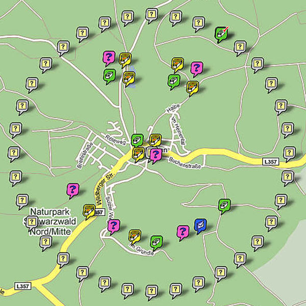
Auf dem Weg kommt man an vielen anderen Caches vorbei (in dieser Reihenfolge):
You pass many other caches on the way (in order):
Over the hills 1
Parke bei den obigen Koordinaten.Park at the published coordinates.
Stage 1
Suche drei Schilder, wobei die oberen zwei dieselbe Form haben und das untere einen grünen Pfeil enthält.
Notiere die Anzahl der Seiten und die äußere Farbe (nicht weiß) des mittleren Schildes. Ist die Anzahl der Seiten...
Look for the three signs where the upper two are the same shape and the bottom one contains a green arrow.
Make a note of the number of sides and outside colour (not white) of the middle shape. If the number of sides is ...
1: Stage 2 is at N 48° 39.396 E 008° 46.515. A=1
3: Stage 2 is at N 48° 39.324 E 008° 46.497. A=2
5: Stage 2 is at N 48° 39.487 E 008° 46.451. A=3
Stage 2
Es gibt ein Schild hier. Notiere die Anzahl der Seiten und die innerste Farbe (nicht weiß) des Schildes. Ist die Anzahl der Seiten...
There is a sign here. Make a note of the number of sides and central colour (not white) of the sign. If the number of sides is ...
1: Stage 3 is at N 48° 39.335 E 008° 46.951. B=1
3: Stage 3 is at N 48° 39.425 E 008° 46.854. B=2
5: Stage 3 is at N 48° 39.279 E 008° 46.919. B=3
Stage 3
Suche ein einzelnes Schild an einem Holzpfosten. Notiere die Anzahl der Seiten und die äußere Farbe (nicht weiß). Ist die Anzahl der Seiten...
Look for a single sign on a wooden post. Make a note of the number of sides and outside colour (not white). If the number of sides is ...
1: C=4
3: C=5
4: C=6
Der Final ist bei .... The final is at ...
N 48° 39.[C][C-A][A+B] E 008° 46.[A+C][A+B][B+C]
Bitte bleib auf den Wegen und gehe nicht wieder bergab. Please stay on the paths and don't go back down the hill.
!! Vergiss nicht, die Bonuszahl zu notieren, die sich im Cachebehälter / Logbuch befindet !!
!! Don't forget to make a note of the Bonus number included in the cache container / logbook !!
Enjoy the walk :o)
Nachdem Du diesen Cache geloggt hast, kannst Du helfen, den äußeren Ring des Smileys zu vervollständigen, indem Du folgenden Cache besuchst ...
After logging this cache you can help complete the Smiley outer circle by visiting
Many thanks to Flitzpiepe for the translation to German :o)