*** This cache is not at the listed coordinates ***
Got Benchmark? This whereigo cache covers eight benchmarks, including an existing cache inside a benchmark and a real physical cache (final location) over an area covering approximately six vertical miles on US 31. All of the benchmarks are of the "park-n-grab" variety and are generally 100 feet or less from US 31. The final, however, is not and is a quart sized plastic jar wrapped in cammo tape that is located in a nature preserve along the route of this wherigo cache.
Note: You must complete the wherigo tasks in sequential order (first task is at the listed coordinates) to complete the cartridge and find the final physical cache.
In surveying, benchmark is a survey marker with a precisely known vertical elevation. The term benchmark originates from the chiseled horizontal marks that surveyors made in stone structures, into which an angle-iron could be placed to form a "bench" for a leveling rod, thus ensuring that a leveling rod could be accurately repositioned in the same place in future. These marks were usually indicated with a chiseled arrow below the horizontal line. More enduring benchmarks may be chiseled into a wall (the usual type in the UK) or marked by a small brass or aluminum, steel pin, or bolt attached to a stable foundation, such as a concrete post, bridge abutment, building, or a purpose-made concrete block. These markers are then used as starting points for subsequent surveys to establish the elevation of nearby points. The height of a benchmark is calculated relative to the heights of nearby benchmarks in a network extending from a fundamental benchmark, a point with a precisely known relationship to the level datum of the area, typically mean sea level.
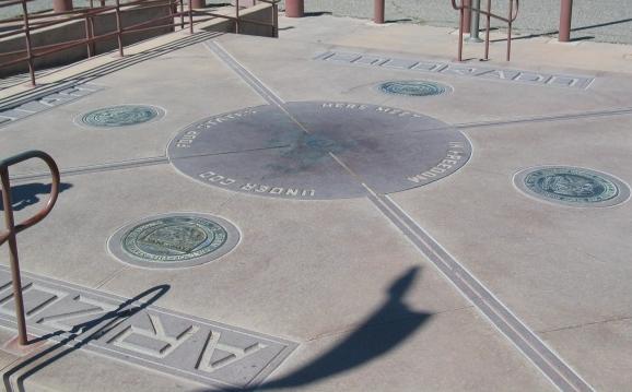
The most famous benchmark of all is the Four Corners Benchmark, the only location in the U.S. where the boundaries of four states (Utah, Colorado, Arizona and New Mexico) meet. A picture of that is below:
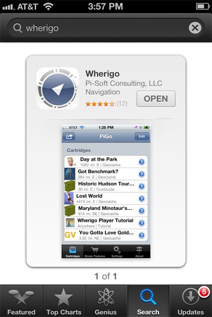
What is a Wherigo Geocache?
Wherigo is a new way of utilizing GPS technology to play games, take tours, and yes geocache. Visit WHERIGO.COM to learn more about this new software.
Do I need special equipment?
Yes! To find this cache the proper way and to truly experience the hunt the way it was meant to be experienced, you will need two things, both of which you can get from WHERIGO.COM
1. The Wherigo Player. Note that the Wherigo Player comes pre installed on the Garmin Colorado & Oregon series GPSr units. A version of the player is available for download for use by GPS enabled Pocket PC devices on WHERIGO.COM.
2. The "Got Benchmark" cartridge. This is also available at WHERIGO.COM.
 This cache placed and maintained by a member of NMG. Click here for more details. This cache placed and maintained by a member of NMG. Click here for more details. |