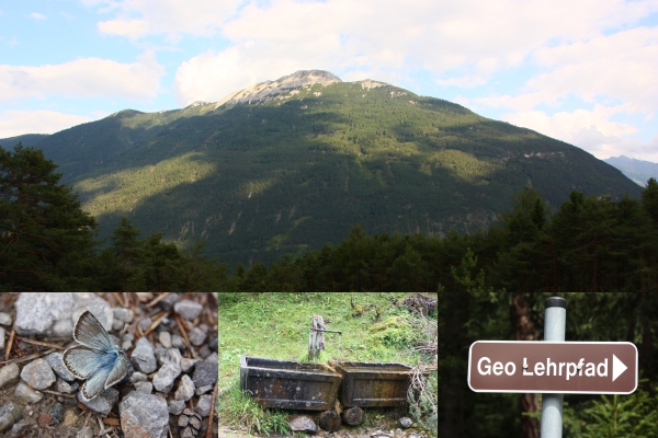
Geolehrpfad "Tschirgantmassiv" Teil 1 - Low Level EarthCache
Geolehrpfad "Tschirgantmassiv" Teil 1 - Low Level
-
Difficulty:
-

-
Terrain:
-

Size:  (other)
Please note Use of geocaching.com services is subject to the terms and conditions
in our disclaimer.

Teil 1
Dieser Teil beschäftigt sich mit den Bewohnern der Meere und deren Ablagerungen im Gestein des Tschirgant.
Das Tschirgantmassiv steht nach allen Seiten vollständig frei. Im Süden trennt das Inntal den Bergstock vom altkristallinen Grundgebirge. Im Westen ist es das Gurgltal, dass die Grenze zu den Lechtaler Alpen bildet. Im Norden ist es der nur schwach ansteigende Sattel von Holzleiten, der den Tschirgantstock begrenzt. Die Ostbegrenzung schließlich bildet der Mieminger Bach, der sich im oberen Teil bis in das kalkalpine Grundgebirge einschneidet.Die Freistellung des Tschirgant hängt mit der allseitigen tektonischen Begrenzung zusammen (Inntalstörung, Gurgltalstörung etc.)
Der Lehrpfad ist so angelegt, dass er durch das geologische Kerngebiet des im Inntal markant aufragenden Tschirgantmassivs führt. Er verfolgt das Ziel den interessierten Besucher die geologische Entwicklung, der in diesem Abschnitt zu durchwandernden Schichtfolgen näher zu bringen. In den Lehrtafeln werden die Gesteine und ihre Entstehung in farbigen Bildern dargestelt und erläutert. Die Gesteine entlang der Lehrpfad-Route sind ausschliesslich solche, die aus Meeresablagerungen hervorgegangen sind und erst im Zuge jener Gebirgsbildung, in der die Alpen entstanden, ferntransportiert, übereinandergeschoben, gefaltet und schließlich hochgewölbt wurden. Sie sind Teil der nördlichen Kalkalpen, die sich von Vorarlberg bis in die Umgebung von Wien erstrecken.
Beantworte nun folgende Fragen an den folgenden Koordinaten:
1. N 47° 14.005 E 10° 45.820
Bei dieser Koordinate findest Du eine Tafel und einen geologischen Aufschluß.
Welches Gestein zeigt Dir der geologische Aufschluß?
(AAAAAAAAAAA)
2. N 47° 14.118 E 10° 45.824
Bei dieser Koordinate findest Du eine Tafel und einen geologischen Aufschluß.
Welches Tier lebte in der Wassersäule des Muschelkalkes (lat.)? Hint: ..boot
(BBBBBBBB)
3. N 47° 14.140 E 10° 45.836
Bei dieser Koordinate findest Du eine Tafel.
Welche Tiergruppe bewegte sich am Boden? (erstes Wort, rote Schrift)
(CCCCCCCCC)
Bilde Dir nun eine Emailadresse nach folgendem Schema:
AAAAAAAAAAA.BBBBBBBB.CCCCCCCCC@gmail.com
Wer möchte kann nun noch zur Karröster Alm aufsteigen und dort eine kleine Rast einlegen. Anschließend kommt Ihr entweder den gleichen Weg oder über den Rundweg zurück zum Auto.
Zeitumfang: ca. 4-5 Stunden
Strecke: etwa 10 km
Viel Spass.
hy_koo
*Gemäß der neuen Richtlinien von Earthcache.org sowie Geocaching.com muss nach dem Besuch eines Earthcaches und der Absendung der Antworten nicht mehr auf eine Logfreigabe gewartet werden. Dies will ich ebenfalls umsetzen. Die meisten meiner Earthcaches verwenden sogenannte Autoresponder. Diese dienen euch als Kontrolle, ob ihr genau die Antworten getroffen habt und werden direkt an die unten stehende Adresse weitergeleitet. Ihr erhaltet also direkt nach der Absendung eine Bestätigung, dass die Antworten richtig sind. Natürlich führen damit kleinere Fehler, die aber den Lernwert des Earthcaches nicht ausschliessen, zu keiner Antwort. In diesem Fall sendet eine Nachricht an mich. Sollten dann die Antworten garnicht stimmen, melde ich mich bei euch. Ansonsten hoffe ich, ihr hattet viel Spaß mit dem Earthcache und konntet etwas für euch entdecken.

Part 1
This part deals with the inhabitants of the oceans and their deposits in the rocks of the Tschirgant.
The massif of Tschirgant to all sides is completely free. In the south separates the Inntal the floor of the old mountain crystalline bedrock. In the West, it is the Gurgltal that the border of the Lechtal Alps formed. In the north it is only weakly rising from the saddle Holzleiten, the Tschirgantstock limited. The eastern border, finally, the small river "Mieminger Bach", located in the upper part to the limealpine Mountains intersects. The basic exemption of Tschirgant depends on the mutual tectonic boundary along (Inntalstörung, Gurgltalstörung etc.)
The trail is designed so that it through the geologic core of the emergent Inntal markedly massif of "Tschirgant" leads. He aims to show how the geological development, in this section walking Layers effects to you. In teaching, the rocks and their formation in colored images show and explained. The rocks along the trail route are solely those of the marine deposits are formed and only The course of that mountain-building, in the Alps emerged transported, pushed on top of each other, folded, and finally were high arched. They are part of the Northern Limestone Alps, from Vorarlberg to the outskirts of Vienna cover.
Answer the following questions to the following coordinates:
1. N 47 ° 14,005 E 10 ° 45,820
In this coordinate you find a table and a geological information.
Which rock shows the geological information?
(AAAAAAAAAAA)
2. N 47 ° 14,118 E 10 ° 45,824
In this coordinate you find a table and a geological information.
Which animal has lived in the water column of the mussel limestone (Latin)? Hint: ... boot
(BBBBBBBB)
3. N 47 ° 14,140 E 10 ° 45,836
In this coordinate you find a table.
Which group of animals moving on the ground? (first word, red font)
(CCCCCCCCC)
Do you now an email address as follows:
AAAAAAAAAAA.BBBBBBBB.CCCCCCCCC@gmail.com
Who can now ascend to Karröster Alm" and then a little rest. Then comes your way, either the same or on the circuit back to the car.
Time scale: 4-5 hours
Itinerary: about 10 km
Have fun.
hy_koo
* According to the new guidelines of Geocaching.com and Earthcache.org,after visiting a EarthCaches and the dispatch of the answers must no longer wait for a permission to log. We intend to implement as well. All our so-called EarthCaches use autoresponders. These serve as a check you know if you've hit exactly the answers and are sent directly to the address below. You gain so directly after sending a confirmation that the answers are correct. Of course, this cause minor errors that do not exclude the learning value of the Earthcache to reply. In this case send an message to me. Should then agree not at all the answers, I will contact you. Otherwise, I hope you had fun with the Earthcache and could you find something for you.
Additional Hints
(No hints available.)