The entrance to the quarry is on the right through the kissing gates. There are lots of information boards to read and plenty of space to have a picnic. Brown End Quarry is a former limestone quarry used from the 18th century until the 1960’s. The stone from here was used for building stone, lime and finally aggregate. Due to the porous nature of limestone the quarry has been turned into a nature reserve as it can not be used as a landfill site. The entrance to the quarry is off the A523 in the village of Waterhouses between Leek and Ashbourne. We have lived in Leek for over ten years and have only recently discovered this amazing place.
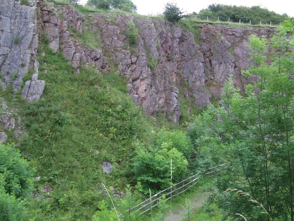
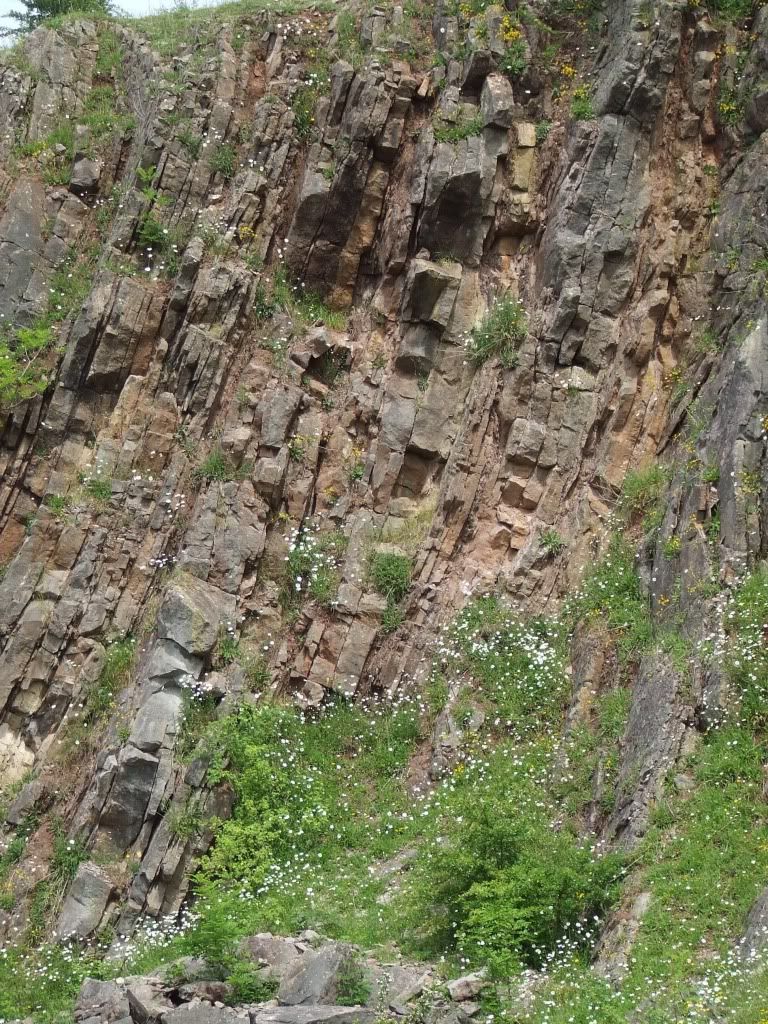
Fancy a swim?……. In a warm tropical sea? The quarry is designated as a Site of Special Scientific Interest due to the limestone here being made up of much smaller mud-sized particles where were deposited in water probably around 300 metres deep. Due to the water’s depth animals from the shallower waters would sometimes be wash down onto the seabed. Resulting in a high number of fossils, there is an area of rocks in the quarry where you are free to search for fossils the kids will have great fun searching for them, please do not take to many and do not climb any fences to get any from the rock faces. Much of the rest of the Peak District limestone is much coarser as that was the result of much shallower waters. The limestone in the quarry has not always been here, it was once the floor of a warm tropical ocean which due to plate movements has slowly been moved over many millions of years to its current location; it is still slowly moving northwards. The seabed is in the region of 350 million years old. As time has progressed the seabed. Which would have been a squishy muddy material was squashed by hundreds of metres or sediment; this would have squashed most of the water out. The effects of a giant geological collision in the south between plates shaped the rocks pushing them into a giant zig zag, with our seabed pushed up and on edge. Coupled with erosion and the continued movement of the earth’s plates, the one you are stood on is moving at about the rate your finger nails grow (a couple of centimetres a year.) Geokids will enjoy looking for fossils in the ’collectors heap’, but please do not take fossils from anywhere else on this site.
To log this cache:
1) Using your GPS email me the distance from the waypoint at the entrance, to the top of the hill at the end of the mammoth footprints, this vantage point also provides an excellent view of the quarry.
2) Take a photo of yourself with your GPS in the main part of the quarry with the angled rock face in the background.
3) I am happy for you to log this earthcache, without receiving confirmation from me, but any log posted without a photo and an email answer being sent to me may be deleted.
Many thanks to Helen Gee at the Staffordshire Wildlife Trust for allowing me to use the quarry as an earthcache. Please visit the website for the quarry.