
Claypits Bottom
Islands Thorns Inclosure is one of the most attractive of the statutory inclosures being almost entirely hardwood, with most of the mature oak dating from the initial planting of the inclosure in 1852. The name, in all probability, should be “Highland Thorns”, the cartographer failing to allow for the common practice of dropping ‘aitches’ when he was making local enquiries concerning traditional place-names.
Health & Safety
Let's get all the H&S stuff out of the way first. Some of this is important, so please don't skip it!
1. You may see warning signs regarding forestry operations. It is easy to disregard these as many have been abandoned after the work is completed. However, Geocachers are smart enough to use their common sense. Don’t go close to areas where machinery is being used - the workers will not know you are there. Do not climb on stacked timber! Despite appearances, it can sometimes move easily and cause horrendous injuries.
2. In October the stags are rutting. A bit noisy at times, and best observed from a discreet distance.
3. If you see dead or injured livestock, note the position and please call the Forestry Commission on 023 8023 3141. The owner will be thankful for your care and concern.
4. This cache has been placed in accordance with the GAGB New Forest guidelines. There are other organisations that hide boxes in the New Forest. Make sure you find the right box! See image in the Gallery.
5. Please note there is no night caching allowed in the New Forest.
The starting point for this walk is the car park at Bramshaw Telegraph (Telegraph Hill). This is one of the highest points in the New Forest at 128 metres above sea level.
In the 19th century it was the site of an optical shutter signal station, one in a line that linked Plymouth with the Admiralty in London. Devised by Lord George Murray, the stations operated from 1806, and were used primarily during the Napoleonic Wars to send messages at speed. A similar system was used between London and Portsmouth. The stations were manned by a naval officer and two ratings who sent signals by opening and closing six shutters in a vertical frame. Powerful fixed telescopes trained on adjacent stations in the line were used to read the signals, which were then sent on. Messages took about 20 minutes to get from London to Plymouth. To operate successfully, the stations needed a clear line of sight one to the other, and in the event of poor visibility, messages were carried by a rider on horseback. The stations either side of Bramshaw Telegraph were at Toot Hill, near Rownhams, where Telegraph Wood can still be found, and on Pistle Hill, across the county boundary in Dorset. The buildings were of wood, and none survive. The Bramshaw Telegraph is believed to have been close to Hope Cottage.
To get us started, we need to answer a few questions to calculate the coordinates of the first stage. The answers are all at the entrance to the car park.
A = Number of nuts on the gate hinges, including the support pintle on the gate post.
B = Number of bolts on the Telegraph Hill sign
C = Number of posts stuck in the ground for the gate.
D = Same as “A”, but include those on the post to which the gate is padlocked.
Right, turn on your GPS, collect all your gear, including water supplies, children and dogs. Time to go! The first waypoint is:-
HOLLOW HOLLY
N50° 56.AA9
W001° 40.CA5
This first warm-up leg of our walk follows a track across open heath, gradually working away from the road, and towards a copse with some old holly trees with twisted and hollow trunks. In his book 'Ancient Woodland', Oliver Rackman elaborates on the importance of Holly as fodder in the New Forest since ancient times and says that repeatedly pollarded specimens may be more that 250 years old. At certain times of year, small branch tips are found lying on the ground around some Holly trees. These have been bitten off by the ponies and are left to lie for some days before being eaten. This process is thought to make the leaves more palatable.
Visiting this waypoint has made our approach to the second waypoint much easier. The GPS route from the car park to “Big Beech” would have taken us through a boggy bit. Whilst we are here, a short detour will take us to our first cache of the walk, Bonnie’s Bounty GC3G11A. This is a “must” if you have a geodog!
Now onto our second waypoint, after we enter the wood:-
BIG BEECH
N50° 56.CD8
W001° 40.BD9
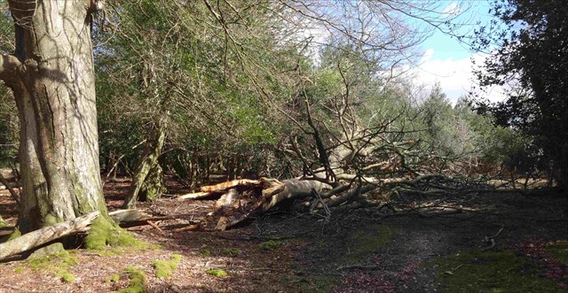
The second waypoint was the first big tree in Eyeworth Wood. Unfortunately, after “Storm Katie” over Easter 2016, most of the tree above our clues was broken off! However, on the stump that remains, count the number of major branches that had previously snapped off between the ground and 10m up the trunk. Only count those at least a metre long.
E = 2 times number of branches
F = A - E
What Katie Did Next
You can devise your own route to the next waypoint. We will join you there. You can start by following the track, but you will need to decide when the direct or Great Circle route is best.
STUDLEY CASTLE
N50° 56.ADB
W001° 41.FFE
Hi! Glad you found us. This might look just like any other bit of woodland, but it is an Ancient Monument.
“Studeley Castle is a royal hunting lodge of the mediaeval period, situated on a south-facing spur at the north east end of Islands Thorns Inclosure. The moat surrounding the lodge survives as a shallow ditch and a low inner bank encloses a square area, 35m across. Both the ditch and bank are 4-5m wide and the bank stands on average 0.4m above the interior but rises slightly higher at the sharp corners. The interior is divided roughly in half by a slight ditch running in a north-south direction across it, and there is a faint indication of a low central platform situated immediately west of this ditch, approximately 12m in diameter, which may have formed a foundation for the lodge. No visible traces survive of the lodge itself, although pieces of slate and mediaeval tile have been observed on the site and further buried remains can be expected to survive. Historical records indicate that the original structure was built between 1358 and 1361, that it included a kitchen, and was of timber frame and plaster construction, with a roof of Purbeck and Cornish slates. It formed part of a set of four lodges constructed at the same time in the New Forest for Edward II.”
Depending on the time of year, the features described above may be difficult to discern. Starting with the corners, you will be able to make out the line of the bank, but the interior of the castle and two of the banks have been visibly damaged by tracked heavy machinery. However there is one very distinctive tree which has a 40cm diameter hollow in its trunk. At the base of the tree, between the roots, you will find a tunnel where the elves have hidden a Lucky Stone. They brought it home from visiting their relations who live in a sea cave on the Greek island of Kefalonia, so it is precious and you should make sure you hide it as found, and obscured from raiding trolls, muggles, etc. It is the final clue to help you find the cache. Count the number of holes where you can see through the stone, and measure its length to the nearest inch. (Elves use Imperial Measurements, where 1 inch = 25.4mm)
Please hide the stone where you found it, and covered.
X = Number of holes through the stone. Y = Length of stone in inches.
G = (X+Y)/2 + 2
This final mathematical exercise will enable us to work out the coordinates of the final cache, which is the other side of Islands Thorns. The route is not direct, and whilst you can look for elves to help you, the deer, knowing these woods too well, will not. As it is about 2km, try navigating without your GPS for a while, using the sun (hopefully!) and the lie of the land to guide you. Good luck, if you make it, we will join you there for the end of the quest.
THE HOLLIN
N50° 55.GE0
W001° 42.0CD
Glad you made it. From Tolkien (Lord of the Rings), we learn Hollin is the name among Men for the land of Elves known as Eregion, that thrived in the lands west of Khazad-dûm during the early part of the Second Age. The name comes from the great holly trees that grew there. Good enough clue for the location of the final cache. The “Hint” may help, “But not a lot!”, according to The Magician.
Rather than retracing your steps back through the forest, you should walk on up the slope and find a trail back around the outside. Good views to be enjoyed to the west, including Cranborne Chase to the Isle of Purbeck. On the way back to the starting point, you can visit your third cache of the trip, GC664NJ “Hugh's Stone”. This dedicated to Hugh Passmore, a key figure in ensuring the New Forest is here for us to enjoy today. .
We hope you have enjoyed this walk as much as we do, and we will have the pleasure of your company in the future.