|

Video give up by Balarum \ Video cedido por Balarum
 Version en castellano más abajo Version en castellano más abajo
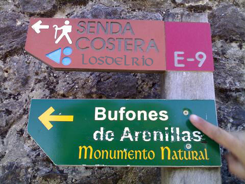
The "bufones" (blowholes) declared Natural Monument, are located on the platform between Llanes and Unquera and have a karst morphology, that the periodic phenomenon of the tides, is responsible for the main singularity of the place. Nearby is similarly large Bufón de Santiuste also been declared Natural Monument in the locality of Buelna.
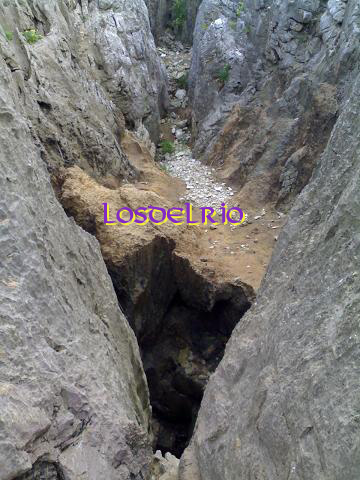 Seawater ascends with pressure through the perforations carved on the rocks due to the erosion by the sea. When the water ascends, till spurts of up 20 metres high, there is a kind of noise similar to a whistling or snort which gives name to this phenomenon. In spanish from "bufido" (snort), we obtain "bufón" (blowhole) the special name given to that sea rocky holes. Seawater ascends with pressure through the perforations carved on the rocks due to the erosion by the sea. When the water ascends, till spurts of up 20 metres high, there is a kind of noise similar to a whistling or snort which gives name to this phenomenon. In spanish from "bufido" (snort), we obtain "bufón" (blowhole) the special name given to that sea rocky holes.
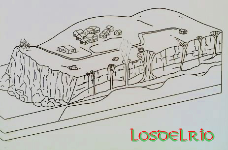
The formation of the bufones is based on the disintegration of the limestone by the effect of rainwater erosion. The rain seeps through small fractures or zones of weakness till sea level. The erosive action of the sea makes the enlargement of the original small cavities, leading over time to form a cave in communication with the vertical duct. When the waves reach the cliff, air or water on the cave is compressed at high pressure and they come out the outside.
If the sea is calm, vents of underground cavities are confined to remove the air compressed in the galleries from the blows of the waves. But in the days of white water "the bufones" become a spectacle that produces admiration and awe. Then the air and water tight in these narrows underground escape together through the cracks of the dome thinned. The land opens to the sky spitting bits of sea with deafening noise and a slight "Orbayu" (Asturian thin light rain) salt water the fields. 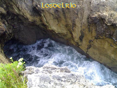
The moans of "Bramadoriu", as they are called locally, can be heard from several miles and ground eroded by millennia of waves, threatening to break definitively.
Warning! In the stormy days bufones are extremely dangerous and should be viewed from a distance to avoid accidents.
The cache
To validate this cache you must:
1) Answer this question correctly: number of "bufones" that are within the limits of the Natural Monument.
2) Answer this other question correctly: type of ground or terrain which due to erosion has originated "the bufones".
3) Take a picture with your GPS in one of the bufones provided you don't put yourself in danger or other people to make that picture. ¡PLEASE BE CAREFUL!
Once you get the answers please email me through my profile. You don't need my confirmation about the correct answers to log. Please log your visit directly, including your voluntary photo and if there is some problem about the matter I'll contact with you.
Logs that include the answers will be deleted without notice.
HINTS:
The best time of year to enjoy "Los bufones" is in autumn or winter and at high tide.
You can see high tides time here: ASTURIAS TIDE TABLES (SPANISH)

Los bufones, declarados Monumento Natural, están situados sobre la plataforma de la rasa entre Llanes y Unquera y presentan una morfología kárstica, que con el fenómeno periódico de la mareas, es la responsable de la principal singularidad del lugar. Además de los de Arenillas también ha sido declarado Monumento Natural el bufón de Santiuste en la localidad de Buelna a escasos kilómetros de estos. 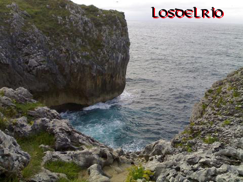
Los bufones son grietas y chimeneas abiertas en la costa y conectadas con simas marinas por las que el agua del mar penetra a presión, formando surtidores de agua pulverizada visibles desde el exterior y que pueden alcanzar más de 20 metros de altura.
La formación de los bufones se basa en la disgregación de la roca caliza por efecto de la erosión del agua de lluvia. La lluvia penetra por pequeñas fracturas o zonas de mayor debilidad hasta el nivel del mar. La acción erosiva del mar favorece el agrandamiento de las pequeñas cavidades originales, provocando con el paso del tiempo que se forme una cueva en comunicación con el conducto vertical. Con la llegada de las olas, el aire o el agua que existe en la cueva se comprime y sale a gran presión al exterior.
Si la mar esta en calma los respiraderos de las cavidades subterráneas se limitan a expulsar el aire, comprimido en las galerías por los golpes del oleaje. Sin embargo en los días de fuerte marejada los bufones se transforman en un espectáculo que produce admiración y temor. 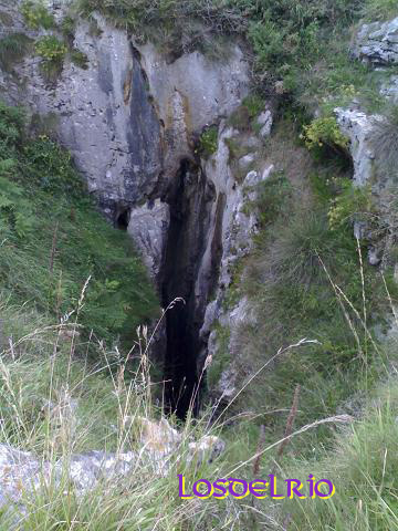 Entonces el aire y el agua, apretados en esas angosturas subterráneas, escapan juntos por los resquicios de la adelgazada bóveda. La tierra se abre escupiendo al cielo trozos de mar con ensordecedor ruido y un ligero orbayu de sal riega los campos. Entonces el aire y el agua, apretados en esas angosturas subterráneas, escapan juntos por los resquicios de la adelgazada bóveda. La tierra se abre escupiendo al cielo trozos de mar con ensordecedor ruido y un ligero orbayu de sal riega los campos.
Los quejidos del Bramadoriu, como se denominan localmente, se dejan oír a muchos kilómetros y el suelo, desgastado por milenios de oleaje, amenaza con romperse definitivamente.
¡Atención! En los días de temporal los bufones son extremadamente peligrosos, debiendo contemplarse desde la distancia para evitar accidentes.
El cache
Para realizar este caché deberás:
1) Responder correctamente a esta cuestión: número de bufones que hay dentro de los límites del Monumento Natural.
2) Responder correctamente a esta otra cuestión: tipo del terreno que debido a la erosión ha originado los bufones.
3) Publicar una foto vuestra con el gps en uno de los bufones, siempre y cuando no os pongáis en peligro ni a vosotros mismos ni a otras personas al realizar dicha foto. ¡SER PRUDENTES!

Una vez que tengais las respuestas por favor envíarme un correo electrónico a través de mi perfil. No necesitáis mi confirmación a las respuestas correctas para loguear el erthcache. Por favor loguear vuestra visita directamente, incluyendo vuestra foto voluntaria y si hay algún problema al respecto me pondré en contacto con vosotros.
Los registros que incluyan las respuestas serán borrados sin previo aviso.
CONSEJOS:
La mejor epoca del año para disfrutar de "Los bufones" es en otoño e invierno y con marea alta.
Podeis mirar cuando está la marea alta aquí: TABLA DE MAREAS DE ASTURIAS


|