[Cz] Lokalita Pod vinohrady
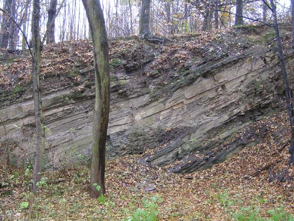
Z hlediska geomorfologickeho patri ke starsim geologickym utvarum. Utvarela se nekdy pred 350 miliony lety na dne tehdejsiho more. Vetsina hornin na uzemi se proto sklada temer vyhradne z prvohornich morskych sedimentu. Tvori jej z velke casti drobove piskovce, misty prechazejici v drobove slepence, ale predevsim obsahuji mohutne vrstvy hlinitych bridlic. Tyto bridlicnate vrstvy zde vystupuji viditelne na povrch.
Zkameneliny v techto vrstvach jsou vsak vzacnosti. Kdyz v pozdejsim obdobi more ustupovalo, objevily se v teplem a vlhkem klimatu bujne rostouci kapradovite rostliny, ktere i na tomto uzemi daly vznik cernemu uhli.
Vychodne od obce Kyjovice prameni potok Polancice, ktery proteka podel soucasne turisticke stezky mezi obcemi Olbramice a Klimkovice a tvori katastralni rozhrani v udoli Pod vinohrady. Dale proteka pod silnici III. tridy kolem rybnika Pistany smerem k Lagnovu. Louky podel toku jsou z jara plne petrklicu, sasanek a dalsich kvetin typickych pro vlhke lokality. Lesni porosty byly prevazne premeneny na smrkove monokultury, jen v casti Pod vinohrady a u obce Janovice jsou smrky vice zastoupeny starymi buky a mladymi habry.
V teto oblasti je znacny vyskyt srncu, zajicu, koroptvi, bazantu a divokych prasat. Taky zde lovi predatori jako lisky, kuny, tchori, lasice, hranostajove, a castecne take jezevci.
Informace cerpany z knihy Klimkovice od autora p. Antonina Huba, vydane v roce 1994 Mestskym uradem v Klimkovicich.
O kesi
Pokud chcete lovit autem, doporucujeme jej odstavit na odbocce do obce Janovice (viz waypoint). Jsou i dalsi moznosti, ale to bychom vam hodne napovedeli cestu pres jednotlive zastavky. Pokud pocestujete autobusem, je potreba vystoupit na zastavce U rybnicku.
Cestou od prvni zastavky ke kesce se projdete krasnym udolim Polancice v celkove delce cca 2km (jednim smerem). Jedna se o klasickou multinu, kde v kazde casti je nutno splnit jeden ukol, ktery vam pomuze najit souradnice finalky. Celkove jsou zde 3 zastavky a finalka. Keska je ulovitelna za kazdeho pocasi, jen cestou k finalce to muze v desti trochu klouzat. Pri vetsi vrstve snehu nedoporucujeme lovit. K finalce vedou 2 pristupove cesty, jedna ma obtiznost 2* a druha tak 4*. Cestu si kazdy voli sam  . Pokud bude hodne zvednuta hladina potoka (normalne je hloubka tak 20 cm), je potreba davat pozor na geomrnata, at nespadnou do vody.
Jednotlive zastavky
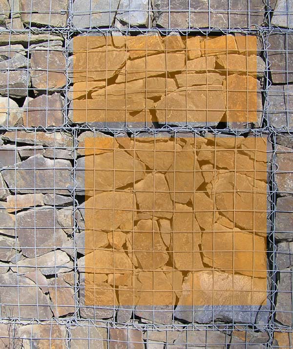
Zastavka 1: Uvodni souradnice vas zavedou ke kamenne zidce. V teto casti zidky najdete nejvyssí misto (to, kde je na sobe nejvice kamennych kleci). Spocitejte, kolik kleci ma v nejvyssim miste zidky obdelnikovy tvar (A) a kolik ctvercovy tvar (B). Nad touto zidkou je jeste jedna, ktera ma kameny zalite betonem, proto se s nimi nepocita. Ctverce a obdelniky pocitat svisle dle obrazku v listingu
Zastavka 2: Souradnice vas dovedou k ocelove prekazce. Vasim ukolem je spocitat bile (C) a cervene (D) policka na prekazce. Pocitat je treba obe strany prekazky. Kdo ma zajem, muze kousek odtud (cca 50 m v lesiku) videt zvrasnene bridlicove skaly.
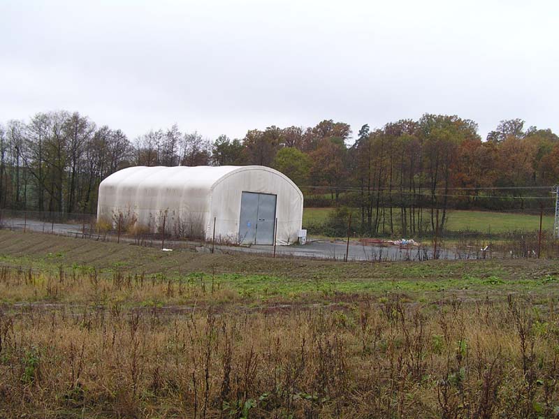
Cestou od zastavky 2 k zastavce 3 budete prochazet kolem mista, kde od dubna 2008 do cervna 2009 stavala provizorni hasicska stanice profesionalnich hasicu, po ktere tu zbyl jen oploceny areal s hangarem. Stanice je nyni prestehovana do Ostravy-Privozu.
Zastavka 3: Zde se nachazi nekolik drevenych staveb. U prvni z nich (ze smeru z ktereho prichazite) spocitejte pocet (E) dilcu v naslapne casti.
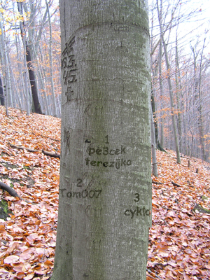
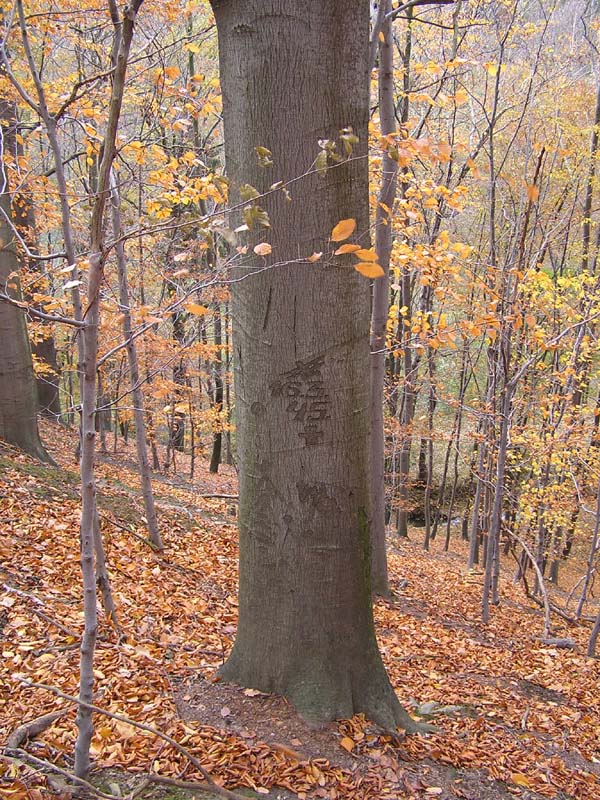
Zastavka 4: Pro postup k finalce ji potrebovat nebudete. Roste tam strom, na kterem jsou na pamatku valecnych hrdinu vyryty monogramy a datum. V techto historickych dnech byla bombardovana nedaleka osada Janovice, predpokladame, ze se to nejak spolu souvisi. Jelikoz se nam nepodarilo nikde zjistit informace o tomto datu, prosime kacery, pokud by nekdo vedel, at nam napise bud do logu nebo na mail a my jeho informace doplnime ke kesce (s odkazem na jeho profil).
Final: Souradnice finalky:
N 49°47,FGH
E 18°0K,L72 kde
F=A+(2*B)
G=(E+7):8+1
H=D:4-1
K=(C-2):4
L=(E+6):9
POZOR !!! Pro uspesny lov finalky ani jednotlivych zastavek NENI nutne se jakkoliv priblizovat k dalnici !!! Dbejte prosim na bezpecnost svou a svych geomrnat!
Pokud se rozhodnete lovit s pomoci geohafanu, nasadte jim prosim nahubek. Odlisite je tak od mudlopsu, kteri tam pobihaji se svymi mudly jen tak bez nahubku.
29.3.2010 - Na zaklade pripominek kaceru jsem hinty doplnil i do waypointu..
16.4.2014 - Nové umístění finálky po ztrátě keše. POZOR, také změna výpočtu finálky, ale čísla z jednotlivých zastávek jsou stále stejná !
26.3.2021 - POZOR, také změna výpočtu finálky, neboť došlo ke změně stavby na zastávce č.3 !
Puvodni obsah kese: 2 prupisky, tuzka, strouhatko, logbook, informacni letak, slunicko, mys, slon, zirafa, snurka na mobil, logo z moduritu (s moznosti vymeny).
Na žádost kačerů přidána 28.10.2014 kontrola souřadnic finálky:

[En] Locality "Pod vinohrady"
From the geomorphological point of view belongs to the older geological formations. Shape is sometime before 350 million years ago on the bottom of sea. Most rocks on the territory, therefore, consists almost entirely of Paleozoic marine sediments. It is composed largely sandstone, passing sporadicaly into conglomerates, but includes a massive layer of loamy shale. They perform here shale layers visible on the surface.
Fossils in these layers, however, are rare. When the sea receded in a later period, appeared in a warm and humid climate the lush ferny growing plants, which in this territory gave rise to the black coal.
East of the village Kyjovice spring creek Polancice, which flows along the hiking trails at the same time the municipalities Olbramice and Klimkovice and forms the cadastral interface in the valley Vineyards below. Next flows underneath the road III. class around the pond Pistany towards the Lagnov settlement. The meadows along the river are full of spring primrose, wood-anemones and other flowers typical for wet locations. Forests were mostly converted to spruce monocultures, only in part under the vineyards and villages Janovice are more represented ancient beech trees and young hornbeams.
In this area considerable incidence of deer, hares, partridges, pheasants and wild pigs. Here are predator such as foxes, martens, fitchews, weasels, ermines, and partly badgers.
Informations are from book Klimkovice from author Mr. Antonin Hub, edited municipal office Klimkovice in the year 1994.
About cache
If you want to catch with a car, we recommend you shut down near of the village Janovice (see waypoint). There are other options, but we wish not show a way via any stages. If you will travel by bus, it needs to get off at stop "At the pond".
Way from the first stage to the end point is a beautiful walk trough valley Polancice in a total duration about 2 kilometers (one way). It is classical multicache which in each section must be complete any tasks, that will help you find the final coordinates. Overall are 3 stops and final. Cache is available in all-weather, just the way to final could be in the rain a bit slippery. If is it more of snow, it may be not possible hunt this cache. To the final are 2 ways. The one have terrain 2* and the second have 4*. Everybody have his way . If the level rises will be very creek (normal is the depth of 20 cm) is needed to be careful of the children, at fall down into the water.
Particular stages
Stage 1: Beginning coordinates will take you to the stone wall. In this section you can find the top of a wall (where they are wearing the most stone cage). Count how many cage on the highest point of the wall have rectangular shape (A) and how many square shape (B). Above this wall is another one, which has stones embedded in concrete, that's why not count them. Square and rectangle calculate vertically - see picture in listing.
Stage 2: The coordinates take you to the steel barrier. Your task is to calculate the white (C) and red (D) stripes of barrier. Is needed to calculate both sites of the barrier. Who is interested, can short walk away (about 50 m in forest) to see wrinkles slate rocks.
On the way from stage 2 to stage 3 you will see the place where from April 2008 to June 2009 was standing the fire station of professional firefighters, after which there stayed only fenced area with a hangar. The station is now moved to Ostrava-Prívoz.
Stage 3: Here are a few wooden buildings. The first of them (from the direction from which you come from) count the number (E) of walkway components.
Stage 4: It is not need to the procedure to final. Tree grows there, where are the memory of war hero the date and monograms engraved . In these historic days, was bombed near the village Janovice, assume that it somehow related. Because we could not find information anywhere on this date, we please geocachers, if they know someone, write to us the log or email and we enter this information to cache (referring to their profile).
Final: Final coordinates:
N 49°47,FGH
E 18°0K,L72 kde
F=A+(2*B)
G=(E+7):8+1
H=D:4-1
K=(C-2):4
L=(E+6):9
Atention !!! For your succesfully hunt of this cache and all stages IS NOT NECESSARY to walk to neighbourhood of highway !!! Be very carefully!
When you wish hunt with your dogs, apply you muzzle to dogs. So will you other as non-cachers, who are going with your dogs without muzzle.
29.3.2010 - By remark on my listing I write hints in waypoints too.
16.4.2014 - New location of final after the loss of cache. Caution, change the calculation of final, but the numbers from the stages are still the same !
26.3.2021 - Caution, change the calculation of final, because the number of stage 3 is now other, because the wood building on stage 3 is new !
Original content of cache: 2 pens, pencil, pencil sharpener, logbook, information pamphlet, sun, mouse, elephant, giraffe, twine to mobile phone, logo from ceramic substance (this can be change too).
At the request of the cachers added 28 October 2014 check of Coordinate: