Lockport Prairie EarthCache
-
Difficulty:
-

-
Terrain:
-

Size:  (other)
Please note Use of geocaching.com services is subject to the terms and conditions
in our disclaimer.
IMPORTANT NOTE: If you log a find on this EC without providing the appropriate answers, I will exercise the right to delete your log without explanation. So please read the full listing & take appropriate steps to ensure this does not happen.

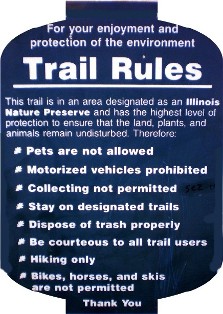
Welcome to Lockport Prairie. The prairie is an Illinois State Nature Preserve; is managed by the Will County Forest Preserve District (WCFPD); and is owned by the Metropolitan Water Reclamation District of Chicago. Thanks to WCFPD with whom permission was obtained to establish this earth cache. Please familiarize yourself with all WCFPD preserve rules & policies.

Google Earth imagery
Many years ago, Illinois was covered by glaciers. As the glaciers melted, the melt-water run-off carved large valleys and sometimes scraped the landscape to the bone or, in this case, “to the stone”. The resulting landscape is called a dolomite prairie.
You now stand in a dolomite prairie – a flood plain in the Des Plaines River valley. This natural scene is a scarce find in Will County, let alone the entire Midwestern USA. At one time, prairies & savannas covered 80% of Will County landscape; now it is less than 1/10 of 1%.
The trademark characteristics of this dolomite prairie consist of:
- Shallow limestone soils (very little soil covers the limestone base)
- Cold water (low in oxygen content, high in calcium content) “percolating” up through the bluffs and seeping up from the stone
- Numerous streams/rivulets flowing through the prairie
- Plants such as Low Calamint, Slender Sandwort, and Ohio Horsemint
Also unique to this prairie are various flora & fauna that are categorized as State or Federal threatened/endangered species. A short list includes:
- Lakeside daisy (found in only 3 other US locations)
- Leafy Prairie Clover
- Hines emerald dragonfly
- Spotted Turtles

Overall, a few reasons contribute to this prairie’s existence. One reason is that this land was purchased for the construction of the Chicago Sanitary and Ship Canal, but was never developed. Another reason… well, that is for you to determine and submit as a logging requirement for this cache. Essentially, the prairie remained in its natural state as a “remnant of pre-settlement Illinois”.
Now it is yours to enjoy! Feel free to hike the whole .40-mile trail. The waypoint LX designates the trail’s end; do not go beyond this point. Enjoy the sights and sounds of the prairie, especially the cool, flowing rivulets.
TO LOG THIS EARTH CACHE
Please complete the following tasks and
send your results through my Geocaching profile:
1. Waypoint L1: Per the informational sign, what are the different unique habitats found in this area?
2. Waypoint L2: The exposed stone is your reference; how deep below the soil surface on which you stand is the limestone sub-surface?
3. At the listed coordinates, post a picture of your GPS device on the bridge (It is optional to include yourself in the pic).
4. At any point on the trail, scan the area & note the prairie’s gradual downward slope. Estimate the difference in elevation between the prairie’s lowest point and the bluffs on the western side. In other words, how deep is this valley?
5. Why do you think early Illinois settlers generally left this area untouched?

Website Sources & Image Montage Credits:
Will County Forest Preserve District
Illinois Prairie Plants
Illinois DNR
Plants of Concern
Chicago Wilderness Magazine
McHenry County Conservation
US Fish and Wildlife Service
| With Mother Nature's help, I have earned GSA's highest level: |
 |
Additional Hints
(No hints available.)