WHEN? The Illinoian Stage of Glaciation

This kame formed during the Illinoian stage of glaciation.
Geologic time is classified with the following divisions: eon,
era, period, epoch and age. The term "stage" is used to refer to a
layer of rock that correspond to a geologic "age".
The stage we are interested in is the Illinoian Stage (of the
Middle Age of the Pleistocene Epoch in the Quaternary Period during
the Cenozoic Era of the Phanerozoic Eon, Whew!) The Illinoian Stage
occurred 300,000 and 130,000 years ago.
WHERE? The Laurentide Ice Sheet

This kame was formed from debris carried by the Laurentide Ice
Sheet.
An ice sheet is a type of glacier described as a
continental-scale ice mass which is not constrained by topography.
The Laurentide Ice Sheet covered 85% of the state of Illinois and
covered a total area of about 16 million square kilometers and
measured nearly 4000 meters in thickness. This ice sheet reached as
far south as Carbondale, Il.
HOW? A Meltwater Landform
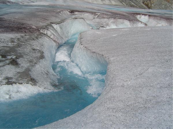
The water of the glacier helped shape the surrounding area and
carried the components that would become the Williamsburg Hill.
150,000 years ago, on the surface of the glacier, a debris laded
supraglacial stream flowed. The stream became englacial, that is,
it dropped into a fissure or crevice and began flowing inside the
glacier, much like a river in a cave.
WHAT? A Moulin Kame

A kame is a deposit, composed largely of material sorted by
moving water in the glacial stream and is formed when in direct
contact with glacier ice. A moulin kame occurs when the glacial
stream falls into a vertical shaft in the glacier, loses momentum
and drops the debris it was carrying in one fell swoop!
WHO? Meet Williamsburg Hill

Williamsburg Hill reaches an official height of 771 feet
(although my readings and many other sources are higher!) and is
located in Shelby county. The deposits here consist of gravel,
sand, silt, and till and constitute the Glasford Formation of the
Illinoian Age.
This moulin kame makes up only a part of an intricate network of
ridges and knolls where lobes of the ice sheet intersected
depositing its debris and forming the beautiful landscape.
WHY...are you here?
To get a smiley and learn a little about the geography of
course!
In order to get credit for this earthcache, email me by clicking
at the link at the top of the page or directly through MutherAndSun@gmail.com with the
following information. Please do not post answers in your log.
1. During which geological era did this kame form?
2. What is the elevation of the base N 39 18.937 W 88 56.152 AND
at the top of the hill? N 39 18.035, W 88 55.956
3. How have human's used the geological components of the kame?
N 39 17.766, W 88 56.893
4. Describe what is found at this location: N 39 18.216, W 88
56.196
5. Optional, but encouraged, post your favorite photo from this
EarthCache journey.
Be sure to check out the other 4 caches in the Williamsburg Hill
series.