NOTE 10/2/17:
I've decided to shut this down
My last update will be on the evening of Monday 7/30/18 and I will pull the container on Tuesday 7/31/18
Plan accordingly
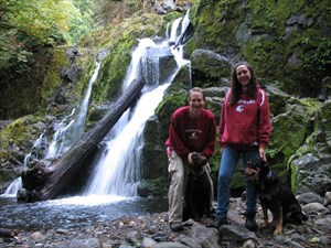
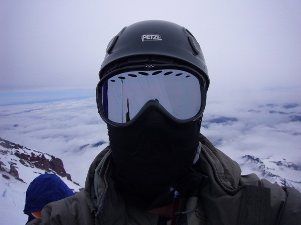
Three Fingers

I know there are other people that feel the same way. If that describes you then you’re welcome for the additional motivation to get on the trail. Or if you’re one that wonders if you feel the same way but haven’t yet been motivated enough to get out and test the theory, then here’s a great opportunity for you.
Pratt Valley

I’ve played with the thought of doing this challenge for a few years and discussed different ideas with friends over time, usually and most appropriately while in the trail. Final motivation came when the idea was brought up on the Hike 100 Miles Challenge (WA State) cache page, a challenge that I suggest attempting concurrently since there are many similarities.
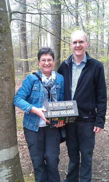
Kendall Peaks

By the way, I understand that 50,000 feet sounds like a lot. It is. Though not overwhelmingly and it’s completely do-able over time. If this challenge is still intimidating then consider:
- A lot of the hardcore ele junkies have already gotten most of the nearby caches so this challenge will be equally hard for them just in a different way as they will find it necessary to drive further and hike farther then they have before
- Getting the 500 foot minimum for qualifying trips is relatively easy especially if done over enough distance so the slope is reduced
- It’ll get easier as you go; getting into better shape has its benefits
- It’s not work when you’re enjoying yourself
- Geocaches are an easy and excellent way to find trails and interesting destinations: visit Switchbacks.com and download NW Trail Maps and NW Topo mapsets to see the incredible number of trails available in the PNW; to view the mapsets use the free Basecamp software by Garmin.
The Challenge
The basic idea is simple, all you need to do is gain at least 50,000 feet of total accumulated elevation under your own human power and do it while going to find a geocache.
You don’t even have to come down if you don’t want to though it’s highly recommended. And since this is all about the gain, when you do eventually come down you can do it the easiest way possible; if you are able to base jump off a 4,000 ft cliff and land in the parking area moments later then more power to you!
The Spirit
The spirit of this challenge cache is to:
- Have fun
- Promote caching, exercise and outdoor activity
- Promote map skills
- Provide a personal challenge
The Statistics
Finishers
| Geocacher Name |
 |
Total Gain |
 |
Start Date |
Finish Date |
| CJJIT |
 |
54,600 Ft |
|
2/15/2011 |
5/21/2011 |
| GrnXnham |
 |
51,040 Ft |
|
1/22/2011 |
7/26/2011 |
| Lfppdf8&MyBetterHalf |
 |
50,580 Ft |
|
5/1/2011 |
7/31/2011 |
| SKS |
 |
52,310 Ft |
|
5/7/2011 |
9/11/2011 |
| lucyandrickie |
 |
54,280 Ft |
|
1/19/2011 |
10/6/2011 |
| B+L |
 |
57,920 Ft |
|
1/27/2011 |
10/23/2011 |
| Ruck |
 |
50,070 Ft |
|
1/23/2011 |
12/3/2011 |
| Libertyfan76 |
 |
53,660 Ft |
|
2/11/2012 |
7/16/2012 |
| Brasstax |
 |
53,660 Ft |
|
2/11/2012 |
7/16/2012 |
| Shaggy, Scooby, and Velma |
 |
54,290 Ft |
|
5/3/2011 |
5/30/2013 |
| Boonie-Medic |
 |
58,050 Ft |
|
1/1/2011 |
7/8/2013 |
| NeWa |
 |
52,210 Ft |
|
9/15/2012 |
9/19/2013 |
| CoolCowCachers |
 |
52,370 Ft |
|
5/15/2011 |
2/8/2014 |
| Qaz&Kids |
 |
58,310 Ft |
|
11/15/2012 |
8/9/2014 |
| crouchcrew |
 |
54,250 Ft |
|
5/10/2013 |
9/16/2014 |
| twlare |
 |
53,010 Ft |
|
12/1/2013 |
9/16/2014 |
| jim_carson |
 |
55,670 Ft |
|
1/11/2011 |
10/11/2014 |
| JesandTodd |
 |
58,120 Ft |
|
2/19/2012 |
10/11/2014 |
| Curious Joe |
 |
50,070 Ft |
|
1/4/2014 |
10/14/2014 |
| pcakes |
 |
50,460 Ft |
|
2/3/2011 |
10/14/2014 |
| Babberly |
 |
56,980 Ft |
|
7/4/2013 |
3/1/2015 |
| Muddy Teapot |
 |
50,000 Ft |
|
6/5/2014 |
6/4/2015 |
| X-Huey-Drv |
 |
53,020 Ft |
|
3/18/2015 |
7/13/2015 |
| philgeorge1 |
 |
56,640 Ft |
|
4/13/2013 |
8/3/2015 |
| obarshay |
 |
52,810 Ft |
|
9/10/2014 |
9/10/2015 |
| PNWRich |
 |
54,760 Ft |
|
6/8/2015 |
11/7/2015 |
| Windstorm+ |
 |
53,750 Ft |
|
1/30/2015 |
11/26/2015 |
| blindleader |
 |
50,040 Ft |
|
9/5/2015 |
6/8/2016 |
| gsbarnes |
 |
51,220 Ft |
|
10/7/2012 |
9/4/2016 |
| Highpointer |
 |
50,040 Ft |
|
1/1/2016 |
9/11/2016 |
| _Wynn |
 |
59,260 Ft |
|
4/21/2017 |
6/2/2017 |
| mmcash |
 |
50,010 Ft |
|
9/4/2016 |
8/19/2017 |
| rakis2 |
 |
54,010 Ft |
|
1/2/2017 |
6/22/2018 |
| bolosky |
 |
50,260 Ft |
|
9/3/2016 |
6/24/2018 |
| boshea |
 |
50,000 Ft |
|
9/9/2012 |
6/29/2018 |
| Id repperi |
 |
56,010 Ft |
|
6/23/2015 |
7/21/2018 |
| Huc id est |
 |
52,220 Ft |
|
6/23/2015 |
7/21/2018 |
| mikedawg360 |
 |
60,320 Ft |
|
7/12/2017 |
7/30/2018 |
| PippiLongstockings |
 |
51,350 Ft |
|
11/1/2014 |
7/30/2018 |
|
Active Participants List (~6 months)
Last updated July 30, 2018
2013  2012
2012  2011
2011 
The Rules
To log a find on this cache you must:
- Accumulate at least 50,000 feet of elevation gain
- Gain the elevation using your own power
- Do your trip on a road or trail in Northwest Topos mapset (NW Topos)
- Find an active physical cache that was published at least three months before you find it
- Gain more than the minimal amount of qualifying elevation in each trip
- Be current and timely with your trips and posts
- Log each trip per the logging requirements
Detailed information about each rule is provided below:
- Accumulate at least 50,000 feet of elevation gain
- The trip to the final will be included as your last qualifying elevation gain and you can choose to either:
- Finish: accumulate enough elevation so that your overall total will be at least 50,000 feet when including the trip to this cache
- Max your Final Elevation: accumulate over 50,000 feet first then include the trip to this cache adding the elevation as a bonus to your overall total (you can add trips until your overall total is at or above 50,000 feet)
| ___________ |
Hike to Final Elevation Table
| Start |
Route |
Gain |
Min. Overall Required |
| Little Si Trailhead |
Mt Si summit |
4,280' |
45,720' |
| Mt Si Trailhead |
Mt Si summit |
4,120' |
45,880' |
| Mt Si Trailhead |
Mt Teneriffe roads |
3,900' |
46,100' |
| Mt Teneriffe Trailhead |
Mt Teneriffe roads |
3,610' |
46,390' |
|
- Gain the elevation using your own power
- Use any combination of hiking, running, snowshoeing, skiing or mountain biking
- Descent may be by any means, or not at all
- Do your trip on a road or trail in Northwest Topos mapset (NW Topos)
- Trips on trails and roads within the boundaries of, but not yet included in, NW Topos will usually be accepted the understanding that you will submit your tracks to Switchbacks for inclusion in and improving the mapset
- NW Topos currently includes Washington, North Idaho, western Montana, much of northern and western Oregon, the areas around Victoria and Vancouver in British Columbia, and Calgary, Alberta
- Find an active physical cache that was published at least three months before you find it
The three month blackout is to avoid this challenge being a motive for placing caches
- The following DO NOT count
- Caches published less than three months before you find it
- DNFs (you must find the cache)
- Archived and temporarily disabled caches
- Virtuals, Earthcaches, etc.
- Your own caches
Exception: finds are allowed on your adopted caches provided you found them when you are not the owner
- Puzzle and multi-caches
Exception: They are allowed if I already know where the final is located. Even if I don't have a found log on the cache there is still some chance that they will be accepted. For example, I may have solved the puzzle but not yet gone to physically find it. I strongly suggest getting my approval ahead of time via email or you will most likely end up finding that some or all of your elevation gain is not accepted towards the challenge. And, of course, please do not post in your logs the coordinates of, or otherwise give any critical information about, puzzles or multi cache solutions or final locations
- Gain more than the minimal amount of qualifying elevation in each trip
- A trip is a single continuous human powered event; a segment is a section of gain within a trip
The typical trip is a single segment from the trailhead to the cache and back
An example of an additional segment is the elevation gained back up to a summit or ridge if the cache is located down the other side (elevation gained on the return counts)
A trip can use multiple modes of human powered travel (for example mountain biking and hiking) but ends at the use of any non-human powered mode (for example using your car to go to another trailhead)
A trip can last more than one day. For example, a backpacking trip
Multiple trips can be done on the same trail or to nearly the same destination provided a different cache is found on each trip. They can be completed on the same or different days
- The total qualifying elevation for a trip is the sum of all the qualifying segments
Qualifying elevation gained is usually less than the actual elevation gained
You need only log one segment for each trip; you may add additional segments to claim more elevation
The trip minimum can be reached with two or more segments; for example, two segments of 250 feet meets the trip minimum
- The minimum qualifying trip elevation is 500 feet; the minimum qualifying additional segment elevation is 100 feet
Trips with elevation less then the minimum do not qualify for this challenge
Many trails and routes have significant ups and downs that add to the accumulated elevation gain and these may be included as additional segments provided each is a minimum of 100' vertically and are logged per the logging requirements
- Official elevations are based on the topo contour lines in the NW Topos Mapset
GPSr elevation readings vary considerably and are therefore much too inaccurate to be considered
- For elevation to qualify it must be directly related to finding a cache
Elevation gain that is not related to finding a cache is absolutely fine to do during a trip, it just won't count towards the challenge
It is acceptable to string together multiple caches during one trip to create a route with more qualifying elevation gain; be careful as a DNF on a cache can cause parts of the trip to not qualify
- Be current and timely with your trips and posts
- The challenge starts for you when you join
To join the challenge, let us know by posting a note log using the current date, a 'join log'; only hikes on or after this date qualify (you can post your join log the same day as your first hike but your first hike can not be before the date of your join log).
Your official start date will be the date of your first hike.
- Post your trip soon after completing it. Trips posted more than seven days after completed will not be accepted unless there is a compelling reason
This challenge page is intended to show a current view of your progress and logs must have the same date they were submitted: no backdating of logs is allowed (your hike date and log date may differ). This makes it much easier on me to maintain the participation stats and keeps the chart fair and accurate for those that have already started
The compelling reason exception will be very seldom allowed and is only for special circumstances; email me to discuss before posting a log
- Log each trip per the logging requirements
- For each trip post the information in the list below in a note type log. This makes it easier to do my check and helps any of us who get inspired and want to do the same hike for ourselves. A reminder that posts must be done in a timely manner to qualify (see rule #6 'Be current and timely with your trips and posts').
The list is numbered for reference only and the information doesn't need to be in the same order, it just needs to be included, so feel free to post in your own style. If you would like please feel free to include more than the minimum information as myself and others enjoy reading about your adventures and progress, and the information can be useful for planning our own trips. It can also helpful to number your hikes to keep track. Trips posted by others can be a great source for ideas on how to post more complicated logs such as multi-segment or multiple trips in a day.
- Trip logs need to include the following information:
- Date of trip
- Route
- Total elevation gained
- Starting location and elevation
- Destination cache code and elevation
- Details about additional elevation segments (optional)
For each segment:
- Starting location and elevation
- Ending location and elevation
Detailed information about each required item is provided below:
- Date of trip
- Provide the date the trip was completed
The log date, the date on the log that is posted to this challenge page, might be different. Do not alter the log date, it should remain the date that the log is actually posted
- Route
- Provide enough information so that it's possible to follow your trip
-
- Name the trails in order traveled (as an alternate, attached a screenshot of your mapped GPS track)
- Off-trail travel
For each section of off-trail travel provide:
- Starting location
- Ending location
- If your general route between the starting and ending locations is not immediately obvious then provide additional information about it by describing it accurately or attaching a marked up map to your log
- Total elevation gained
- The total amount of qualifying elevation for the trip
- Starting location and elevation
- Where you started your elevation gain
Logged per the section 'Additional requirements for coordinates and elevations' below
- Destination cache code and elevation
- The elevation of the cache you found
Logged per the section 'Additional requirements for coordinates and elevations' below
- Provide the GC code for the cache
- Details about additional elevation segments
This item is only necessary when claiming additional elevation segments
- Provide the following additional information for each segment of 100' or more that you wish to claim:
- Starting location and elevation
Logged per the section 'Additional requirements for coordinates and elevations' below
- Ending location and elevation
Logged per the section 'Additional requirements for coordinates and elevations' below
Additional requirements for coordinates and elevations
- For locations: use the cache code, a place name on NW Topos or provide the coordinates
If I can't find it you don't get credit
Please provide coordinates in the format NXX XX.XXX WXXX XX.XXX (no comma) so I can cut and paste directly into software. This makes life much easier for me
- For elevations: use NW Topos or another topo map and round to the nearest 10'
NW Topos is the official mapset being used for this challenge. I check each trip for accuracy and if I adjust any information I will let you know in my summary log that I post at every update. There are differences between topo mapsets so if you use another mapset your posted elevation may differ from the official elevations. It may be that you very accurately determined the elevation on the mapset you're using but then I still adjust it during the check. If that is the case, please do not take it as a statement of your mapping skills but rather as a way of highlighting the differences between maps. That is meant to build knowledge and intuition about maps and navigation, a key goal I have for this challenge
Software
- Basecamp
A map and GPS software by Garmin. It can be used to view the NW Topos and NW Trails and other map sets and the official elevation file. It can also be used to upload and download information to and from Garmin and some other GPSrs
- Northwest Trails Mapset
A very valuable map set for Basecamp or other related software. It contains many of the trails in the Pacific Northwest and is set up as an overlay which means that it can be used at the same time as another mapset in order to see the trails and the other mapset together (obtain other mapsets from other sources such as purchasing from Garmin or from free open sources on the web)
- Northwest Topos Mapset
Another valuable map set for Basecamp or other related software. It is a portion of the Northwest Trails data combined directly with a topo map. This is the official reference for this challenge
- Official Elevations File (.gpx)
Left click to view or right click and 'save as' to download. This is a file containing location and elevation information for trips already submitted by participants. I use this as my first resource to check newly posted trips and then add any new information to it as it comes up. I am making it available for you as a convenience to make your logging easier; it is not necessary to use it to log your trips. This file is in gpx format and can be opened with Basecamp or other software. It will be updated occasionally so be sure to check back if you want to have the latest version: the last updated was 07/30/2018
Other Items
Discussion Forum
- If you have any questions, comments, feedback or find errors please feel free to discuss here