Nordsee oder Schwarzes Meer?
Wo entspringt der Neckar? Seit Generationen quälen
Erdkundelehrer mit dieser Frage ihre Schüler. Tatsächlich
ist die Antwort auf diese Frage gar nicht so einfach. Sicher ist
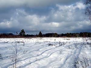
nur, dass der Ursprung des Neckars im Schwenninger Moos liegt, dort
sammelt sich das Wasser des Neckars. Von hier aus fließt es
zum einen nach Südwesten über die Brigach zur Donau ins
Schwarze Meer und zum anderen nach Norden über die historische
Neckarquelle zum Rhein in die Nordsee. Denn das Schwenninger Moos
liegt auf der Wasserscheide von Rhein und Donau.
Das einstige Torflager des Schwenninger Mooses wurde in den letzten
200 Jahren abgebaut und Entwässerungsmaßnahmen
führten zudem zum Zusammenfallen des restlichen
Moorkörpers. Erst durch die Austrocknung des Moores war es
Sträuchern und Bäumen möglich sich hier
auszubreiten, so dass das Moos immer mehr verwaldete. Die dadurch
eintretende Anreicherung mit Nährstoffen sowie die
Verschattung bewirkten, dass die moortypische Flora und Fauna fast
ganz verdrängt wurde. In den 80er Jahren des vergangenen
Jahrhunderts wurde das Problem erkannt und es konnten die ersten
Schritte zur Rettung eingeleitet werden. Es wurden
Renaturierungsmaßnahmen in Angriff genommen, um den
Wasserhaushalt zu verbessern. Die Entwässerungsgräben,
die zum Torfabbau gegraben wurden, konnten verbaut werden, damit
konnte das Niederschlagswasser gestaut und der Wasserspiegel
insgesamt wieder angehoben werden. Das anschließende Wachstum
der Moose und anderer typischen Moorpflanzen brachte eine echte
Regenerierung des Schwenninger Mooses mit sich. Heute dient es auch
wieder als natürlicher Wasserspeicher für den Neckar.
Die Fragen
Um diesen Cache zu loggen, mache bitte ein Foto von Dir mit Deinem
GPS bei den Listingkoordinaten mit dem Neckarursprung im
Hintergrund. Ferner sende mir eine E-Mail mit den Antworten auf
folgende Fragen. Die Lösung findet ihr auf einem Schild nahe
den Listingkoordinaten.
- Wie viele Neckursprünge sind in historischen Karten des
19ten Jahrhunderts eingezeichnet?
- Wo entspringt die historische Neckarquelle?
- Was verläuft mitten durchs Moos?
Es darf gleich geloggt werden, bei Problemen melde ich mich schon
...
Hinweis!
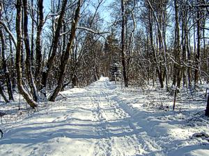
Ihr befindet euch in einem Naturschutzgebiet. Es ist der Lebensraum
zahlreicher gefährdeter Pflanzen und Tiere. Bleibt also auf
den Wegen, unterlasst das Füttern von Vögeln und Fischen
sowie das Pflücken oder Ausgraben von Pflanzen.
North Sea or Black Sea?
Where rises the Neckar? Since generations geography teachers
torment their pupils with this question. But the answer is not
quite easy. What is known for sure is that the source of the Neckar
is in the Schwenninger Moos, there the water for the Neckar
collects. Thence it flows southwest to the Brigach and so with the
Donau into the Black Sea as well as northwards via the historical
source of the Neckar to the Rhine and so into the North Sea.
Because the Schwenninger Moos lies on the watershed of Rhine and
Donau.
The former peat deposit of the Schwenninger Moos was cut in the
last 200 years and dewatering measures involved the subsidence of
the peat. Only by the dehydration it was possible for bushes and
trees to grow up. And the typical peat vegetation became displaced.
In the eighties of the former century the problem was seen and so
the first step for the rescue could be started. Measures for
renaturation started to correct the water balance. From that on the
former typical peat vegetation grew again and so the regeneration
of the Schwenninger Moos started. And today it is a natural
waterdepot for the Neckar again.
The Questions
To log this cache, please take a picture of you and your GPS at the
original cache coordinates with the info board "Neckarursprung" in
the background (optional). Additionally send me an E-mail with the
answers to the following questions. You find the solutions on a
sign close to the listing coordinates.
- How many sources of the Neckar are drawn in historic maps of
the 19th century?
- Where does the historic source of the Neckar rise?
- What goes middle through the Moos?
You can log your visit directly, if there are any problems, i'll
contact you ...
Important Information!
The Lake Area has been designated as a nature reserve. The way must
not be leaved!