Constructed in 1824 as an earth dam by the Warrington and
Stockport Turnpike Trust (and now carrying the A56) over a pool and
stream in the valley below St. Mary's church, Lymm dam was built to
help avoid congestion in the village. A lake now known as Lymm dam
soon grew behind it. More information on the history of the dam can
be found
here or here (with
map).
The wooded area surrounding the dam is now popular with walkers,
responsible dog owners, anglers, bird watchers, cyclists and horse
riders, enjoying the Oak and Beech woodland, and variety of
wildflowers and wildlife.
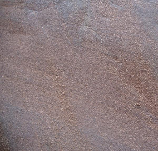
Surrounding the dam are many areas of exposed rock, which have
been identified as sandstone, a sedimentary rock formed over a
period of millions of years by the compression of many layers of
tiny grains of sand, which settle over time either from water
(bottom of a river / lake / sea) or on land (i.e. a desert),
and are then compressed by the weight of overlying layers. The
sandstone surrounding the dam was created during the permo-triassic
period (i.e. towards the end of the Permian geological period, and
the start of the Triassic geological period), and is around 250
million years old.
The sandstone at the northern end of the lake is known as Helsby
sandstone, which is known for its red-brown colour (certainly more
red than that of the layer of Wilmslow sandstone which lies
underneath, and is visible if you move further north, through the
village of Lymm and into Slitten gorge beyond), which was primarily
formed by sedimentation from streams and rivers.
This particular earthcache is located on a rocky bluff below St.
Mary's church and is of special interest as one of only two
examples discovered in the UK of formations known as "Nye Channels"
and "Scallops" (The other location is at Thurstaston Hill on the
Wirral).
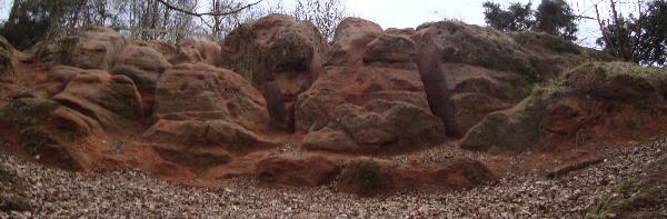
Nye Channels are the deep cuts found in the rocks, and Scallops
are the rounded steps found in the vertical sections. These
were formed around 10-13,000 years ago at the end of the last
glacial period (known as the Devensian glaciation), when Cheshire
was covered with ice - under which flowed meltwater containing rock
and soil deposits, eroding the sandstone in this unique way. The
Nye Channels and Scallops were formed where the water flow was the
greatest.

To claim this earthcache you
must send me an e-mail with the answers to the following
questions;
1) What
direction do the majority of the Nye Channels run (e.g.
North-South).
2) What is the
approximate depth of the deepest channel.
3) OPTIONAL -
Upload a photo of yourself with your GPS by the lake in front of
bluff.
Please note,
you do not need to send the e-mail before logging a find, however
logs without a corresponding e-mail, or logs containing the answers
may be deleted.
Please do not
damage the formation, leave it as found for others to
enjoy.
Thanks to Tim
Baker (Area
Ranger, Lymm & Thelwall) for kind permission to list this
earth cache.
Car parking can be found at N53 22.588 W002 28.632.
This earthcache can be accessed via bus (No's 5, 6, 37, 37a, 38
& 47).
This earthcache is pushchair & wheelchair accesible, via a
path from N53 22.686 W002 28.753.