An estuary is a geological feature that provides a unique
habitat. It forms in a semi-enclosed body of water where freshwater
from rivers mixes with saltwater from the ocean. Thus it is a
transitional area from land to sea, considered one of the most
productive environments in the world, and supports and nurtures an
immense diversity of wildlife.
At 400 square miles, and with a 2,200 square mile watershed,
Tampa Bay is Florida’s largest open-water estuary.
Four major rivers (Alafia, Hillsborough, Little Manatee, and
Manatee Rivers) provide about 70-85% of the roughly 525 billion
gallons of freshwater inflow to Tampa Bay each year. Old Tampa Bay,
in the northern part of Tampa Bay, usually has salinities of 18-32
parts per thousand (ppt). Salinity generally ranges 25-38 ppt in
Lower Tampa Bay, nearest the mouth of the bay. (For comparison,
fresh water is less than 1 ppt, and the ocean averages 35 ppt.)
Oysters are immobile shellfish that filter water as they feed.
Live oysters and dead oyster shells form in mounds on the bay
floor, creating bars or reefs. Oyster bars are most prevalent near
river mouths and in sections of the bay that receive a steady
influx of fresh water. The oyster bars trap sand, silt, and organic
matter. Mangrove propagules are able to germinate at the edges of
the oyster bars, and add more organic matter as they grow.
Mangrove trees are vital to the establishment and growth of
landforms at the edges of the estuary because they are able to live
and thrive in saline environments. They trap and cycle pollutants,
and also function as the basis of the food chain for a multitude of
marine species. Mangrove roots anchor the shorelines and oysters
frequently colonize at their base, further promoting growth of the
landform. Mangrove branches provide sheltered nesting for birds,
and they provide food and cover for fish and animals.

Weedon Island has three species of mangroves. Red mangroves are
found closest to the water, and have tangled prop roots. Their root
systems exclude the uptake of salt from seawater. Black mangroves
are found at slightly higher elevations, and feature numerous
finger-like root projections, called pneumatophores, around the
base of the tree. White mangroves occupy the highest elevations of
the three species. They usually have no visible aerial root system,
and the leaves are yellow-green and notched on the tip. Black and
white mangrove trees remove salt from the water, and the crystals
may be seen on the leaves of the tree.
Seagrasses are underwater flowering plants found at shallow
depths in protected bays and lagoons and in patches along the
continental shelf of the Gulf of Mexico. As a nursery environment,
seagrasses support small fish, shrimp, and crabs that hide among
the blades and feast on decaying leaves. Seagrasses also help
stabilize shifting sands on the bottom of the bay and improve water
clarity by trapping fine sediments and particles. Seagrass beds are
susceptible to dredge-and-fill activity, declines in water quality,
and damage from motor boats; as boats carve through shallow grass
flats, their propellers cut sandy trenches that may stay barren for
years.
Since the 1950s, almost half of Tampa Bay's original marshes and
mangroves have been lost, half of its natural shoreline has been
altered by construction of roads, causeways, subdivisions and other
development, and 40 percent of its underwater seagrass beds have
disappeared.
Additional waypoints of interest:
N 27° 50.858 W 082° 36.409 Visitor Center
N 27° 50.651 W 082° 36.576 Riviera Bay observation
tower
To get credit for this EarthCache, e-mail me the answers to
questions #1 and #2, below, and post a picture as described in #3
and #2.
1. Identify the mangrove species at the water’s edge seen
from the posted coordinates and describe its geological role (How
does it help to shape our earth?).
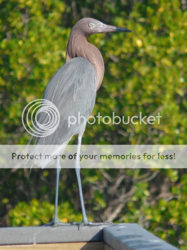
2. Identify or describe a creature that you saw during your
visit to Weedon Island Preserve, and post a picture, if
possible.
3. (Optional) Post a picture of yourself at your favorite
location in the preserve.


I have earned GSA's highest level. Go to earthcache.org to find out
how you can become an EarthCache Master, too.