This puzzle cache was
inspired by
"Mission
Impossible" GCKP67 by BostonTerrier.
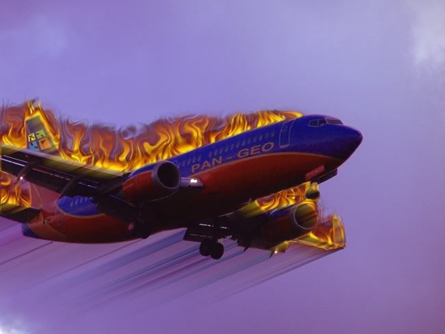
The story line goes that Pan-Geo airlines,
flight GC26PGQ has run into trouble as they approach a local
airport and contacts the tower to advise of their condition. They
are attempting to land, but smoke has filled their cockpit and they
are uncertain what exactly is wrong. Sadly the plane suddenly
explodes, killing everyone on board. The black box could yield some
important clues but search crews were unable to find it. The device
transmitted information indicating that it landed at 403 ft. above
sea level, but not its actual coordinates before all contact was
lost. FAA investigators are desperate and knowing that geocachers
are perfectly suited to help find lost/hidden containers, are
experts at complex math puzzles, and are knowledgeable in all
things related to GPS technology and waypoint projection; have
released the final transcripts between the ill-fated cockpit crew
and the tower. They have also included some additional information
from their radar logs.
Captain Mike: Tower, this is Pan-Geo
flight GC26PGQ. We are experiencing technical difficulties and need
assistance. Again, we need assistance. Do you copy?
FAA Note: Radar logs show that the plane
was flying at an elevation of 4200 ft. (above sea level) and their
position was marked at N42° 44.771' W71° 19.460' at precisely 7:10
PM.
Control Tower: We read you Pan-Geo, what
is your situation? Over.
Captain Mike: Smoke is filling the
cockpit, making it difficult to read the instruments and we have
intermittent loss of steering. We cannot determine our current
position.
Control Tower: Pan-Geo we have you on our
radar but surely you must be able to see something of your
controls.
Captain Mike: Tower, we can only just
barely make out the gauges. We are trying to bring her down to 475
ft. but we have no control over the wing flaps. We are locked in
and flying level - and stop calling me Shirley.
Control Tower: We have contacted
emergency services and they are expected to be on site at T minus
19 seconds.
Captain Mike: We are attempting to lower
the landing gear, or was that the lever for the yaw? I always get
those two confused. We are seeing small fires from engines #4 &
2. Is that bad? Over.
Control Tower (unaware that the microphone
was turned on, the controller can be heard whispering to the person
sitting next to him): These poor guys don't stand a chance. I
mean they are just going to all go "splat" all over the place.
It'll be awful.
Captain Mike: Tower, what was
that???????
Control Tower: DAMN! Oh nothing captain,
just clearing my throat. You'll be landing soon and we'll all have
a big laugh over this. I'll buy you a beer at Millie's Tavern.
Would you like that?
FAA note: The plane suddenly blows up
when it was located at N42° 52.286' W71° 23.883', exactly 56.537
seconds after 7:10 PM.
Please be advised
that the cache is NOT winter-friendly, but if you are determined to
go after this one with snow on the ground, I'd suggest using the
encrypted hints below.
GeoChecker: Geocaching Coordinates Checker
Fizzy Calc will be extremely helpful in your calculations. Project
your waypoint using the "high accuracy" setting. The basic steps in
solving this puzzle are to determine how fast the plane was flying
(in feet per second) and what the bearing is using the first two
coords and how long it took to get from one point to the other.
Then calculate how long it took for the box to reach the ground.
Divide the distance it ACTUALLY fell by 16.1 Then take
the square root of that number and that will give you the number of
seconds of flight time before the box hit the ground. Multiply the
number of seconds it was falling by the speed the plane was flying
(in feet/seconds) and you will then know how many feet it traveled
horizontally toward the runway. Plug that distance into Fizzy Calc,
along with the bearing and you'll get your final
coordinates.