
-
NÚMERO....................................................:
59425
-
NOMBRE....................................................:
Comampla
-
MUNICIPIO................................................:
Alcalà de Xivert
-
PROVINCIA................................................:
Castellón
- FECHA DE CONSTRUCCIÓN......................:
17 de diciembre de 1987
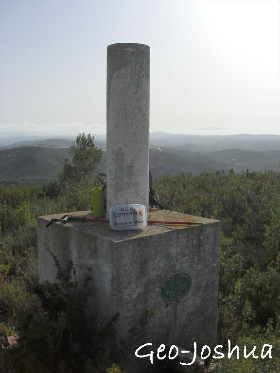
- PILAR SIN CENTRADO FORZADO...............: 1,20
m. de alto, 0,30 m. de diámetro.
- ÚLTIMO
CUERPO.....................................: 1,00 m. de
alto, 1,00 m. de ancho.
- TOTAL
CUERPOS......................................: 1 de
1,00 m. de alto.
|
| COORDENADAS
GEOGRÁFICAS: |
| Sistema de
ref........: |
ED 50
|
ETRS89
|
| Longitud.................: |
0º 13' 22,89120'' |
0º 13' 18,57298'' ± 0,094 m. |
| Latitud....................: |
40º 15' 50,23660'' |
40º 15' 46,05429''
± 0,099 m.
|
| Altitud....................: |
|
262,712 m. ± 0,083 (BP) |
| Compensación.......: |
01 de junio de 1991 |
01 de noviembre de 2009 |
| COORDENADAS UTM. HUSO
31: |
| Sistema de
ref........: |
ED 50
|
ETRS89
|
| X.............................: |
263847,420 m. |
263752,050 m. |
| Y.............................: |
4460831,310 m. |
4460628,636 m. |
| Factor escala.........: |
1,000286501 |
1,000287107 |
| Convergencia.........: |
- 1º 47' 44,21179'' |
- 1 47' 46,85000'' |
|
Altura sobre el nivel medio del mar:
212,531
m. (Base Pilar)
|
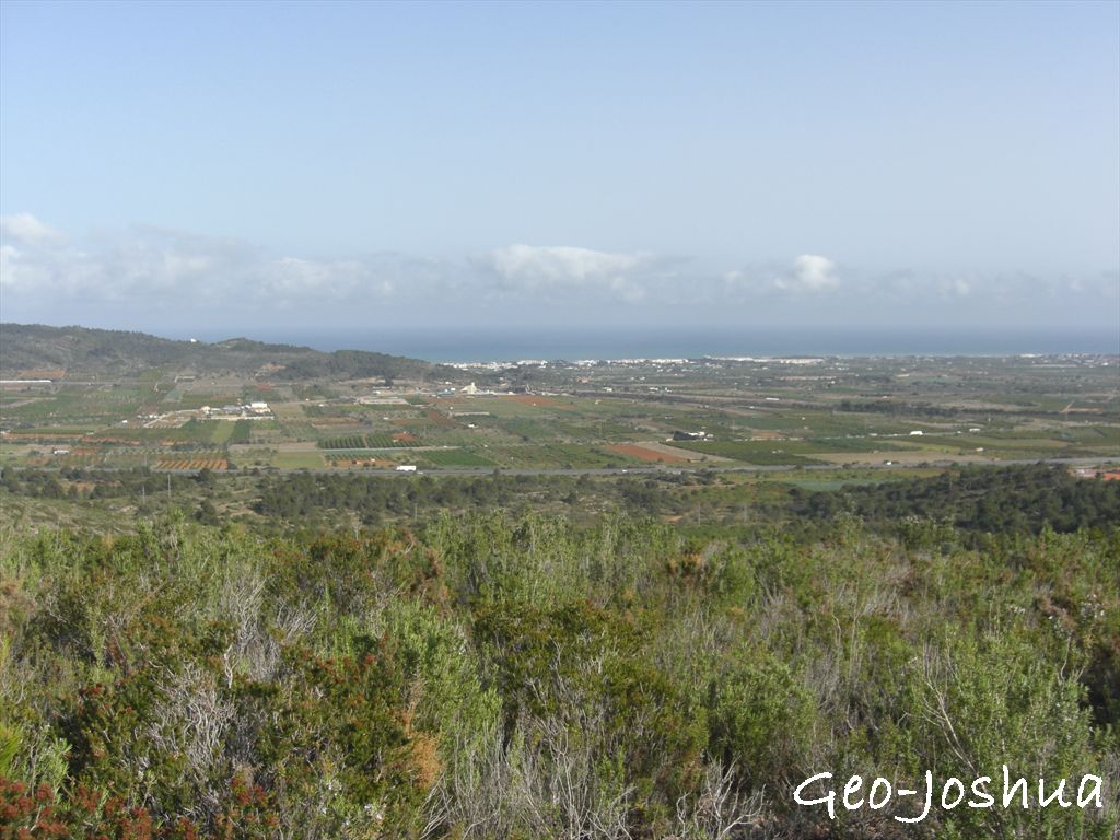
situación:
Situado en lo alto de un cerro
que da nombre al vértice, de terreno con piedras
sueltas.
ACCESO:
Se puede acercarse con
vehículo por diferentes sitios hasta el "VGG:
COMAMPLA", pero el último tramo debe ser campo a
través.
Una posibilidad podría ser
seguir las instrucciones que aparecen en la reseña del vértice
geodésico.
Otra posibilidad es el acceso
desde el interior, dejar el coche en parking N40 16.072 E0
12.567; primero por camino y después campo a través; ascender
al VGG, por donde se pueda (si quiere aventura y sufrir un
poco).
Otra posibilidad ( que yo
hice) es si se quiere un poco de aventura y sufrir un poco menos,
se puede hacer una ruta ( a veces senda - a veces montaña a
través). Desvío a camino en N40 15.393 E0 13.823, parking en
N40 15.495 E0 13.712; inicio de senda en N40 15.587 E0
13.687, y recto ascendiendo : bordeando una finca de
algarrobos, travesando unos bancales abandonados y pasando por el
Corral de Roig.

contenedor:
El contenedor es un recipiente
hermético de 22 x 14 x 7 cm. que contiene inicialmente:
- - Cuaderno de REGISTRO.
- - Lápiz, goma y sacapuntas.
- - DIPLOMA FTF.
- - Vaso plástico infantil.
- - Baraja española de cartas.
- - Agenda.
- - Cochecito de plástico.
- - Animal de granja.
FELIZ BúSQUEDA ! !
!