How the Fens were formed
At the end of the most recent glacial period, known in Britain as
the Devensian, ten thousand years ago, Great Britain was joined to
Europe, notably, by the ridge between Friesland and Norfolk. The
topography of the bed of the North Sea indicates that the rivers of
the southern part of eastern England would flow into the River
Rhine, thence through the English Channel. From the Fens northward
along the modern coast, the drainage flowed into the northern North
Sea basin, which, in turn, drained towards the Viking Deep. As the
land-ice melted, the rising sea level drowned the lower lands,
ultimately establishing the coastlines of today.
These rising sea levels flooded the previously inland woodland of
the Fenland basin, and over the next few thousand years led to the
development of both extensive salt-water and freshwater wetlands.
Silt and clay soils were deposited by marine floods in the
salt-water areas and along the beds of tidal rivers, while organic
soils, or peats, developed in the fresh-water marshes. The peak of
the water levels in the fens was in the Iron Age; earlier Bronze
and Neolithic settlements were covered by peat deposits, and have
only been found recently. During the Roman period, waters levels
fell once again, and settlements were possible on the new silt
soils deposited near the coast. Though water levels rose once again
in the early medieval period, by this time artificial banks, such
as the great Sea Bank, protected the coastal settlements and the
inland from further deposits of marine silts, though peats
continued to develop in the freshwater wetlands of the interior
fens.
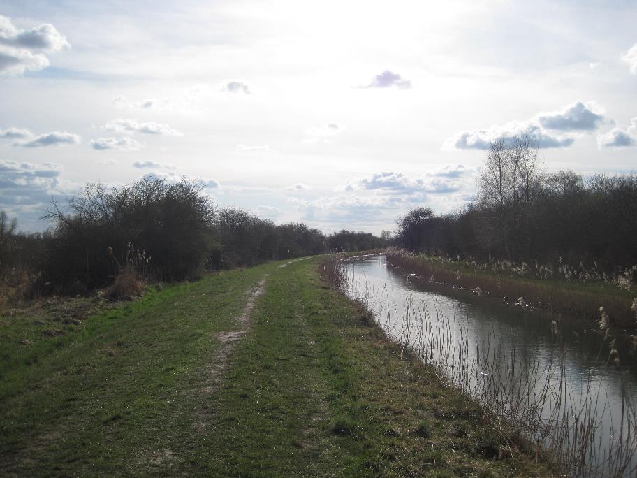
View of the Fens
The wetlands of the fens have historically included:
* Wash, which at greater or shorter intervals had bodies of water
flowing over it, as in tidal mud-flats or braided rivers.
* Marsh, which was the higher part of a tidal wash on which
salt-adapted plants grew. It is now usually called salt-marsh. This
probably arises from the fact that salt was produced in such
places.
* Fen, a broad expanse of nutrient-rich shallow water in which
plants had grown and died without fully decaying. The outcome was a
flora of emergent plants growing in saturated peat.
* Moor. This developed where the peat grew above the reach of the
land-water which carried the nutrients to the fen. Its development
was enabled where the fen was watered directly by rainfall. The
slightly acidic rain washed the hydroxyl ions out of the peat,
making it more suitable for acid-loving plants, notably Sphagnum
species. This is exactly the same as bog but that name entered
English from the Irish language. Moor has a Germanic root and came
to be applied to this acid peatland as it occurs on hills. These
moors disappeared in the nineteenth century, and it had been
thought that the Fenland did not have this kind of peat, but
archeological and documentary evidence has since demonstrated that
it did until the early nineteenth century.
As well as waters in
* Tidal creeks. For naming purposes, the English settlers seem to
have ignored them unless they were big enough to be regarded as
havens. The creeks (in the British sense) reached from the sea,
into the marsh, townland and in some places, the fen.
* Meres, or shallow lakes which were more or less static, but
aerated by wind action.
* many rivers, both natural and (from the Roman and medieval
periods forward) artificial.
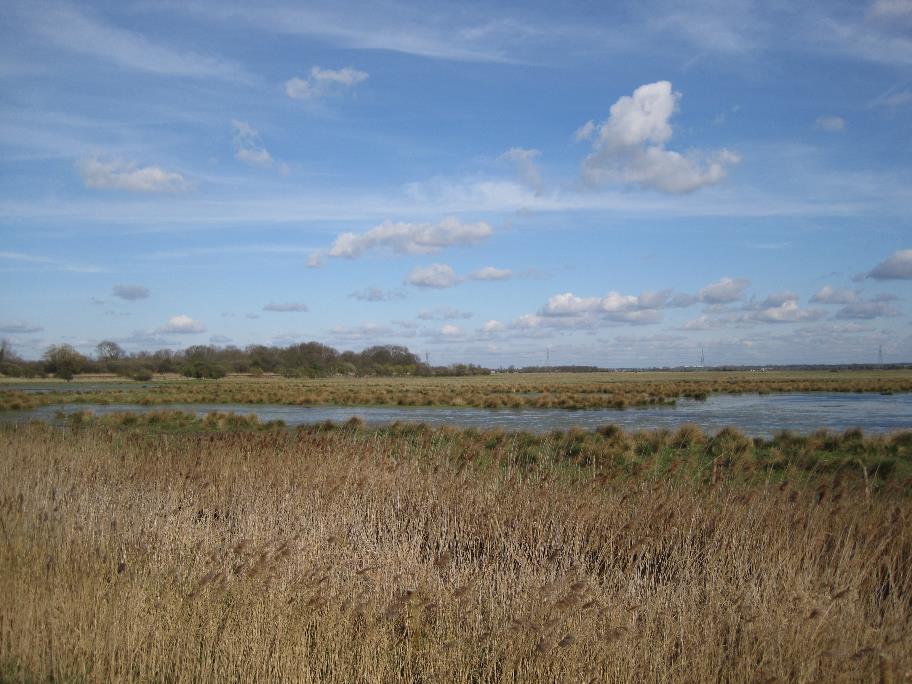
Wicken Fen
Wicken Fen is unique in landscape terms. A remnant of the once
massive Cambridgeshire Fens, it preserves a true sense of wetland
wilderness. Standing in the middle of the reserve, nothing is
visible other than wild habitats of fen, water and woodland.
Outside the boundary is an expanse of fields and intensive
farmland, but within is an ancient landscape of great diversity and
aesthetic appeal.
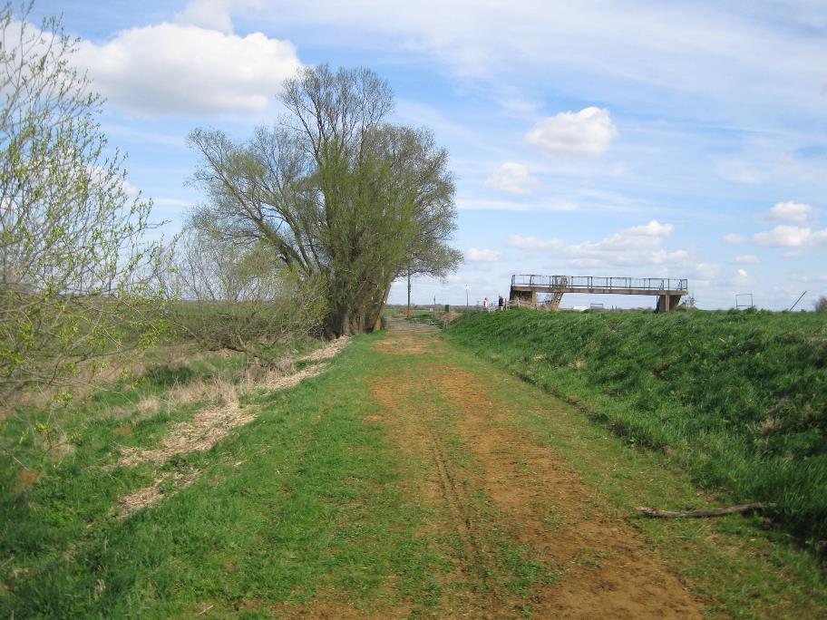
View of the Grazing Land
The Fen is as well known for its wildlife as its topography.
Wicken Fen was originally saved as nature reserve because of its
invertebrate interest, especially its rare moths, butterflies and
beetles. However, it is also very important for lots of different
groups of species, such as plants, birds, spiders, dragonflies,
fungi and snails. Over 7800 different species have been recorded at
Wicken Fen, making the site one of the most species-rich nature
reserves in Britain.
The Fen is managed by the National Trust and has a Vision for
the future.
It plans to obtain land (around 53 square Kilometers) between
Cambridge and Wicken to create one of the biggest lowland projects
in the country. They plan to return much of the land back to its
original state where possible.
There are even plans in conjunction with Sustrans to build a cycle
way through the middle of the land.
This picture shows a difference in height between the lode bank and
the surrounding ground (not the answer to the
question).
Sources - National Trust and Wikipedia.
The Cache
To claim the cache you need to satisfy the follow four tasks.
Question 1 (Waypoint Quest1) - How high is the
lode bank from the point where you stand to the nearest foot and
explain why this may be so ?
Question 2 (Waypoint Quest2) -Here you can see the
exposed cultivated fenland soil. Describe the feel, texture and
colour of the soil ?
Question 3 -Using resources available to you -
Describe at least two differences between a Bog and a Fen ?
Email your answers to Question 1, 2 and 3 to me - (Do not include
them in your log).
At Waypoint Photo 1 - Take a picture of yourself
or GPS with the structure in the background and post it with your
log.