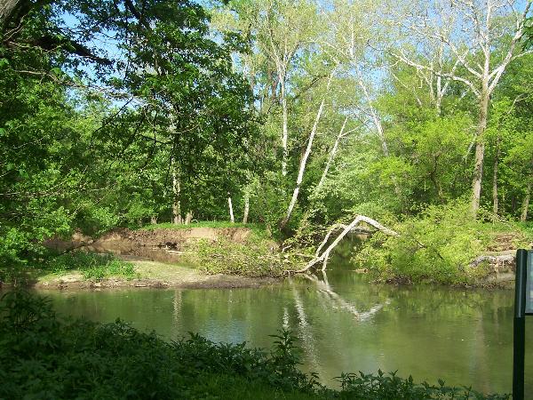
Three Creeks Confluence
The details of Three Creeks Metro Park can be found on http://www.metroparks.net/default.aspx. Please review this website for information about park hours of operation and review the associated detailed map of the park. Trail maps are also available within the park. Park at the Confluence Trails Area parking lot off Bixby Road and head out along the Alum Creek Greenways Trail. As soon as you cross the large bridge over the creek and come upon the first rest stop on your right, look for the Confluence Trail. The cache site is found about one hundred yards back along the Confluence trail near the creek(s). This cache was specifically placed to cause cachers to take a short hike along first a paved and then a dirt trail to view the confluence itself, a unique photo opportunity. This Columbus Metro Parks CMP-Three Creeks cache is placed with the permission of park management using Permit Number GCP 14-0009-10, a requirement for metro park caches. I recommend that you bring a camera with you when doing this cache. Dogs and bicycles are permitted on the paved trail although they are not on the Confluence Trail. After completing this cache, enjoy a 10.2 mile round trip hike/ride north along the paved Alum Creek Greenways Trail, a 5.6 mile round trip hike/ride east along the paved Blacklick Creek Trail, or go fishing in the Heron Pond. A 15 mile ride free from vehicle traffic makes for a great family caching event.

In seasons when area creeks and rivers are running high I would not advise going for this cache as the trail would likely be too muddy or wet to follow. Otherwise, in nicer weather, this is an excellent cache due to the location near the confluence!
CONGRATS TO CHIEF_OSCEOLA FOR FTF!!!