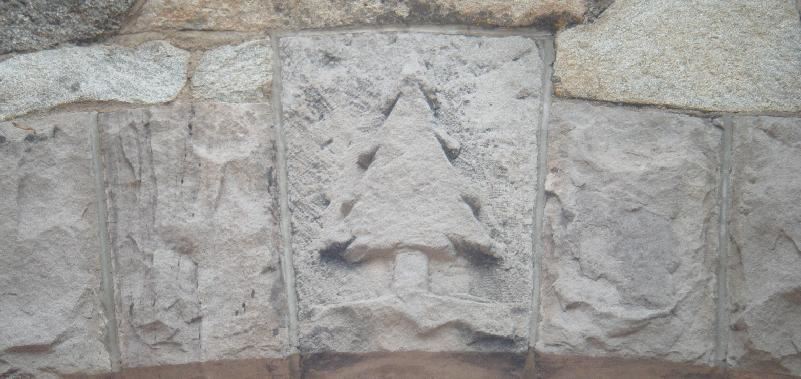
Apishapa Arch
The Spanish Peaks area in southern Colorado is world-famous for its radial dike geologic features. Radiating outward from the summit of West Spanish Peak, the dikes form long, straight rocky ridges just a few meters thick.
Long ago, southern Colorado was an area of shallow seas. Mountains to the west shed huge amounts of sediment towards the east, covering the region with thousands of feet of mud, sand, and gravel.
Various mountain-building episodes finally raised Colorado well above sea level, deforming, tilting, and eroding the sediments.
More recently, tectonic stresses have caused faulting to occur. The Sangre de Cristo Mountains were pushed upwards, while the San Luis Valley dropped down. The whole region rose even higher above sea level. Molten rock seeped up from below, filling cracks and other weak areas. In many places, volcanoes formed during eruptions. In other areas, the magma cooled and solidified before it reached the surface.
Approximately 27 million years ago, the area of the Spanish Peaks was still covered by many thousands of feet of sediments when it was invaded by magma. The magma forced its way into cracks in the rock. It also spread along weak layers in the sedimentary rocks. As the magma spread upward in a few spots, the surrounding rocks cracked in a radial pattern. Magma then filled these new cracks.
As far as anyone can tell, the magma under the Spanish Peaks never reached the surface to form volcanoes. Instead, it froze in place to form intrusive igneous rock. Several different magmas intruded over the years, forming granites, granodiorites, and syenodiorites.
With continuing uplift, the surrounding sediments eroded away. However, the Spanish Peaks themselves were resistant. The hard igneous rock was less prone to being eroded. Also, the magma cooked the nearby sediments, making them more resistant than the softer sediments elsewhere.
Now the Spanish Peaks tower above the neighboring valleys. They display their interesting geologic history to all who wish to look.
The main intrusions are called stocks -- small masses of intrusive igenous rocks. They can easily be seen in the areas of the Spanish Peaks that are above timberline.
The filled cracks are called dikes -- a sheet-like intrusion, usually fairly narrow.
The dikes are quite prominent in the area. Many radiate outwards like spokes from the central intrusions of the Spanish Peaks region. Since they are more resistant to erosion than the nearby sediments, they appear to be walls of rock that are visible from miles away. They range from 1 to 100 feet wide, and can be up to 14 miles long. Some are single dikes, while others are sets of parallel dikes. Some have names, such as Devil's Stairway and Apishapa Arch.

Jose de Jesus Cordova operated a ranch near Aguilar, Colorado in the early 20th century. He dreamed of a road from Aguilar to Cuchara Pass and secured funding for the project in 1928. The road was completed in 1934 and renamed Cordova Pass Road in 1978. One prominent landmark along the way is the Apishapa Arch, a tunnel through one of the igneous dikes on the slopes of the Spanish Peaks.
To reach the Earchcache site, take State Highway 12 (Highway of Legends) to the top of Cuchara Pass, then turn east on County Road 46 and drive 9.9 miles to the Arch. CR46 is passable in a typical passenger vehicle during summer months, but is closed in winter.
To log this Earthcache, observe the dike and surrounding rock and email the following observations.
1. Mention one or two differences between the igneous rock of the dike and the surrounding sandstone.
2. Measure or estimate the thickness of the dike at the point where the tunnel passes through it.
In your online log, be sure to post a photo of yourself or your GPS with the Arch in the background.
