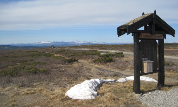
Utsikt fra Listulhøgda mot Rondane / View from Listulhøgda towards
Rondane.
Peer Gynt Vegen er en 60 km lang fjellvei (og bomvei) gjennom
deler av Norges vakreste fjellverden. Ikke få turister kjører den
delen av veien som går fra Skei til Gålå. Om lang midtveis er
Listulhøgda, veiens høyeste punkt på 1053 m.o.h. Der er det
utmerket sted og stoppe, ta en kopp kaffe og nyde den praktfulle
utsikten. I vest ser en over til Jotunheimen og mot nord
Rondane.
Peer Gynt mountain (toll) Road is a 60 km long road passing
through some of Norway's most beautiful mountains. It is also the
main mountain road through Gudbrandsdal valley. Many tourists are
traveling the part of this road which goes from Skei to Gålå.
Approximately halfway of this part is Listulhøgda, which is the
highest point of the road (1053 m.a.s.l). There you should stop,
take a cup of coffee, and just watch the magnificent scenery. In
west you'll see Jotunheimen and in north Rondane.