Glaciers on the Beach? EarthCache
-
Difficulty:
-

-
Terrain:
-

Size:  (other)
Please note Use of geocaching.com services is subject to the terms and conditions
in our disclaimer.

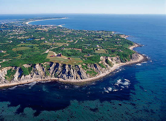
The rocky Rhode Island coast and islands were once covered in glacial ice. Until about 18,000 years ago, per scientific theory, glaciers extended south of Rhode Island many miles beyond the present-day coast.

There is evidence of this glacial advance along the rocky soils of Clay Head Beach on Block Island.


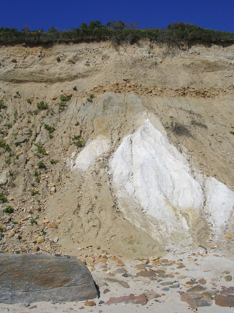
This cliff consists of a loess layer, which is a light-colored thinner layer of soil sometimes marked with swiss-cheese-like holes, and a fluvial layer, which is a thicker layer of mixed till, lake floor deposits, and glacial clay blocks.
You will also find chunks of white Cretaceous Age sand and clay deposited by glaciers at the base of the cliffs.

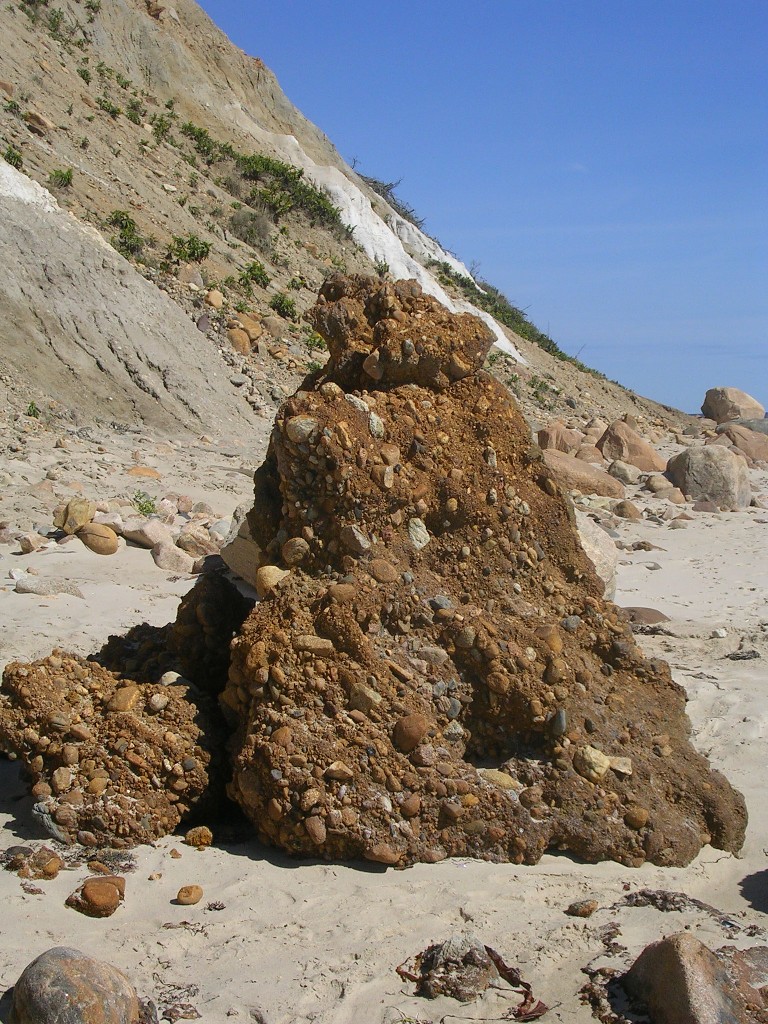
Formations called 'pots and kettles' can be seen along the beach,as well. These formations are a mixture of sand, gravel and stone, cemented by iron oxide.

The posted coordinates are approximately the half-way point of the cliffs, but you can collect your data anywhere along the bluff.


Accessing Block Island:
No roads leas to Block Island. The island accessible by private boat, ferry or plane.
The most common and least expensive transport is the Traditional Block Island Ferry from Point Judith, RI. The ferry operates several times daily and is open to automobiles.
The coordinates for the ferry parking lot are 41° 22.717' N, 071° 30.639' W.
Below is more information on transportation to Block Island.
By Private Boat:
Boaters may dock at the marinas or anchor in the Old Harbor or New Harbor areas.
By Ferry:
There are four ferries to Block Island. The closest are the Block Island Ferry (The only ferry that carries vehicles to the island, but reservations are required.) and the Hi-Speed Ferry (mid-May through mid-October.) These ferries depart from the State Pier in Point Judith. Visit www.blockislandferry.com or call (401) 783-4613 for schedules and rates.
The other ferries are the Block Island Express from New London, CT, which runs May through September. Visit www.goblockisland.com for schedules and rates. The Viking Fast Ferry from Montauk, NY runs Memorial Day through Labor Day only. Visit www.vikingfleet.com for schedules and rates.
By Plane:
Daily service from Westerly, RI is provided by New England Airlines. Visit www.block-island.com/nea or call (800) 243-2460 for schedules and fares.


To log this earthcache, please visit the site and submit your answers to the following questions:
1. In your estimation, what is the elevation of the cliff wall relief?
2. In your own words, describe the soil layers of the cliff?
OPTIONAL: Photographs of yourself or surroundings will be met with giddy earthcache-geek excitement.

Resources and credits:
Greenwich Bay Sailing Association, gbsa.info
Malcolm Greenaway
James D. Turenne, nesoil.com
Wesleyan University, wesleyan.edu

Placed by a member of Denton Area Wayward Geocache Seekers.
Additional Hints
(No hints available.)