Devil’s Backbone
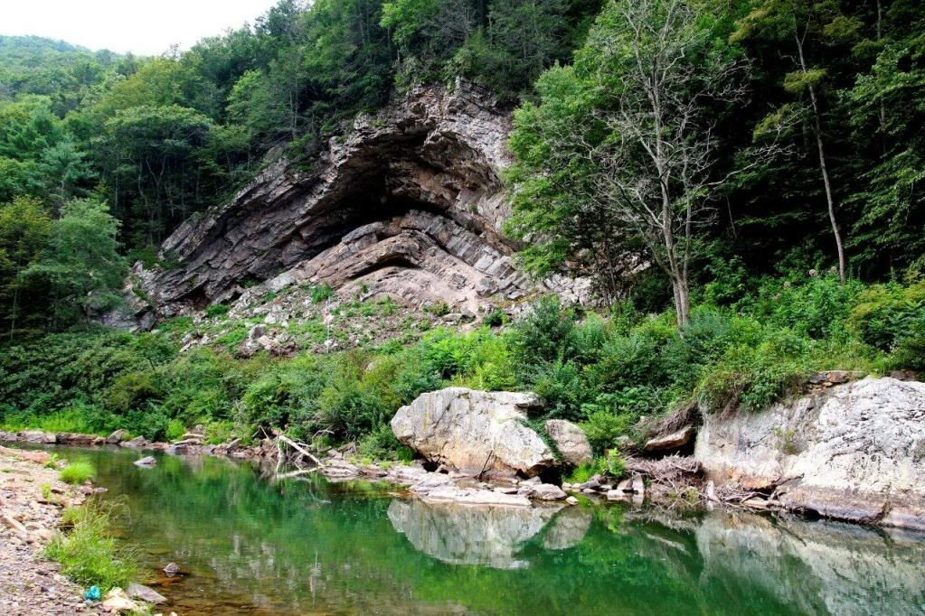
Along Route 39 just southeast of Marlinton, West Virginia and on the banks of Knapps Creek is a truly fascinating geological formation…Devil’s Backbone. The eastern region of West Virginia lies in is referred to as the Ridge and Valley Appalachians. These mountains are characterized by long, even ridges, with long, continuous valleys in between. They are the remnants of an ancient fold-and-thrust belt. Within these ridges and valleys are two different types of rock folds, anticlines and synclines.
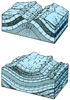
An anticline is a fold structure in which the sides of the fold slope apart. Its shape is concave downward. The younger rocks are generally found on the outside of the fold. Deep underground, anticlines are highly desired by petroleum prospectors. The rock beds trap rising hydrocarbon fluids, allowing oil and gas to build up in the pore space of the anticline rocks. The largest oilfields occur in large, gentle anticlines in thick sedimentary rock layers.
A syncline is a fold structure in which the sides of the fold slope together. Its shape is concave upward. The younger rocks are generally found on the inside of the fold. An interesting fact of synclines is that they can be as small as a hand specimen, and that the geologic structure does not much affect the topography. In other words, a syncline does not necessarily create a valley. In very young landscapes it might, but generally how a syncline is expressed depends on the rocks. If softer rocks are in the core of the syncline, they will erode to form a valley, but if the inner layers are harder, erosion carves them into a peak instead.
In order to claim this Earth Cache please send me an email with the answers to the following questions:
1) Would you classify this fold as an anticline or syncline?
2) In your estimation, what is the height and width of this fold?
3) What type of rock do you think makes up the majority of this fold?
4) What two things could be trapped under this fold?
Although Earth Cache regulations prohibit the requirement of a photo, please feel free to post a picture with your log.
As a word of caution, please be extremely careful if you decide to cross the road. It may be highly traveled at times, so please take care when crossing.
Resources on Geologic information: (visit link) (visit link) (visit link)