Geologists say that Massanutten Mountain forms the western edge of a down fold, or a syncline, that is continuous with the Blue Ridge Mountains anticline. To the west of the Blue Ridge anticline lies the Valley and Ridge Province. To the east of the Blue Ridge Province lies the Piedmont Province. As one looks east you can see the lower hills which are the plutonic cores of a much older part of the Appalachian Mountain range that once stood much higher.
Over the past 100 million years the mountains here have undergone steady erosion, shaping them into the rounded mountain peaks that we see today. The deep stream gorges and waterfalls are evidence that this is an ongoing process. During this span of time the rock structures deposited earlier were undergoing intense folding and faulting. The result of these stresses was the uplift of the Appalachians into a series of long, parallel folded ridges.
These mountains are believed to have been exposed at the surface continuously since the Triassic Geologic Period millions of years ago. Such exposure has provided a long time for erosion to work surface areas away. Great displays of natural forces have formed gaps in the mountains throughout the region. Some are water gaps, others are wind gaps. A wind gap is a mountain pass or lower point in elevation between ridges formed by erosion over long periods of time. Yes the name is a misnomer. Despite their name, wind gaps are not created by wind action at all, but rather are carved by streams that once flowed through them when valley elevations on either side stood higher than they do today. A wind gap is a water gap in which the water source did not "survive" the complete erosion of the mountain. A water gap is a similar location, but one where a waterway has carved a complete path through each rock horizon and geologic period of development. Water gaps and wind gaps often offer a practical route for roads to cross a mountain ridge.
Scientists say wind gaps are usually considered older geological formations than water gaps, as they take much longer to develop. The other ways of forming a water gap is by stream erosion that uncovers an older structure, such as an anticline. In effect the stream is draped over the emerging structure and cuts a gorge across it. A water gap is not guaranteed. When the stream cannot cut fast enough or if it’s course is abandoned because of stream capture or some other reason, a small gap might result without a stream in it, perched high on a ridge. This gap is a wind gap.

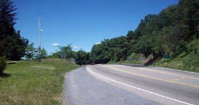
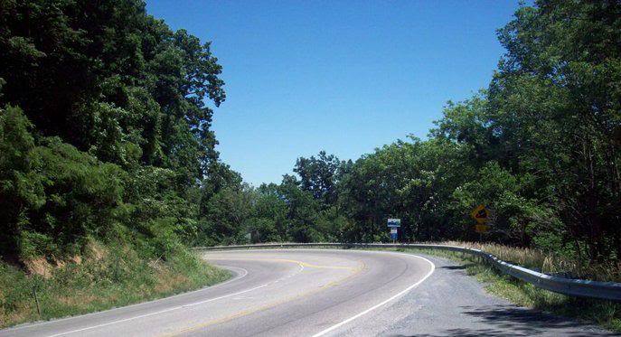
New Market Gap is located in the middle of Massanutten Mountain, dividing it into almost equally into north and south sections. US Route 211 runs through the gap connecting the towns of New Market and Luray Virginia. It is a wind gap.
Geologists speculate that an ancestral stream formerly flowed through Massanutten Mountain through New Market Gap, crossing the mountain anticline and the very resistant Silurian aged sandstone. As erosion development of the landscape preceded, a stream to the north, flowing on more readily erodible limestones and shales, rapidly eroded its valley head ward. It eventually captured the flow of the New Market Gap stream, leaving the gap itself literally high and dry.
Scientists say that where these mountain fronts are crossed by transverse drainage lines, spectacular gaps frequently expose complex structural features. These gaps display complex features that can shatter bedrock. The positioning of weakened bedrock zones high on structures where down cutting streams have had access to them has played a role in drainage localization here.
1.Shoot an elevation at the coordinates provided. What is the elevation of the crest of the floor of the gap?
2.The North Side of the mountain gap is 2800’ in elevation. What is the difference in feet from the top of the north side of the gap to the floor of the gap here?
3.The South Side of the mountain gap is 2500’ in elevation. What is the difference in feet from the top of the south side of the gap to the floor of the gap here?
4.Where the gap crosses Massanutten Mountain, two counties converge. What two counties are they? (Hint: Information is on a highway sign adjacent to the picnic pull off area.)
Questions still remain on what tectonic effects, rates and timings of uplift, erosion and deposition have had on formations of gaps and what was the importance of other factors such as climate and catastrophic events on these dynamic formations.