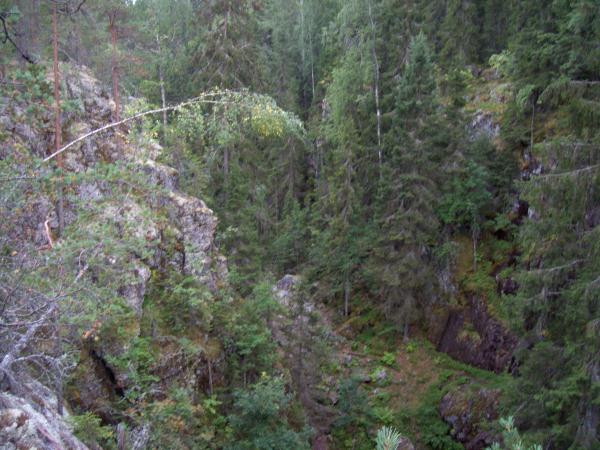
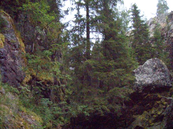
[FIN] Hitonhauta on sekä geologiselta että maisemalliselta arvoltaan hyvin merkittävä luonnonnähtävyys keskellä Keski-Suomea ja se kuuluu Natura-2000 verkostoon. Se on suuruusluokaltaan suurin ja syvin rotkokanjoni koko Keski-Suomen maakunnassa.
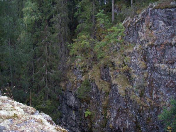
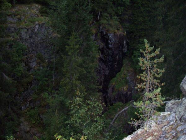
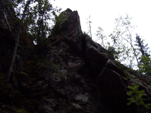
Hitonhaudan pystykallioseinämissä esiintyy runsaasti rakoilua ja luolia joista suurin ja merkittävin luola sijaitsee keskivaiheilla rotkolaakson luontopolkua. Suurinta luolaa eli Pirunluolaa vastapäisen kallion päältä suihkuaa pienen puron vesiputous alas kanjonin pohjalle. Vaikuttavimmillaan putous lienee keväällä lumien sulamisaikaan. Jyrkät seinämät , huuhtoutunut maaperä ja rotkolaakson kaakkoispuolen pyöristyneet kivet ovat muodostuneet 10 000 vuotta sitten jääkauden sulamisvesivirtojen hiomana peruskalliomosaiikin saumaan, niinsanottuun rikkonaisuuskohtaan. Repeämä paljastui kun laajeneva mannerjäätikkö raappasi sen ja sitten jääkauden päättyessä sulaneiden mannerjäätiköiden vesimassat painesuihkun voimalla poistivat kaiken irtaimen tieltään. Nykyinen louhikko rotkovajoaman pohjalla on syntynyt 10 000 vuotta sitten jääkauden jälkeen pakkasrapautumisen tuloksena.
Hitonhaudan hienoimmassa kohdassa on tänäkin päivänä nähtävillä selvästi kuinka jääkauden voimakas jäätikkövirran pyörre on syönyt alueen kallioon valtavan kattilan eli hiidenkirnun huuhtoen vesimassojensa mukana virtansa uumeniin kaiken irtaimen.
Alueen kallioperässä on havaittavissa varhaisproterotsooisia muodostumia joista merkittävimmät ovat granodioriittiä ja graniittia jotka ovat muodostuneet alueelle noin 1860 miljoonaa vuotta sitten. Saattaapa alueelta löytää myös jopa pyrokseenipitoista graniittia ja montsoniittia paikka paikoin joka ilmenee punertavina kenttinä harmaissa graniittikallioseinämissä.
Hitonhaudan rotkoon pääsee niin eteläkautta kuin teiden risteyksistäkin, mutta suositeltava tapa on lähestyä tätä ”Pirunhautaa” Hirvaskankaan Shellin vierestä lähtevän Hitonhaudantien eteläpäästä jonne olen parkkipaikkakoordinaatitkin antanut. Alueelle on Hitonhaudantieltä asti opastusviitat, myös polut ovat opastettuja. Suositeltava parkkipaikka on waypointeissakin näkyvä Parking area 1, mutta Parkin area 2:selta lähtee opastettu kävelypolku Hitonhaudalle. Parking area 2 ei ole suositeltava enää autolla ajettavaksi koska alueen tie on todella huonokuntoista ja roudan syömää.
Ja sitten tehtäviin:
1. Mene annettuihin koordinaateihin ja näet ”Pirunluolan”. Arvioi luolan katon korkeus ”oven” suulta ja miten luola on jääkauden jälkeen syntynyt???
2. Arvioi luolan edustalla olevan solan leveys ja korkeus.
3. Mistä kallioseinämää pitkin alas soliseva puro saa alkunsa lähellä annettuja koordinaatteja??
4. Jos otit kameran mukaasi ota valokuvan itsestäsi ja GPS-laitteestasi annetuissa koordinaateissa niin että Pirunluolan ovensuu näkyy taustallasi ja lähetä se joko sähköpostilla kätkönomistajalle tai liitä se kätkölogisi yhteyteen!
5. Lähetä kätköpaikalla suoritetut arviointitehtävän vastaukset 1 – 3 sähköpostilla kätkön omistajalle. Tämän jälkeen voit tehdä löytöloggauksen. Mikäli vastaukset ovat täysin väärin tai jos vastauksia ei ole lainkaan lähetetty kätkön omistajalle ennen loggausta, niin kätkön omistaja poistaa löytöloggauksen. Mikäli vastauksissa on vain pientä huomautettavaa, niin saat kommentit kätkön omistajalta.
[ENG] Devil's Tomb long and narrow canyonity Rift Valley is located in the northwestern part of the municipality Laukaa and Äänekoski near the city boundary. [ENG] Devil's Grave is that geological and landscape treatments worth a very important natural attraction in the middle of the Central Finnish and it belongs to the Natura 2000 network. It is the magnitude of the largest and deepest gorgecanyon throughout the province of Central Finland. Devil's Tomb vertical rock walls of the high incidence of fracturing and caves of which the largest and most important cave is located in the middle of the gorge nature trail. Devil's cave also largest cave or rock off the opposite spraying a small waterfall in a stream down the canyon bottom. Probably the most impressive waterfall in the spring when the snow unfreezing time. Steep walls, washed the soil and gorge south-east side of rounded stones are formed 10 000 years ago the ice age unfreezingwatercourses flowed bedrockmosaics a seam, the so-called broken point. Rupture was revealed when the continental glacier tear expanding it, and then the end of the Ice Age continental glaciers unfrozed pressure water jet propelled masses removed everything movable before it. Current gorgegrave boulder soil background has arisen 10 000 years ago after the Ice Age freezecrumblings result. Devil's Tomb's finest point is clearly visible to this day how strong the Ice Age glacier flow vortex has eaten a huge area of rock with the boiler or grove churn jet powered water bodies in the depths of everything movable. Area of bedrock is visible Paleoproterozoic formations are the most significant of granodioritic and granite that formed the region of about 1.86 billion years ago. You could also see on region can also find even pyroxenerich montsonite granite and in places which fields from reddish gray granite rock walls. Devil's Tomb, get to the pit through the south of the crossroads, but the recommended way is to approach this as a "Devil's Burial" Hirvaskangas Shell next to the outgoing Hitonhaudantie Road south to where I am given also Parking area coordinates. Devil's Tomb is a highway until guidance refers to, including the paths are guided. Recommended parking is visible waypoint Parking area 1, but the Park's area 2: selta leaves guided walking path Devil's Tomb. Parking area 2 is not recommended to run a car anymore because the road is really poor condition and frost rebuilt.
And then, the tasks:
1. Go to the coordinates and see the "Devil's Cave." Evaluate the cave roof elevation "door" from the mouth of the cave and how to be born after the Ice Age??
2. Evaluate the cave off to the gorge width and height.
3. Down falling rock wall where the water comes down along the close of the coordinates?
4. If you did bring your camera, you can take a photo of yourself and your GPS device so that the coordinates on the Devil's Cave doorway is on your background and send it by e-mail to cache-owner or link it your cachelog link, but this is a voluntary task!
5. Send your answers to tasks by e-mail to the cache's owner. After sending your answers, you can make "Found it" logging. If the answers are totally wrong, or if you don't sent your answers at all, the cache's owner will delete your log.
