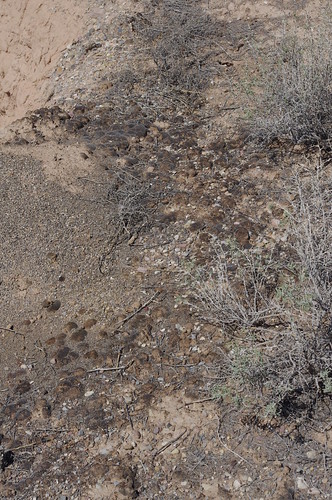
This is the location of a wash that came down from the valley above. This is actually known as Denmark Wash on the old maps. In many places washes are know as an Arroyo.
Typically an arroyo is dry, arid, and no water will flow for much of the year. In the mountain west we may get some small runoff that makes these similar to a seasonal creek, or small stream, depending on the runoff.
However this was is something that you used to be able to walk accross. It was a small streambed, only a few feet deep and you could hop in easily, and walk accross the rocky or sandy bed to the other side. Walking from one side of the valley to the other was simple.
Then came 1983. That year there was an exceptional snowpack, and it stayed cold and kept building into the spring. Many of the mountains valleys, and hills that are barren in March up stream from here had a few feet of snow in May. By the start of June the skies cleared and the summer temperatures of 80° rolled in. All of the snow melted and had to go somewhere. There was so much that it saturated the ground, and had a hard time coming down.
That runoff moving through the wash tore into it. What was a small traversable wash became a torrent. A flood plain that ran across this small valley. Normally those storms or rains may come, and they tear up the area and are gone. However this one was sustained. Not for a few hours, but for weeks.
Erosion tore into the bed of the valley. Sinking the base of the wash into a deep gulley. It could no longer be safely walked across. Bridges were destroyed and all the roads were severed.
That was nearly thirty years ago. You can see the valley slowly reforming. Now rather than a simple wash, a wide and deep gully remains.
On a side note if you look to the ground to the NW you can see some cryptobiotic soil. It looks like dried moss sitting on the ground. This is a biological mass, and takes years/decades to develop. Many plants use this to have the nutrients they need to grow. Please avoid stepping on it and causing damage.
Logging tasks
1-Looking at the area to the west you can see into the gully. Does it appear that it is getting deeper or is the erosion/deposts making it shallower?
2- New rivers and gulleys are very straight, then they curve and erode sides to widen the valleys, how would you describe this one? Is it early in its development and straight or is it wide?
3-In the initial flood it dug the gulley, how deep do you think the initial flood tore into the soil?
4-In the 30 years since then how much more erosion (if any) seems to have taken place? describe what you see.
cryptobiotic soil 