Stenhamra stenbrott EarthCache
-
Difficulty:
-

-
Terrain:
-

Size:  (other)
Please note Use of geocaching.com services is subject to the terms and conditions
in our disclaimer.

Stenhamra stenbrott [SWE]
I början av 1880-talet beslutade Stockholms stad att köpa in ett stort granitberg, Huvudstaberget vid Jungfrudansen var uttömt. På Svartsjölandet i Sånga socken hittade man Bålberget som bonden Smyl Gustavsson sålde för 25 000 kr. Den nyinköpta marken fick det passande namnet Stenhamra. Man flyttade verksamheten från Huvudsta, bostäder flyttades och de i arbetsstyrkan som önskade fick följa med.
Den 1 september 1884 startade stenbrytningen. Fram till 1919 var drygt 120 personen anställda och man jobbade året runt. Efter 1919 minskade efterfrågan av framförallt gatsten och 1937 upphörde stenbrytningen helt. Dagbrotten i stenbrottet vattenfylldes, samhället med skola, affär och bostäder finns fortfarande kvar.
Granit
Granit är en magmatisk djupbergart som bildats när magman tränger upp i jordskorpan och stelnar på stora djup under högt tryck. Magman tränger in i jordskorpan på flera kilometers djup och stelnar långsamt, vilket skapar stora kristaller. En del är millimeterstora medan andra kan bli flera centimeter, detta ger graniten dess grovkorniga struktur.
Granit finns i alla kontinentalplattorna, inte i oceanplattorna, och har bildats under alla geologiska perioder. Granit är den vanligast förekommande urberget under det relativt tunna lager av sedimentära bergarterna.
Granit är mycket hård, sprickfri och har ovanligt hög motståndskraft mot tryck, stötar och slitage, den är också okänslig för försurat regn. Då den är vanligt förekommande på många håll i världen används den mycket till gatubeläggningar, byggnadssten, murverk och monument. Granit kan vara ljusgrå, mörkgrå och ha nyanser av rött, det är mineralerna som styr. Mineralet fältspad kan innehålla mer eller mindre hematit, ju mer hematit ju rödare granit.
Granit i Sverige
Den berggrund som idag är synlig i stora delar av östra Sverige är rötterna som tillhör den kraftigt nederoderade Svekokarelska bergskedjan. Den bildades för 1 750 till 1 900 miljoner år sedan och var då flera tusen meter hög. Den har sin utbredning från Kiruna i norr till Västervik i söder, plus delar av Finland. Huvuddelen av berggrunden utgörs av granit, exempelvis Haparanda-, Revsunds- och Stockholmsgranit.
Det berg som vi ser i dag bildades ursprungligen på flera kilometers djup.
Plocka upp en bit granit, titta på den och fundera över att den är nästan 2 000 miljoner år gammal.
För att logga cachen
Att tänka på
Detta är en multi-earth där tre platser måste besökas, en timma bör räcka. Det behövs inget rep eller annan utrustning för att besöka topparna, men det är högt så var försiktig.
Besök inte platsen vid dåligt väder eller när det ligger snö. |
 |
Lite tips för att besöka topparna
Börja med Topp 2, gå till cachens koordinater och klättra upp där. Gå sen vidare mot Topp 2-extra waypointen och hitta en lämplig väg ner (det finns en cache där), gå sen upp till vänster om lilla dammen och runt den på ovansidan till Topp-3. Fortsätt vidare runt till Topp-1. Den lättaste vägen tillbaka är sen att gå mot Topp 1-extra och gå till parkeringskoordinaten därifrån. Motsatta håll går såklart lika bra.
Svara på följande frågor och maila svaret till oss
1) Besök de tre topparna, se waypoints, vid varje topp finns metallplattor med bokstäver. Samla bokstäverna, sätt ihop ordet och maila det till oss.
2) Uppskatta, eller mät med GPS, höjden av Topp 1. Mät från dammens vattenyta till toppen.
3) Granit består i huvudsak av två mineraler, fältspat nämns i cachen men vad heter det andra?
4) Den Svekokarelska bergskedjan innehåller Sveriges näst äldsta berggrund, vad heter Sverige äldsta berggrund?
Cachen kan loggas direkt när svaren skickats in, är något svar fel så hör jag av mig. Bifoga gärna bilden i loggen. Inga svar i loggen tack.
Lägg gärna in en bild tillsammans med din logg.
|

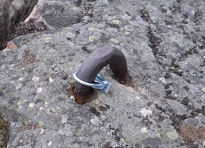
Detta är vad du letar efter. |
Stone quarries in Stenhamra [ENG]
In the early 1880s, the City of Stockholm decided to buy a huge granite rock, the old quarries at Huvudsta was exhausted. On Svartsjölandet in Sånga parish they bought Bålberget from the peasant Smyl Gustavsson for 25 000 SEK. The newly purchased land was named Stenhamra, meaning hammering in stone. The operations in Huvudsta closedown and moved to Stenhamra, housing was moved and the workforce who wished could follow.
The extraction started on September 1, 1884. Until 1919 was just over 120 employees, working all year round. After 1919 decreased demand of particular setts, and in 1937 ceased extraction completely. Part of the quarry was filled with water, the community with school, business and housing are still there.
Granite
Granite is a intrusive igneous rock, meaning the rocks has formed when magma penetrates into the crust and solidified at great depth under high pressure. Magma penetrates the crust several kilometers deep and solidifies slowly, creating large crystals. Some are millimeter-sized, while others may be several centimeters, this gives granite its coarse-grained structure.
Granite exists in all the continental plates, not in the ocean plates, and is formed during all geological periods. Granite is the most prevalent bedrock under the relatively thin layers of sedimentary rocks.
Granite is very hard, crack free and has unusually high resistance to pressure, shock and wear, it is also insensitive to acid rain. Since it's common in many parts of the world it's used as pavements, building stone, masonry and monuments. Granite can be light gray, dark gray and have shades of red depending on the minerals. Mineral feldspar can contain more or less hematite, hematite course, the more reddish granite.
Granite in Sweden
The rock which is now visible in large parts of eastern Sweden are the roots belonging to the strongly eroded Svekokarelska mountain range. It was formed 1750-1900 million years ago and was several thousand meters high. It has a range from Kiruna in the north to the south of Västervik, plus parts of Finland. Most of the bedrock consists of granite. The mountains that we see today was originally formed several kilometres deep.
Pick up a piece of granite, looking at it and consider that it is nearly 2 billion years old.
To log the cache
What to think about
This is a multi-earth where three places must be visited, one hour should be sufficient. There is no need for climbing equipment to visit the peaks, but it is high so be careful.
Do not visit the place in bad weather or when there is snow. |
 |
Some tips for visiting the peaks
Start with Topp 2, go to the cache coordinates and climb up there. Then go on to Topp 2-extra and find an appropriate way down (there's a cache there), after that go up to the left of the pond and around the rim to Topp 3. Continue around to Topp 1. The easiest way back is to walk to Topp 1-extra and then go to the parking coordinates from there. The opposite directions will of course work just as well.
Answer the following questions and email the answer to us
1) Visit the three peaks, see the waypoints, at each peak there are metal plates with letters. Collect the letters and put together the word and email it to us.
2) Estimate, or measure with GPS, the height of the peak at Topp 1. Measure from the pond water surface to top.
3) Granite consists mainly of two minerals, feldspar is mentioned in the cache, but what is the other mineral?
4) The Svekokarelska mountain range contains Sweden's second oldest bedrock, what is the name of Sweden's oldest bedrock?
The cache can be logged as soon as the answers are mailed to us; if there is any problems with the answers I will contact you. Feel free to upload your picture with the log. No answers in the log please.
Feel free to take a picture and upload with your log.
|

This is what you looking for. |


Additional Hints
(No hints available.)