Flächennaturdenkmal
"Saugartenmoor"
Das Saugartenmoor liegt
fast in der Mitte der Dresdner Heide, in der Abteilung 67 des
Reviers Bühlau bei
N51°05.587 , E13°49.731.
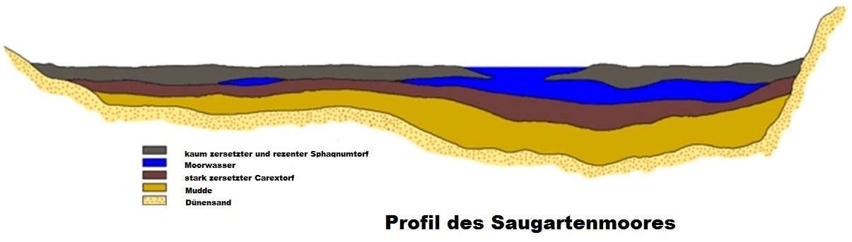
Es ist etwa 75m lang, 60m breit und knapp 230 m über dem
Meeresspiegel in einer Mulde der Lausitzer Platte, die aus
Granodiorit besteht.
Die Mulde, die sich in der Eiszeit gebildet hat, besitzt ein
weiches Bett aus Sand und gut mit Bäumen getarnte Wälle aus hohen
Dünen.
Seit vierhundert Jahren hat es sich durch alle Trockenlegungen in
der Heide durchmogeln können.
Moore sind heutzutage sehr gefährdete Biotope. Das Absterben von
Fichten in und an den Mooren führt zu Veränderungen des
Kleinklimas.
Dies führt zur Zerstörung des empfindlichen
Ökosystems.
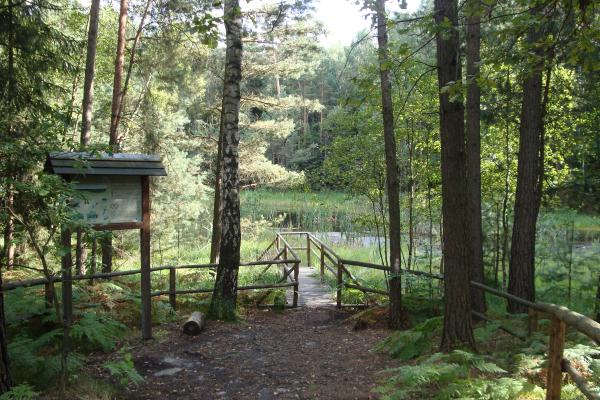
Vor Ort findest du eine Infotafel, wo du die
Informationen, die du zum loggen des Caches benötigst
findest.
Folgende Fragen sind zu beantworten:
1) Um welche Art von Moor handelt es
sich? (Begriff von der Infotafel!!!)
2) Vor wie vielen Jahren ist das Moor etwa entstanden?
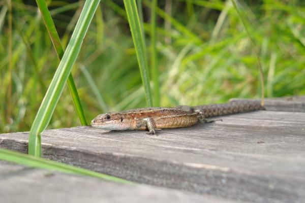
3) Nenne mindestens 3 Tiere die im Saugartenmoor
leben!
4) Bis in welche Tiefe geht das Moorwasser ca.?
5) Welchen Code trägt das Murmeltier im Rucksack? :-)
6) Mache ein Foto von dir und deinem GPS vor dem Moor.
(freiwillig aber erwünscht)
Die Antworten bitte an gc2dehd@googlemail.com senden.
Wenn Ihr die Logerlaubnis erhalten habt könnt ihr loggen!
---------------------------------------------------------------------------------------------------------------------
Natural Monument
"Saugartenmoor"
The "Saugartenmoor"
is almost in the middle of the Dresdner Heide in the
section 67 Bühlau at
N51° 05.587‘ E 013° 49.731‘
It is about 75 meters long, 60 meters wide and 230 meters above sea
level in a depression of the Lausitzer Platte, which consists of
granodiorite.
The depression which was formed during the
Ice Age has a soft bed of sand with well camouflaged walls of high
dunes.
For four hundred years, the moor has
survived many drainings.
Moors are very endangered biotops today.
The dying off of pines in and around the mires leads to changes in
the microclimate.
The result is the damage of this sensitive
ecosystem.
On-site you can find an information board to
collect all the information for logging the
cache!
The following
questions must be answered:
1) What kind of moor is it? (as written on the board
!!!)
2) How many years ago the moor was formed?
3) Name at least three animals living in the moor!
4) How deep is the water approximately?
5) Which code has the marmot in the backpack? :-)
6) Take a photo of the moor and your GPS device!
(voluntary)
Please send me your answers to gc2dehd@googlemail.com
Once
all answers are correct, you can log your visit.

Web Stats