A drumlin is a
whale-shaped hill formed by glacial ice. Drumlins may be more than
45 m (150 ft) high and more than 0.8 km (½ mile) long. The islands
of Boston Harbor are drumlins that became islands when sea levels
rose as the glaciers melted. Boston Harbor is part of the Boston
Basin, topographic lowland underlain by sedimentary layers
deposited at the end of the Precambrian time. In the past 100,000
years, two separate periods of Pleistocene glaciations formed the
hills that cap most islands of Boston Harbor and created the local
drainage system, consisting of the Charles, Mystic, and Neponset
watersheds.

The cores of many
harbor islands are drumlins, glacier-formed, asymmetrical, elongate
masses of till formed into smooth-sloped hills on the Boston Basin
lowlands. In profile, they look like upside-down teaspoons. As the
climate warmed and the glacier receded from the Boston area some
15,000 years ago, the melting of glacial ice raised the level of
the ocean, eventually creating this section of the basin and
isolating the islands. After the ice sheets retreated, they left
behind hills of glacial debris known as drumlins. After an initial
rise in sea level (due to melting ice), the land literally
rebounded from the release of the mass of ice, and sea level fell
to a level much lower than today.  So the harbor islands as they appear today would have been a set
of hills on a grassy plain. Over the past few thousand years, the
land stopped rebounding, and the sea level continued to rise,
submerging the plain and leaving the drumlins visible as islands.
Drumlins in this area are primarily oriented on a
northwest/southeast axis with steeper slopes facing northwest,
indicating the direction of ice movement. Northeast storms over
time have caused much of the erosion along shorelines directly
exposed to these storms.
So the harbor islands as they appear today would have been a set
of hills on a grassy plain. Over the past few thousand years, the
land stopped rebounding, and the sea level continued to rise,
submerging the plain and leaving the drumlins visible as islands.
Drumlins in this area are primarily oriented on a
northwest/southeast axis with steeper slopes facing northwest,
indicating the direction of ice movement. Northeast storms over
time have caused much of the erosion along shorelines directly
exposed to these storms.
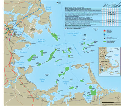
The
coordinates are to Bumpkin Island.
To log this EarthCache you must perform the following tasks and
send an email to the owner with your answers. You do not need to
wait for a reply to log the earthcache.
1. Either estimate the height of the island from sea level or walk
to what you estimate to be the top of the drumlin and view the
altimeter on your GPS unit. Do you think this drumlin is taller,
shorter or the approximately the same height as any other islands
or drumlins you passed on the way out to it?
2. What other features of the island do you notice? You can comment
on what type of beaches the land falls away to (sand, rock, etc.),
the types of trees you found on the island, the presence of any
water on the island, the existence of any bluffs, or the shoreline
feature of the drumlin on its eastern side, as it goes into the
water.
3. Does either side of the island (primarily north or south) have a
steeper slope, and if so what side of the island?
4. Comment on the direction you think the glacier was moving when
Bumpkin was formed. Consider the other harbor islands and if the
glacier changed direction.
Not required but suggested: Take a picture of yourself, your team,
or a prominent feature of the island and post it with your
log.
Sources
1. Boston Harbor Islands, National Park Area.
2. National Park Service,Geology Fieldnotes,
www.nature.nps.gov/geology/parks/boha/index.cfm.
http://en.wikipedia.org/wiki/Drumlin
3. Geology and uses of the Boston Harbor Islands;
www.bostongeology.com
4. Processes and Evolution of Boston Harbor Islands: Peddocks and
Lovells Islands, Rosen and FitzGerald 2004,
http://en.wikipedia.org/wiki/Bumpkin_Island
Congratulations to gonascar on
FTF!!!