Falls of the Ohio Hike - 2013 Event Cache
AirRaidFan: One of the best! See you on 10/11/14.
Falls of the Ohio Hike - 2013
Hidden
:
Sunday, October 13, 2013
-
Difficulty:
-

-
Terrain:
-
Size:  (not chosen)
Please note Use of geocaching.com services is subject to the terms and conditions
in our disclaimer.
NOTE EVENT DATE CHANGE. SEE LOG BELOW
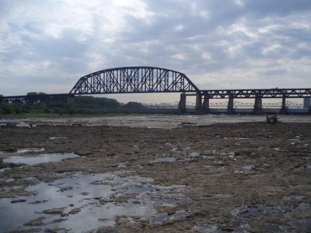
We're moving back to the parking area under the RR bridge. The wooden stairs at the other lot have been washed away.
350 Million Years Ago
...this land mass was 20-degrees south of the equator. It was part of a single mega-continent formed 1100 million years ago. That continent was named RODENA. And then, about 750 million years ago, it began to break up and drift apart.
The fossil beds at the Falls of the Ohio provide proof of an ocean and coral reef that existed here more than 350 million years ago!
The coral reef as seen today, stretches from Louisville north to Indianapolis. Nowhere else in the world does such a large, exposed fossil reef of this period exist. The 220-acre fossilized reef lies exposed only at the Falls of the Ohio!
The Devonian Period occurred between 395 and 345 million years ago. During that time, Indiana and Kentucky languished beneath a warm, tropical sea, and were located about twenty degrees south of the equator. During the Devonian age, fish were the most advanced life forms in the aquatic world. A shifting of the earth's continents eventually moved this part of the earth's surface to its current location.
During the 45 million year span of the Devonian Period, the oceans deposited layer upon layer of lime silt, sediments, and plant and animal remains. Of these deposits, five distinct fossil layers lie exposed at the Falls:
- The uppermost layer - or the youngest rock - is the Paraspirifer Acuminatus Zone, which contains fossils of brachiopods (including paraspirifers, a two-shelled animal similar to a clam); bryozoans (commonly called lace coral); trilobites; and some solitary, branching, and colonial corals.
- Second is the Fenestrate Bryozoan-Brachiopod Zone. Named for the predominant fossils found there, here one also can find crinoid stems in abundance.
- A six-inch-thick layer called the Brevispirifer Gregarius Zone follows, and contains fossils of brachiopods and gastropods (sea snails), horn corals, or cup corals, and one of the Falls' most unusual corals, the astromatoporoid.
- The Amphipora Ramosa Zone, commonly called the Cave Zone. Pocket caves have developed here due to the powerful erosive powers of the Ohio River rushing across the rock. This zone occurs along the vertical cliffs of the river channel, where the cutting force of the river reaches its peak.
- The oldest and most remarkable layer is the largest to be exposed. It bears the name Coral Zone because of its abundance of fossil corals - so many, in fact, that visitors find it difficult to walk on this layer without stepping on fossils exposed in the bedrock.
- To assist in fossil identification, the interpretive center provides an educational website HERE.
NOTE: It is unlawful to collect fossils or rocks! Do not break encrusted corals or fossils from the limestone beds!
_____________________________________________________
That water is only 20-inches deep!
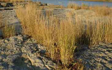
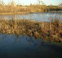
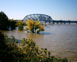
Fall Colors In The Upper Wetlands
_____________________________________________________
And consider this!
- This is an extreme hike, a six-mile round trip on reflective limestone over six hours! A horizontal rock climb! Swift water crossings! Quick sand! Moonscape craters. Knee-deep wading! Potholes! Slippery! Mud flats! Sand dunes! Rock walls! Mesas! Caves! Wet boots! Blisters! You'll LOVE it!
- You'll be walking BELOW the normal level of the upper river pool on an ancient seabed that can be 55-feet UNDER WATER at flood stage! A billion gallons of water are right...THERE! Just inches away!
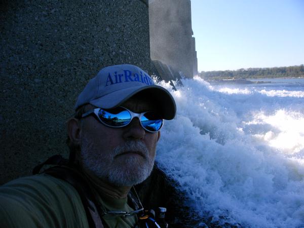
- Hey, put your ear against the big metal spillway gate and hear the water vibrate, moan and hiss as the walls keep 73 miles of water from crashing through and sweeping you to the Gulf of Mexico!
- We'll go where not many people have gone on foot!
- Lewis and Clark, Prince Madok, pioneers, Native Americans and the underground railroad crossed here!
- John James Audubon sketched birds here. Mark Twain was lodged on a rock in a boat for several days here.
- There are several geocaches and EarthCaches to log along the hike!
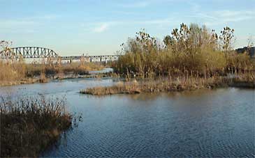
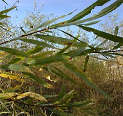
- You'll hike the wetlands. See the Cottonwoods and Willows.
- Lots of driftwood, too! No limit on the number of pieces you can take! FREE, too! Think LANDSCAPING!
- Want creature features? An OCTOPUS was caught here! Live crocodiles and alligators have been seen here. Tropical fish with teeth! Did I mention NO SWIMMING ALLOWED?
_______________________________________________________
At Patch Reef Beach (GCKDET) you'll see the original muggled (smashed) AMMO BOX!
______________________________________________________
NOTE! This hike can only be made if river conditions allow safe passage. The lower gauge must be 12 feet or less. The UPPER SPILLWAY GATES MUST be closed completely (we'll cross there).
For an instant up-to-the-minute NOAA McAlpine Dam lower gauge forecast, click on RIVER LEVEL. So long as that green dotted line keeps marching along at the >12-foot mark, we're good to go!
There's a hurricane watch on this page because rainfall on the east coast might just flow through this dam.
For an instant up-to-the-minute NOAA Tropical Storm Watcher Update, click on
National HURRICANE Center
 Fossil Beds September 20, 2008, and, Fossil Beds September 20, 2004 (after Hurricane IVAN)
Hurricanes and other tropical systems which form on the west coast of Africa and make landfall in the gulf or on the east coast can cause flooding rains which result in a rising Ohio River at Louisville and spell the end to island access. Tropical Storm season runs from June 1 to November 30. However, the upper spillways (where we cross) are opened by 15Oct and it's not accessible by foot again until the following August.
_______________________________________________________
Okay, the DON'Ts:
- MOST IMPORTANT! Don't wander off alone! IT AIN'T COOL TO BE A FOOL! Seriously, if you sink knee-deep in river mud, and you are alone, you are IN TROUBLE! Have a partner!
- Don't walk near the water on ANYTHING other than rock or FOSSIL BED without testing first! River mud is deceptive, looks like water-packed sand. And it loves you, sucks you in and doesn't want to let you go! Walk on HIGH GROUND!
- Don't step on the cracked ground. It's mud with a sandy disguise.
- Don't attempt this with less than three legs. If you have less than three, you'll likely damage one or two. Use a STAFF!
- Use extreme caution crossing swift water! Smooth, swift water is dangerous! It can (and will) sweep you off your feet in an instant!
- Don't stare at moving water while crossing, you'll lose your balance! Look off briefly to maintain perspective. Rocks with moss are slick!
- Don't interact with the orange or metallic water.
- Don't be on the other side when the sun sets. Get out an hour before. Else you may risk a night at the Patch Reef KOA!
The MUST DO's:
- DO bring your moonwalk. You'll need it.
- DO bring your creek legs and sand feet.
- DO be prepared to be knee-deep-wet and sandy. This is, after all, a beach, babe!
- We'll cross at the the upper gates ONLY. You'll see the broken steps by gate #1 leading to the concrete deck.
- DO be prepared to cross moving water. If the lower gauge is around 10.0 feet or lower, current is minimal.
- DO bring a camera. Sure, you may fall and ruin it, but if you don't the pics are priceless! Think PROFILE PIC!
- DO PUT A WATCH ON THIS PAGE FOR UPDATES!
This can be a dangerous and unforgiving place. The description of the possible difficulties associated with this hike is to raise awareness. Carelessness can result in pain here. Crossing moving water is required three times out and back.
_______________________________________________________
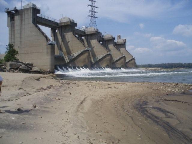
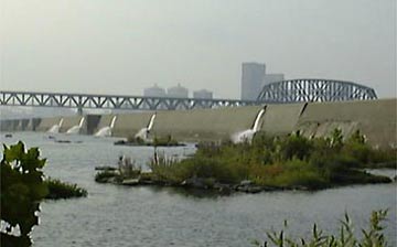
The Lower Spillways Gates
_______________________________________________________
The Plan
The coordinates will bring you to a free parking area under the railroad bridge. First come, first park (fishermen park here, too). No 'back-in' parking (it's the law). Other parking nearby ($2.00). The 'Good Morning' meet and greet starts at 0830 hrs or as early as you arrive. We'll sign the log, press on the name tags, pass out some printed data, have a brief Q/A session, then SHOVE OFF at 0900 SHARP!
Plan to be WET and DIRTY by 0930.
________________________________________________________
Get your GEAR ON!
- Bring water.
- Bring more water. You DO NOT want to run out of fresh water (metallic water nearby)
- NO RESTROOMS (big river). Plan accordingly.
- Snacks, i.e. ENERGY FOOD - No restaurants here!
- UV PROTECTION! Limestone is highly reflective!
- Skeeter beeter! (especially if it recently rained).
- Camera
- Extra batteries.
- Zip-lok storage bag(s) keep stuff dry
- Duct tape. (blister spots)
- Hiking staff.
- A PERMANENT FELT-TIP MARKER (Sharpee?) FOR THE WATERPROOF LOGBOOKS!
- Lace-up footwear recommended (sandals are NOT!)
- Llight travel strongly recommended!
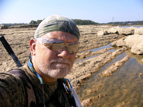
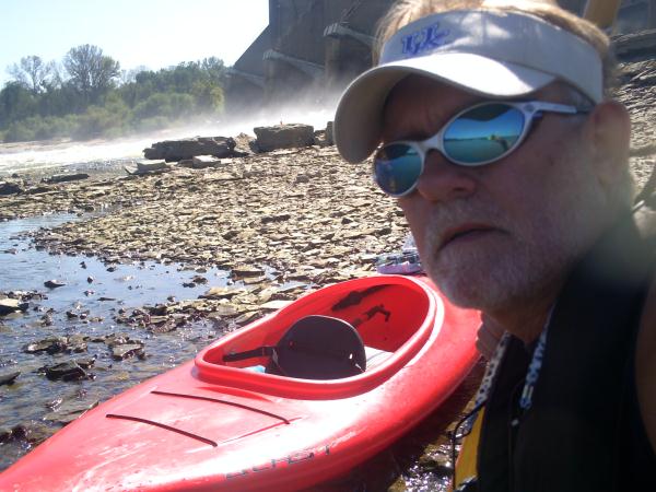
About Your Host and Guide........
ARF! has hosted eight Extreme Hike Events and led many more unlisted outings on the island over the years. I started fishing/boating/hiking here in the 70's but became re-acquainted when I retired and planned this geo-project. I've spent hundreds of hours here. You're in good hands.

Additional Hints
(No hints available.)